Aitha
Aitha is a village in Varanasi district in the Indian state of Uttar Pradesh. It is about 312 kilometers from the state capital Lucknow and 806 kilometers from the national capital Delhi.[1][2][3][4]
Aitha | |
|---|---|
Village | |
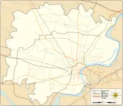
| Coordinates: 25.386964°N 82.979855°E | |
| Country | |
| State | Uttar Pradesh |
| Elevation | 80 m (260 ft) |
| Population (2011) | |
| • Total | 2,398 |
| Languages | |
| • Official | Hindi |
| Time zone | UTC+5:30 (IST) |
| PIN | 221003 |
| STD | 0542 |
| Vehicle registration | UP65 XXXX |
| Village code | 209594 |
| Website | up |


Demography
Aitha has a total population of 2,398 people amongst 354 families. Sex ratio of Aitha is 884 and child sex ratio is 917. Uttar Pradesh state average for both ratios is 912 and 902 respectively[note].[2]
| Details | Male | Female | Total | Comments |
|---|---|---|---|---|
| Number of houses | - | - | 354 | (census 2011) [2] |
| Adult | 1,104 | 970 | 2,074 | |
| Children (0–6 years) | 169 | 155 | 324 | |
| Total population | 1,273 | 1,125 | 2,398 | |
| Literacy | 85.14% | 67.01% | 76.66% | |
Transportation
Aitha can be accessed by road only as it does not have a railway station. Closest railway station to this village is Sarnath (8 km). Nearest operational airports are Varanasi airport (18 kilometers) and Allahabad Airports (143 kilometers).[5]
See also
Notes
- ^ All demographic data is based on 2011 Census of India.
References
- "Village coordinates". latlong.net. Retrieved 28 February 2015.
- "Population & General info". 2011 census. Retrieved 28 February 2015.
- "Village code:2011". Village info. Retrieved 28 February 2015.
- "PIN Code". villagemap.in. Retrieved 28 February 2015.
- "Rail information". indiarailinfo.com. Retrieved 28 February 2015.
Places adjacent to Aitha | ||||||||||
|---|---|---|---|---|---|---|---|---|---|---|
| ||||||||||
This article is issued from Wikipedia. The text is licensed under Creative Commons - Attribution - Sharealike. Additional terms may apply for the media files.
