Varanasi district
Varanasi is a district in the north Indian state of Uttar Pradesh, with Varanasi city as the district headquarters. It is also called Kashi, according to Hindu mythology it is one of the sacred places pilgrimage for Hindus as well as Buddhists. It is believed that Lord Shiva along with Parvathi as Vishwanatha and Vishalaakshi reside there to bless devotees. It is surrounded by Mirzapur district, Jaunpur district, Ghazipur district, Chandauli district and Bhadohi district. The Ganga (Ganges) river flows through the district. It is considered by Hindus to be a sacred and pure river, having the ability to wash away sins when people take a dip in it. Part of the Varanasi division, the district occupies an area of 1,535 square kilometres (593 sq mi) and as of the 2011 Census of India had a population of 3,676,841.
Varanasi district | |
|---|---|
District of Uttar Pradesh | |
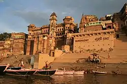 Munshi Ghat, Varanasi | |
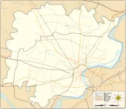
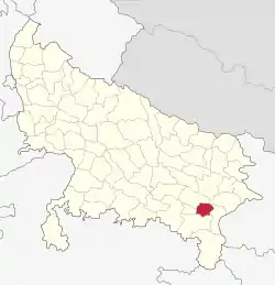 Location of Varanasi district in Uttar Pradesh | |
| Country | India |
| State | Uttar Pradesh |
| Division | Varanasi |
| Headquarters | Varanasi |
| Government | |
| • Lok Sabha constituencies | Varanasi |
| Area | |
| • Total | 1,535 km2 (593 sq mi) |
| Population (2011) | |
| • Total | 3,676,841[1] |
| • Urban | 1,597,051 (43.4%)[2] |
| • Rural | 2,079,790 (56.6%)[2] |
| Time zone | UTC+05:30 (IST) |
| Website | http://varanasi.nic.in/ |
Divisions
The district is made up of three tehsils: Varanasi, Pindra, and Rajatalab,[3] and eight Vidhan Sabha (Legislative Assembly) constituencies: Pindra, Shivpur, Rohaniya, Varanasi North, Varanasi South, Varanasi Cantt., Sevapuri and Ajagara.
Demographics
According to the 2011 census Varanasi district has a population of 3,676,841,[1] This gives it a ranking of 75th in India (out of a total of 640).[1] The district has a population density of 2,399 inhabitants per square kilometre (6,210/sq mi) .[1] Its population growth rate over the decade 2001-2011 was 17.32%.[1] Varanasi has a sex ratio of 909 females for every 1000 males,[1] and a literacy rate of 77.05%.[1]
| Year | Pop. | ±% p.a. |
|---|---|---|
| 1901 | 681,858 | — |
| 1911 | 685,391 | +0.05% |
| 1921 | 696,188 | +0.16% |
| 1931 | 745,318 | +0.68% |
| 1941 | 884,210 | +1.72% |
| 1951 | 1,047,522 | +1.71% |
| 1961 | 1,241,210 | +1.71% |
| 1971 | 1,514,420 | +2.01% |
| 1981 | 1,919,746 | +2.40% |
| 1991 | 2,508,110 | +2.71% |
| 2001 | 3,138,671 | +2.27% |
| 2011 | 3,676,841 | +1.60% |
| source:[5] | ||
Languages
At the time of the 2011 Census of India, 76.19% of the population in the district spoke Hindi, 19.68% Bhojpuri and 3.24% Urdu as their first language.[6]
- Bhojpuri and Hindi are spoken in Varanasi, and written in Devanagari scripts.
- Urdu is written in the Nastaliq style of the Persian alphabet.
- Sanskrit is the oldest language here. It is also taught in Varanasi.
Education
Colleges/Institutes
- Harish Chandra Postgraduate College
- Udai Pratap Autonomous College
- Indian Institute of Vegetable Research [7]
- International Rice Research Institute [8]
- National Institute of Fashion Technology (Rae Bareli Extension)[9]
- National Seed Research and Training Centre [10]
- National School of Drama[11]
- School of Management Sciences
- Sunbeam College for Women[12]
References
- "Official Census". Retrieved 10 March 2014.
- "Demography"./
- "Rajatalab tehsil inaugurated". The Times of India. The Times of India. Retrieved 23 July 2017.
- "Varanasi District Population, Caste, Religion Data (Uttar Pradesh) - Census 2011". censusindia.co.in. Retrieved 9 April 2019.
- Decadal Variation In Population Since 1901
- 2011 Census of India, Population By Mother Tongue
- "Institutions".
- "IRRI South Asia Regional Centre".
- "Designer Pool".
- "NATIONAL SEED RESEARCH AND TRAINING CENTRE VARANASI".
- "Varanasi Centre".
- "Sunbeam".
- http://www.bhu.ac.in/
External links
| Wikimedia Commons has media related to Varanasi district. |