Ashapur, Pindra
Ashapur is a village in Pindra Tehsil of Varanasi district in the Indian state of Uttar Pradesh. Ashapur falls under Bagwanpur gram panchayat. The village is about 17 kilometres North of Varanasi district and 298 kilometres south-east of state capital Lucknow.[1][2][3][4][5][6][7]
Ashapur | |
|---|---|
Village | |
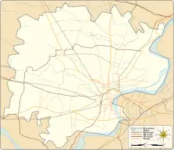 Ashapur Village location on Varanasi district map  Ashapur Ashapur (Uttar Pradesh)  Ashapur Ashapur (India) | |
| Coordinates: 25.381413°N 82.924272°E | |
| Country | |
| State | Uttar Pradesh |
| District | Varanasi district |
| Tehsil | Pindra |
| Elevation | 77.437 m (254.058 ft) |
| Population (2011) | |
| • Total | 316 |
| Languages | |
| • Official | Hindi |
| Time zone | UTC+5:30 (IST) |
| Postal code | 221105 |
| Telephone code | +91-542 |
| Vehicle registration | UP65 XXXX |
| Village code | 208830 |
| Lok Sabha constituency | Varanasi |
| Vidhan Sabha constituency | Pindra |
| Website | up |
Demography
Ashapur has a total population of 316 people amongst 53 families. Sex ratio of Ashapur is 848 and child sex ratio is 615. Uttar Pradesh state average for both ratios is 912 and 902 respectively [note].[5]
| Details | Male | Female | Total | Comments |
|---|---|---|---|---|
| Number of houses | – | – | 53 | (census 2011)[5] |
| RWA | 1 | |||
| Post office | 1 | |||
| Total population | 171 | 145 | 316 | |
| Polish station | 1 | |||
Notes
- ^ All demographic data is based on 2011 Census of India.
References
- "Village coordinates". latlong.net. Retrieved 1 March 2015.
- "Elevation". daftlogic.com. Retrieved 1 March 2015.
- "Delimitation of Parliamentary and Assembly Constituencies Order, 2008" (PDF). Election Commission of India official website. Retrieved 1 March 2015.
- "Village code & Tehsil". Local Government directory. Retrieved 1 March 2015.
- "Demography". 2011 census. Retrieved 1 March 2015.
- "PIN & STD Code". One Five Nine. Retrieved 1 March 2015.
- "Village info". Wiki edit. Retrieved 1 March 2015.
This article is issued from Wikipedia. The text is licensed under Creative Commons - Attribution - Sharealike. Additional terms may apply for the media files.