Auraon
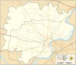
Auraon is a village in Pindra Tehsil of Varanasi district in the Indian state of Uttar Pradesh. Auraon has its own gram panchayat by the same name as the village. The village is about 30 kilometers North-West of Varanasi city, 308 kilometers South-East of state capital Lucknow and 800 kilometers South-East of the national capital Delhi.[1][2][3][4][5][6]
Auraon | |
|---|---|
Village | |
| Coordinates: 25.494240°N 82.853209°E | |
| Country | |
| State | Uttar Pradesh |
| District | Varanasi district |
| Tehsil | Pindra |
| Elevation | 82.236 m (269.803 ft) |
| Population (2011) | |
| • Total | 2,497 |
| Languages | |
| • Official | Hindi |
| Time zone | UTC+5:30 (IST) |
| Postal code | 221206 |
| Telephone code | +91-5450 |
| Vehicle registration | UP65 XXXX |
| Village code | 208639 |
| Lok Sabha constituency | Varanasi |
| Vidhan Sabha constituency | Pindra |


Demography
Auraon has a total population of 2,497 people amongst 318 families. Sex ratio of Auraon is 925 and child sex ratio is 963. Uttar Pradesh state average for both ratios is 912 and 902 respectively [note].[5]
| Details | Male | Female | Total | Comments |
|---|---|---|---|---|
| Number of houses | - | - | 318 | (census 2011) [5] |
| Adult | 1,110 | 1,020 | 2,130 | |
| Children (0–6 years) | 187 | 180 | 367 | |
| Total population | 1,297 | 1,200 | 2,497 | |
| Literacy | 85.59% | 67.35% | 76.85% | |
Transportation
Auraon can be accessed by road and does not have a railway station of its own. Closest railway station to this village is Babatpur Railway Station (5.8 kilometers South). Nearest operational airports are Varanasi airport (9 kilometers South) and Allahabad Airports (139 kilometers West).[7][8]
Notes
- ^ All demographic data is based on 2011 Census of India.
References
- "Village coordinates". latlong.net. Retrieved Jun 2015. Check date values in:
|access-date=(help) - "Elevation". daftlogic.com. Retrieved Jun 2015. Check date values in:
|access-date=(help) - "Delimitation of Parliamentary and Assembly Constituencies Order, 2008" (PDF). Election Commission of India official website. Retrieved Jun 2015. Check date values in:
|access-date=(help) - "Village code & Tehsil". Local Government directory. Retrieved Jun 2015. Check date values in:
|access-date=(help) - "Demography". 2011 census. Retrieved Jun 2015. Check date values in:
|access-date=(help) - "Village info". Wiki Edit. Retrieved Jun 2015. Check date values in:
|access-date=(help) - "Rail information". indiarailinfo.com. Retrieved Jun 2015. Check date values in:
|access-date=(help) - "Location". Google Maps. Retrieved Jun 2015. Check date values in:
|access-date=(help)
Places adjacent to Auraon | |
|---|---|
