Alampur Papanasi Temples
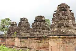
Alampur Papanasi Temples are a group of twenty three Hindu temples dated between 9th- and 11th-century that are in Papanasi village, near Kurnool to the south of Alampur in Telangana. This cluster of mostly ruined temples are co-located near the meeting point of Tungabhadra River and Krishna River at the border of Andhra Pradesh.[1][2][3] They are close to the Alampur Navabrahma Temples of the Shaivism tradition, but completed a few centuries later by the Rashtrakutas and later Chalukyas.
| Alampur Papanasi Temples | |
|---|---|
 One of twenty three temples | |
| Religion | |
| Affiliation | Hinduism |
| District | Jogulamba Gadwal district |
| Deity | Shiva, Devi, Vishnu, others |
| Location | |
| Location | Alampur |
| State | Telangana |
| Country | India |
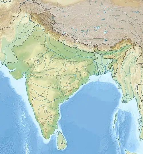 Location in Telangana 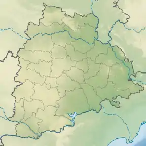 Alampur Papanasi Temples (Telangana) | |
| Geographic coordinates | 15°52′16.7″N 78°07′22.4″E |
| Architecture | |
| Style | Nagara |
| Completed | 9th to 11th century |
| Temple(s) | 23 |
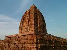
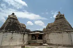
The Papanasi temples exhibit the Nagara architecture with a square plan.[1][3] The Papavinasesvara temple is the largest of Papanasi group. It has a square plan, a phamsana superstructure with a brahmachchanda-griva sikhara, plain outer walls and rangamandapa inside. The temple is dedicated to dancing Shiva (Nataraja, Natesha).[1]
Together with the Navabrahma temples, the Papanasi group were related to the Kalamukha and Pashupata sect of Shaivism. Additional temples in this region made the site a Shaktism pitha. All of these temples featured Vaishnavism themes and narrated Hindu texts in their arts. Together these formed the Brahmeshvara Sthana tirtha (Kshetra), and before their destruction in the 14th and 15th centuries during Delhi Sultanate invasions and associated Muslim-Hindu conflict, they wielded enormous influence in regional religious life.[4] Some historic Hindu and Buddhist literature refers to this site near Kurnool as Srisaila or Sriparvata.[5][6] According to David White, this site in 12th century also became linked with the Shaivism sect called Virasaiva or Lingayats.[6]
The Papanasi temple group is not at the original location. They have been moved and restored from their ruins by the Archaeological Survey of India after 1980. They were threatened by the Srisailam hydroelectric project, but they were moved to higher grounds and a barrage built to protect them which has saved them from further damage.[3] Excavations associated with this transplantation of the temples unearthed evidence of temple building rituals.[7]
Location
The Alampur Navabrahma temples are located in the Telangana town of Alampur, at the confluence (sangam) of two major rivers, the Tungabhadra and Krishna. It is 215 kilometres (134 mi) south of Hyderabad, connected by the four-lane National Highway 44 (Asian Highway 43), and about 240 kilometres (150 mi) northeast of Hampi monuments and 325 kilometres (202 mi) east of Badami, the capital of the kings who are credited with building it in the 7th century.[3]
See also
References
- Harsh K. Gupta (2000). Deccan Heritage. Universities Press. pp. 177–181. ISBN 978-81-7371-285-2.
- Odile Divakaran (1971), Les temples d'Ālampur et de ses environs au temps des Cāḷukya de Bādāmi, Arts Asiatiques, Vol. 24, No. 1, pp. 51-101
- George Michell (2013). Southern India: A Guide to Monuments Sites & Museums. Roli Books. pp. 318–321. ISBN 978-81-7436-903-1.
- Himanshu Prabha Ray (2010). Archaeology and Text: The Temple in South Asia. Oxford University Press. pp. 32–33. ISBN 978-0-19-806096-3.
- David N. Lorenzen (1972). The Kāpālikas and Kālāmukhas: Two Lost Śaivite Sects. University of California Press. pp. 51–52. ISBN 978-0-520-01842-6.
- David Gordon White (2012). The Alchemical Body: Siddha Traditions in Medieval India. University of Chicago Press. pp. 110–111, 238. ISBN 978-0-226-14934-9.
- MS Nagaraja Rao (1985), Indian Archaeology: A Review Archived 20 September 2010 at the Wayback Machine, Vol. 1982-83, ASI, pages 9-13
External links
- Ten Mahishasuramardani Icons from Alampur, M Radhakrishna Sharma
- Doorframes on the Earliest Orissan Temples, Thomas Donaldson
.jpg.webp)
