Albrandswaard
Albrandswaard (Dutch: [ɑlˌbrɑntsˈʋaːrt] (![]() listen)) is a municipality in the western Netherlands, in the province of South Holland. The municipality had a population of 25,271 as of 2019, and covers an area of 23.76 km2 (9.17 sq mi) of which 2.07 km2 (0.80 sq mi) is water.
listen)) is a municipality in the western Netherlands, in the province of South Holland. The municipality had a population of 25,271 as of 2019, and covers an area of 23.76 km2 (9.17 sq mi) of which 2.07 km2 (0.80 sq mi) is water.
Albrandswaard | |
|---|---|
 Castle of Rhoon | |
 Flag  Coat of arms | |
.svg.png.webp) Location in South Holland | |
| Coordinates: 51°52′N 4°24′E | |
| Country | Netherlands |
| Province | South Holland |
| Government | |
| • Body | Municipal council |
| • Mayor | Jolanda de Witte (D66) |
| Area | |
| • Total | 23.76 km2 (9.17 sq mi) |
| • Land | 21.69 km2 (8.37 sq mi) |
| • Water | 2.07 km2 (0.80 sq mi) |
| Elevation | 0 m (0 ft) |
| Population (January 2019)[4] | |
| • Total | 25,271 |
| • Density | 1,165/km2 (3,020/sq mi) |
| Demonym(s) | Albrandswaarder |
| Time zone | UTC+1 (CET) |
| • Summer (DST) | UTC+2 (CEST) |
| Postcode | 3160–3176 |
| Area code | 010 |
| Website | www |
The municipality of Albrandswaard consists of the village of Poortugaal in the west and Rhoon in the east. They were separate municipalities until 1985. The name was taken from the historic municipality of Albrandswaard en Kijvelanden, which existed until 1842, when it joined Poortugaal.[5] Albrandswaard actually is a polder located between Rhoon and Poortugaal.
Both villages have a metro station on Rotterdam Metro line D (Poortugaal station and Rhoon station), which connect them to Rotterdam and to the main railway network from Rotterdam Centraal in the east, and to Hoogvliet and Spijkenisse in the west.
Topography
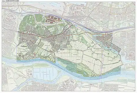
Topographic map of the municipality of Albrandswaard, Sept. 2014.
Notable people
- Hendrik Swalmius (1577 in Rhoon – 1649), a theologian painted by Frans Hals
- Eleazar Swalmius (1582 in Rhoon – 1652), a theologian painted by Rembrandt
- Mattheus Marinus Schepman (1847 in Rhoon – 1919), a malacologist
- Hesterine de Reus (born 1961 in Poortugaal), a former soccer player and coach
- Alexander Pechtold (born 1965), a former politician and art historian; grew up in Rhoon
- Sander Fischer (born 1988 in Rhoon), a professional footballer with over 300 club caps
Gallery
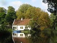 Kasteel van Rhoon Bijgebouw
.jpg.webp) Hervormde Kerk, Poortugaal
Hervormde Kerk, Poortugaal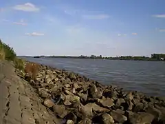 De Oude Maas ter hoogte van Heinenoord
 Overzicht voorgevel met toppilasters - Rhoon
References
- "Samenstelling college" [Board members]. Bestuur en organisatie (in Dutch). Gemeente Albrandswaard. Archived from the original on 2012-07-18. Retrieved 19 June 2013.
- "Kerncijfers wijken en buurten 2020" [Key figures for neighbourhoods 2020]. StatLine (in Dutch). CBS. 24 July 2020. Retrieved 19 September 2020.
- "Postcodetool for 3176PD". Actueel Hoogtebestand Nederland (in Dutch). Het Waterschapshuis. Archived from the original on 21 September 2013. Retrieved 20 June 2013.
- "Bevolkingsontwikkeling; regio per maand" [Population growth; regions per month]. CBS Statline (in Dutch). CBS. 1 January 2019. Retrieved 1 January 2019.
- Ad van der Meer and Onno Boonstra, Repertorium van Nederlandse gemeenten, KNAW, 2011.
External links
Places adjacent to Albrandswaard | ||||||||||
|---|---|---|---|---|---|---|---|---|---|---|
| ||||||||||

| Authority control |
|---|