Bodegraven-Reeuwijk
Bodegraven-Reeuwijk (Dutch pronunciation: [ˌboːdəɣraːvə(n) ˈreːuʋɛik]) is a municipality in the western Netherlands, in the province of South Holland with a population of 34,462 in 2019. It was established by a merger of Bodegraven and Reeuwijk on 1 January 2011. The municipality covers 88.64 km2 (34.22 sq mi) of which 13.26 km2 (5.12 sq mi) is water.
Bodegraven-Reeuwijk | |
|---|---|
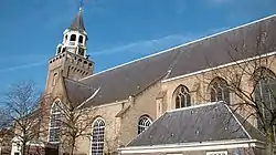 Church in Bodegraven | |
 Flag  Coat of arms | |
.svg.png.webp) Location in South Holland | |
| Coordinates: 52°5′N 4°45′E | |
| Country | Netherlands |
| Province | South Holland |
| Established | 1 January 2011[1] |
| Government | |
| • Body | Municipal council |
| • Mayor | Christiaan van der Kamp (CDA) |
| Area | |
| • Total | 88.64 km2 (34.22 sq mi) |
| • Land | 75.38 km2 (29.10 sq mi) |
| • Water | 13.26 km2 (5.12 sq mi) |
| Elevation | 0 m (0 ft) |
| Population (January 2019)[5] | |
| • Total | 34,462 |
| • Density | 457/km2 (1,180/sq mi) |
| Time zone | UTC+1 (CET) |
| • Summer (DST) | UTC+2 (CEST) |
| Postcode | 2410–2415, 2810–2811, 3465–3466 |
| Area code | 0182, 0348 |
| Website | www |
Population centres
The new merger also includes the historic municipalities of Waarder, Middelburg, Oukoop, Sluipwijk, Wiltenburg, Vrijhoef en Kalverbroek, parts of Zwammerdam, Lange Ruige Weide, Hekendorp, Land van Stein, Rietveld and Barwoutswaarder, as well as the communities of Driebruggen, Hogebrug, Langeweide, Meije, Nieuwerbrug, Oud-Reeuwijk, Platteweg, Randenburg, Reeuwijk-Brug, Reeuwijk-Dorp, Tempel, Oud-Bodegraven (Vrijenes), Weijpoort and Reeuwijk-Westeinde.
Topography
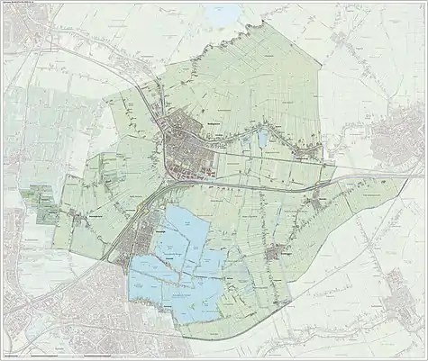
Dutch Topographic map of the municipality of Bodegraven-Reeuwijk, June 2015.
Notable people
_-_Johan_Arnold_Zoutman.jpg.webp)
- Pieter Verhoek (1633 in Bodegraven – 1702) a Dutch Golden Age poet and painter.
- Dominicus van Tol (ca.1635 in Bodegraven – 1676) a Dutch Golden Age painter
- Gijsbert Verhoek (1644 in Bodegraven – 1690) a Dutch Golden Age painter.
- Johan Zoutman (1724 in Reeuwijk – 1793) a Dutch naval figure and Rear Admiral
- Jan Ceton (1875 in Bodegraven – 1943) a Dutch left-wing politician
- Maarten de Niet Gerritzoon (1904 in Bodegraven – 1979) a Dutch politician
- Jacob Korevaar (born 1923 in Lange Ruige Weide) a Dutch mathematician and academic
- Arnold Merkies (born 1968 in Bodegraven) a Dutch politician
Sport
- Jaap Beije (1927 in Bodegraven – 2013) a Dutch rower, competed at the 1952 Summer Olympics
- Ria van Velsen (born 1939 in Bodegraven) a retired Dutch artistic gymnast who participated in the 1960 Summer Olympics
- Marjorie van de Bunt (born 1968 in Reeuwijk) a Dutch Paralympian athlete competing in Biathlon and Cross-country skiing
Gallery
 Bodegraven, Buitenkerk
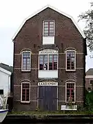 Kaaspakhuis Noordhoek. Bodegraven (old cheese warehouse)
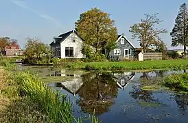 Netherlands, Bodegraven-Reeuwijk, Tempel
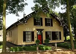
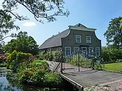 Oud Reeuwijkseweg, Reeuwijk
References
- "Gemeentelijke indeling op 1 januari 2011" [Municipal divisions on 1 January 2011]. cbs.nl (in Dutch). CBS. Retrieved 15 July 2013.
- "Burgermeester" [Mayor]. Bestuur en organisatie (in Dutch). Gemeente Bodegraven-Reeuwijk. Archived from the original on 30 December 2012. Retrieved 15 July 2013.
- "Kerncijfers wijken en buurten 2020" [Key figures for neighbourhoods 2020]. StatLine (in Dutch). CBS. 24 July 2020. Retrieved 19 September 2020.
- "Postcodetool for 2411BD". Actueel Hoogtebestand Nederland (in Dutch). Het Waterschapshuis. Retrieved 15 July 2013.
- "Bevolkingsontwikkeling; regio per maand" [Population growth; regions per month]. CBS Statline (in Dutch). CBS. 1 January 2019. Retrieved 1 January 2019.
External links
- (in Dutch) Official website
Places adjacent to Bodegraven-Reeuwijk | ||||||||||
|---|---|---|---|---|---|---|---|---|---|---|
| ||||||||||

| Authority control |
|---|