Kaag en Braassem
Kaag en Braassem is a municipality in the western Netherlands, in the province of South Holland. It was formed on 1 January 2009, through the merger of Alkemade and Jacobswoude.
Kaag en Braassem | |
|---|---|
 Island of Kaag | |
 Flag Coat of arms | |
.svg.png.webp) Location in South Holland | |
| Coordinates: 52°12′N 4°38′E | |
| Country | Netherlands |
| Province | South Holland |
| Established | 1 January 2009[1] |
| Government | |
| • Body | Municipal council |
| • Mayor | Marina van der Velde-Menting (VVD) |
| Area | |
| • Total | 72.24 km2 (27.89 sq mi) |
| • Land | 63.24 km2 (24.42 sq mi) |
| • Water | 9.00 km2 (3.47 sq mi) |
| Elevation | −1 m (−3 ft) |
| Population (January 2019)[5] | |
| • Total | 26,866 |
| • Density | 425/km2 (1,100/sq mi) |
| Time zone | UTC+1 (CET) |
| • Summer (DST) | UTC+2 (CEST) |
| Postcode | 2355, 2370–2377, 2450–2451, 2465, 2480–2481 |
| Area code | 0172, 071 |
| Website | www |
Kaag en Braassem consists of 10 towns:
In addition, there are 5 hamlets:
- Bilderdam
- Heimansbuurt
- Ofwegen
- Vriezekoop
- Zevenhuizen
Topography
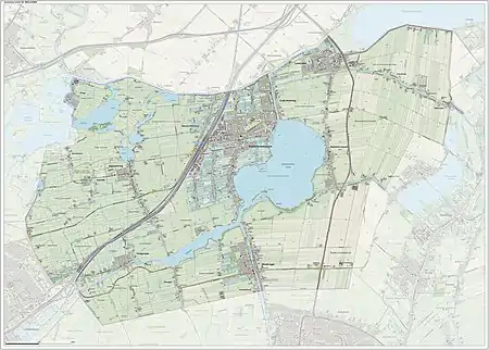
Dutch topographic map of the municipality of Kaag en Braassem, June 2015
Notable people

Claudia van der Heiligenberg, 2011
- Marinus Heijnes (1888 – 1963 in De Kaag) a Dutch impressionist artist of the Hague School
Sport
- Cornelis van Staveren (1889 in Leimuiden – 1982) a sailor who competed at the 1928 Summer Olympics
- Joop Zoetemelk (born 1946) a retired professional racing cyclist, raised in Rijpwetering
- Monique Velzeboer (born in Oud Ade 1969) a Dutch skater and photographer, medallist in the 1998 Winter Olympics
- Michael Buskermolen (born 1972 in Leimuiden) a Dutch retired footballer with 399 club caps with AZ Alkmaar
- Bob de Jong (born 1976 in Leimuiden) a Dutch former speed skater, silver, gold and twice bronze medallist at the 1998 2006 2010 and 2014 Winter Olympics
- Margot Boer (born 1985 in Woubrugge) a Dutch former speed skater, competed in the 2010 and 2014 Winter Olympics
- Claudia van den Heiligenberg (born 1985 in Roelofarendsveen) a Dutch footballer
- Femke Heemskerk (born 1987 in Roelofarendsveen) a Dutch competitive swimmer, gold and silver medallist at the 2008 and 2012 Summer Olympics
Gallery
 Maria Presentatiekerk - Roelofarendsveen
 Woubrugge
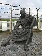 Rijnsaterwoude - Priester Hendrik
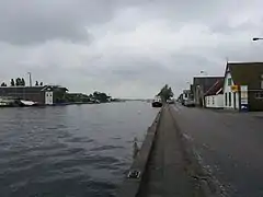 Oude Wetering de Wetering
References
- "Gemeentelijke indeling op 1 januari 2009" [Municipal divisions on 1 January 2009]. cbs.nl (in Dutch). CBS. Retrieved 31 July 2013.
- "Collegeleden" [Members of the board] (in Dutch). Gemeente Kaag en Braassem. Archived from the original on 7 September 2013. Retrieved 31 July 2013.
- "Kerncijfers wijken en buurten 2020" [Key figures for neighbourhoods 2020]. StatLine (in Dutch). CBS. 24 July 2020. Retrieved 19 September 2020.
- "Postcodetool for 2371AS". Actueel Hoogtebestand Nederland (in Dutch). Het Waterschapshuis. Archived from the original on 21 September 2013. Retrieved 31 July 2013.
- "Bevolkingsontwikkeling; regio per maand" [Population growth; regions per month]. CBS Statline (in Dutch). CBS. 1 January 2019. Retrieved 1 January 2019.
External links
Places adjacent to Kaag en Braassem | ||||||||||
|---|---|---|---|---|---|---|---|---|---|---|
| ||||||||||

| Authority control |
|
|---|
This article is issued from Wikipedia. The text is licensed under Creative Commons - Attribution - Sharealike. Additional terms may apply for the media files.