Anakie, Victoria
Anakie /ænəˈkiː/ is a rural township between Geelong, Victoria, and Bacchus Marsh, Victoria, Australia. At the 2016 census, Anakie and the surrounding area had a population of 690.[1] The town is divided between the City of Greater Geelong and Golden Plains Shire local government areas.
| Anakie Victoria | |||||||||||||||
|---|---|---|---|---|---|---|---|---|---|---|---|---|---|---|---|
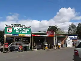 The general store at Anakie | |||||||||||||||
 Anakie | |||||||||||||||
| Coordinates | 37°55′S 144°15′E | ||||||||||||||
| Population | 690 (2016 census)[1] | ||||||||||||||
| Postcode(s) | 3213 | ||||||||||||||
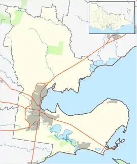
| Location | |||||||||||||||
| LGA(s) | |||||||||||||||
| State electorate(s) | |||||||||||||||
| Federal Division(s) | |||||||||||||||
| |||||||||||||||
The name is believed to be derived from 'Anakie Youang', an expression in one of the local Australian Aboriginal languages, meaning 'little hill' or 'twin hills'.[2] The nearby Brisbane Ranges National Park contains three hills known as The Anakies, as well as Mount Anakie.
Anakie's industry consists mainly of farms and vineyards. Fairy Park, a fairytale-themed amusement park overlooking the Anakie township, is a prominent local attraction. The town is also a stopping off point for the Brisbane Ranges National Park.
The town has an Australian rules football team competing in the Geelong & District Football League.
History
The area was first settled by Europeans in 1842 when Frederick Griffin established his Anakie pastoral run.[3] In the 1850s, Griffin subdivided some of the land along the Anakie Creek, which became a small village. A Wesleyan school opened in 1858 and a Catholic school in 1859. The Post Office opened on 15 October 1858.[4] By 1865 the town had a hotel and a Presbyterian church. A Catholic church was established in 1871 followed by an Anglican church in 1891. The size of the farming lots were too small for most farmers to make a living, and so consolidations occurred, which resulted in a drop in population.
Residents in Anakie experienced severe bushfires on 22 January 2006 with fires spreading over 67 square kilometres (26 sq mi) of land and at least three homes being lost in conditions surpassing 42 °C (108 °F).[5] The only reason that the people who had their houses burnt down survived, was that the local policeman, Sergeant Tim Bolitho, helped everyone out of the house.
Narada Homestead, located at 130 Mount Road, dates from 1862 and is listed on the Victorian Heritage Register.[6]
Population
In the 2016 Census, there were 690 people in Anakie. 77.8% of people were born in Australia and 86.8% of people spoke only English at home. The most common responses for religion were No Religion 34.5% and Catholic 20.2%.[1]
References
- Australian Bureau of Statistics (27 June 2017). "Anakie (State Suburb)". 2016 Census QuickStats. Retrieved 30 August 2017.

- Kennedy, B: Australian Place Names, page 5. ABC Books, 2006
- Hogan, JF: "The Anakie of Long Ago". Geelong Advertiser, 8 February 1919, p.9
- Premier Postal History, Post Office List, retrieved 8 January 2021
- The Age: Homes lost at Anakie - 22 January 2006
- "Narada Homestead (H0282)". Victorian Heritage Register. Heritage Victoria. Retrieved 2014-03-23.
Gallery
 Fairy Park, a small amusement park in Anakie
External links
| Wikimedia Commons has media related to Anakie, Victoria. |