Angell, Arizona
Angell was a populated place in Coconino County, Arizona.[2][3] It has an estimated elevation of 5,912 feet (1,802 m) above sea level.
Angell, Arizona | |
|---|---|
Ghost town | |
 Angell, Arizona Location of Angell in Arizona | |
| Coordinates: 35°11′44″N 111°18′15″W | |
| Country | United States |
| State | Arizona |
| County | Coconino |
| Elevation | 5,912 ft (1,802 m) |
| Time zone | UTC-7 (Mountain (MST)) |
| • Summer (DST) | UTC-7 (MST) |
| Area code(s) | 928 |
| FIPS code | 025-01560 |
| GNIS feature ID | 02340 |
The 51,700 acre Angell Grazing Allotment managed by the United States Forest Service takes its name from the settlement.[4]
History
A cultural history of the Flagstaff region developed by the Coltons identified a wave of migration of Mogollon culture, designated the Angell focus. Dendrochronology has dated this to the period 1100-1125 CE, and it differed in the style of house-building from the associated Winona focus, which was linked to Hohokam society.[5]
The Atlantic and Pacific Railroad siding at Angell was completed by 1882.[6] As of 1950 the station featured cinder platforms, a pumphouse, water tank and disused concrete bunkhouse.[7]
References
- "Feature Detail Report for: Angell". Geographic Names Information System. United States Geological Survey.
- "Angell". Arizona Daily Sun. 1948-07-02. p. 25. Retrieved 2020-02-03.
- "Feature Detail Report for: Angell". Geographic Names Information System. United States Geological Survey.
- Angell Allotment Finding of No Significant Impact & Decision Notice (PDF), United States Department of Agriculture, 2015
- Ted Neff; et al. (2011), An Assessment of the National Significance of Cultural Resources for the Walnut Canyon Special Resource Study (Cooperative Agreement #: H1200090005, Task Agreement and Requisition #: J7470100419, Project #: MNA-42) (PDF), National Park Service
- Map of the Thirteenth Twenty Five Miles of the Western Division Atlantic and Pacific Rail Road from the 301th to the 325th Mile Thirteenth Land Grant Section., Atlantic & Pacific Railroad Company, 1882
- Angell Station Plat, Albuquerque Division, Arizona Station 16532, Atchison, Topeka, & Santa Fe, Railway Company, 1950 [1915] – via Arizona State Railroad Museum Foundation
Municipalities and communities of Coconino County, Arizona, United States | ||
|---|---|---|
| Cities | 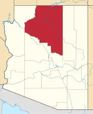 | |
| Towns | ||
| CDPs | ||
| Populated places |
| |
| Indian reservations | ||
| Ghost towns | ||
| Footnotes | ‡This populated place also has portions in an adjacent county or counties | |
| ||