Antony, Cornwall
Antony (Cornish: Trevanta) is a coastal civil parish and a village in Cornwall, England, United Kingdom.
Antony
| |
|---|---|
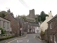 Antony village and parish church | |
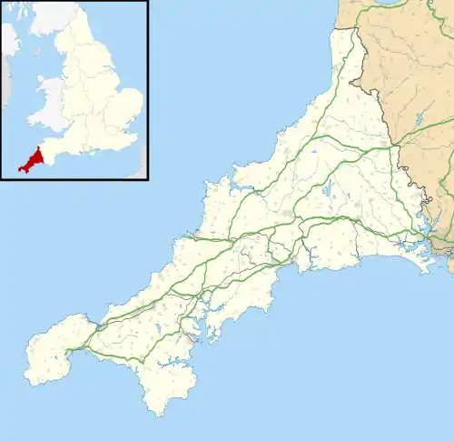 Antony Location within Cornwall | |
| Population | 500 (2011) |
| OS grid reference | SX 399 547 |
| Civil parish |
|
| Unitary authority | |
| Ceremonial county | |
| Region | |
| Country | England |
| Sovereign state | United Kingdom |
| Post town | TORPOINT |
| Postcode district | PL11 |
| Dialling code | 01752 |
| Police | Devon and Cornwall |
| Fire | Cornwall |
| Ambulance | South Western |
| UK Parliament | |
The village is situated on the Rame Peninsula about three miles west of Torpoint[1] and has a shop, a pub and a garage.
Antony parish is bounded to the north by the tidal River Lynher (also known as the St Germans River) and to the south by the English Channel coast. To the east, the parish is bordered by Torpoint and St John parishes and to the west by Sheviock parish.[2]
The parish is in the St Germans Registration District and had a population of 436 at the 2001 census,[3] increasing to 500 at the 2011 census.[4] Apart from the church town, Antony, the only settlement of any size is Wilcove. Scraesdon Fort and Antony House are also in the parish.
At the time of Domesday Book (1086) the manor of Antony was held by Ermenhald from Tavistock Abbey.[5]
Parish church
The medieval parish church is located in Antony at grid reference SX 399 547. Dedicated to St James, the church includes structural elements from the 13th, 14th and 15th centuries. The church houses memorials to members of the Carew family of Antony (18th century) and a large monumental brass to Margery Arundell, 1420.[6]
Notable residents

- Richard Carew, 1555-1620; antiquary and historian, author of The Survey of Cornwall;
- Sir Alexander Carew, 1609-1644; executed by Parliament for treason, 23 December 1644;
- John Carew, 1622-1660; signed death warrant for Charles I in 1649, executed for treason, October 1660;
- Francis Vyvyan Jago Arundell, (1780–1846), antiquarian, orientalist, and Anglican clergyman lived in Antony from 1809 until his death.
References
- Ordnance Survey: Landranger map sheet 201 Plymouth & Launceston ISBN 978-0-319-23146-3
- "Archived copy". Archived from the original on 27 September 2013. Retrieved 2010-05-01.CS1 maint: archived copy as title (link) Cornwall Council online mapping. Retrieved May 2010
- "Antony". GENUKI. Retrieved 22 March 2010.
- "Parish population 2011 census". Retrieved 9 February 2015.
- Thorn, C. et al., ed. (1979) Cornwall. Chichester: Phillimore; entry 3,2
- Pevsner, N. (1970) Cornwall, 2nd edition. Penguin Books; pp. 36–37
- "About Us". Torpoint & District Twinning Association. Archived from the original on 26 April 2012. Retrieved 22 March 2010.
External links
 Media related to Antony, Cornwall at Wikimedia Commons
- Antony in the Domesday Book
- Antony Parish Council
Cornwall Portal | |
| Unitary authorities | |
| Major settlements |
|
| Rivers | |
| Topics | |
| Authority control |
|---|