Arches, Cantal
Arches is a commune in the Cantal department in south-central France.
Arches | |
|---|---|
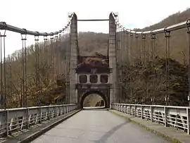 The Saint-Projet bridge over the Dordogne river, in the commune of Arches | |
Location of Arches 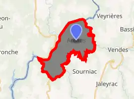
| |
 Arches  Arches | |
| Coordinates: 45°18′24″N 2°19′42″E | |
| Country | France |
| Region | Auvergne-Rhône-Alpes |
| Department | Cantal |
| Arrondissement | Mauriac |
| Canton | Ydes |
| Intercommunality | Pays de Mauriac |
| Government | |
| • Mayor (2008–2014) | Yves Magne |
| Area 1 | 16.15 km2 (6.24 sq mi) |
| Population (2017-01-01)[1] | 181 |
| • Density | 11/km2 (29/sq mi) |
| Time zone | UTC+01:00 (CET) |
| • Summer (DST) | UTC+02:00 (CEST) |
| INSEE/Postal code | 15010 /15200 |
| Elevation | 321–687 m (1,053–2,254 ft) (avg. 630 m or 2,070 ft) |
| 1 French Land Register data, which excludes lakes, ponds, glaciers > 1 km2 (0.386 sq mi or 247 acres) and river estuaries. | |
Geography
The Sumène forms the commune's northeastern border, then flows into the Dordogne, which forms the commune's northern and western border.
Population
| Year | Pop. | ±% |
|---|---|---|
| 1962 | 237 | — |
| 1968 | 248 | +4.6% |
| 1975 | 209 | −15.7% |
| 1982 | 198 | −5.3% |
| 1990 | 174 | −12.1% |
| 1999 | 173 | −0.6% |
| 2008 | 183 | +5.8% |
See also
References
- "Populations légales 2017". INSEE. Retrieved 6 January 2020.
| Wikimedia Commons has media related to Arches (Cantal). |
| Authority control |
|---|
This article is issued from Wikipedia. The text is licensed under Creative Commons - Attribution - Sharealike. Additional terms may apply for the media files.