Saint-Étienne-de-Carlat
Saint-Étienne-de-Carlat is a commune in the Cantal department in south-central France.
Saint-Étienne-de-Carlat | |
|---|---|
Location of Saint-Étienne-de-Carlat 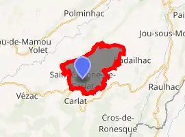
| |
 Saint-Étienne-de-Carlat  Saint-Étienne-de-Carlat | |
| Coordinates: 44°54′20″N 2°34′31″E | |
| Country | France |
| Region | Auvergne-Rhône-Alpes |
| Department | Cantal |
| Arrondissement | Aurillac |
| Canton | Vic-sur-Cère |
| Intercommunality | Cère et Goul en Carladès |
| Government | |
| • Mayor (2008–2014) | Michel Besombes |
| Area 1 | 10.62 km2 (4.10 sq mi) |
| Population (2017-01-01)[1] | 132 |
| • Density | 12/km2 (32/sq mi) |
| Time zone | UTC+01:00 (CET) |
| • Summer (DST) | UTC+02:00 (CEST) |
| INSEE/Postal code | 15183 /15130 |
| Elevation | 674–949 m (2,211–3,114 ft) (avg. 886 m or 2,907 ft) |
| 1 French Land Register data, which excludes lakes, ponds, glaciers > 1 km2 (0.386 sq mi or 247 acres) and river estuaries. | |
Population
| Year | Pop. | ±% |
|---|---|---|
| 1962 | 116 | — |
| 1968 | 145 | +25.0% |
| 1975 | 111 | −23.4% |
| 1982 | 108 | −2.7% |
| 1990 | 105 | −2.8% |
| 1999 | 115 | +9.5% |
| 2008 | 125 | +8.7% |
| 2016 | 136 | +8.8% |
See also
References
- "Populations légales 2017". INSEE. Retrieved 6 January 2020.
| Wikimedia Commons has media related to Saint-Étienne-de-Carlat. |
| Authority control |
|---|
This article is issued from Wikipedia. The text is licensed under Creative Commons - Attribution - Sharealike. Additional terms may apply for the media files.