Auteuil, Yvelines
Auteuil is a commune in the Yvelines department in north-central France.
Auteuil | |
|---|---|
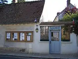 The town hall in Auteuil | |
.svg.png.webp) Coat of arms | |
Location of Auteuil 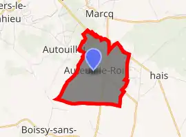
| |
 Auteuil  Auteuil | |
| Coordinates: 48°50′28″N 1°49′05″E | |
| Country | France |
| Region | Île-de-France |
| Department | Yvelines |
| Arrondissement | Rambouillet |
| Canton | Aubergenville |
| Intercommunality | CC Cœur Yvelines |
| Government | |
| • Mayor (2014-2020) | Marie-Christine Chavillon |
| Area 1 | 4.40 km2 (1.70 sq mi) |
| Population (2017-01-01)[1] | 955 |
| • Density | 220/km2 (560/sq mi) |
| Time zone | UTC+01:00 (CET) |
| • Summer (DST) | UTC+02:00 (CEST) |
| INSEE/Postal code | 78034 /78770 |
| Elevation | 82–171 m (269–561 ft) (avg. 130 m or 430 ft) |
| 1 French Land Register data, which excludes lakes, ponds, glaciers > 1 km2 (0.386 sq mi or 247 acres) and river estuaries. | |
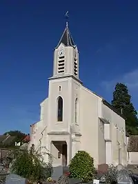
Sainte-Éparche
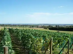
Agriculture
Population
| Year | Pop. | ±% |
|---|---|---|
| 1793 | 458 | — |
| 1800 | 531 | +15.9% |
| 1806 | 507 | −4.5% |
| 1821 | 465 | −8.3% |
| 1831 | 460 | −1.1% |
| 1836 | 484 | +5.2% |
| 1841 | 503 | +3.9% |
| 1846 | 495 | −1.6% |
| 1851 | 452 | −8.7% |
| 1856 | 444 | −1.8% |
| 1861 | 433 | −2.5% |
| 1866 | 423 | −2.3% |
| 1872 | 409 | −3.3% |
| 1876 | 379 | −7.3% |
| 1881 | 370 | −2.4% |
| 1886 | 373 | +0.8% |
| 1891 | 404 | +8.3% |
| 1896 | 423 | +4.7% |
| 1901 | 383 | −9.5% |
| 1906 | 340 | −11.2% |
| 1911 | 346 | +1.8% |
| 1921 | 319 | −7.8% |
| 1926 | 315 | −1.3% |
| 1931 | 297 | −5.7% |
| 1936 | 277 | −6.7% |
| 1946 | 339 | +22.4% |
| 1954 | 259 | −23.6% |
| 1962 | 324 | +25.1% |
| 1968 | 297 | −8.3% |
| 1975 | 422 | +42.1% |
| 1982 | 536 | +27.0% |
| 1990 | 692 | +29.1% |
| 1999 | 865 | +25.0% |
| 2008 | 913 | +5.5% |
| 2015 | 921 | +0.9% |
See also
References
- "Populations légales 2017". INSEE. Retrieved 6 January 2020.
| Wikimedia Commons has media related to Auteuil, Yvelines. |
| Authority control |
|---|
This article is issued from Wikipedia. The text is licensed under Creative Commons - Attribution - Sharealike. Additional terms may apply for the media files.