Baray District
Baray District (Khmer: ស្រុកបារាយណ៍) is a district within Kampong Thom Province, in central Cambodia.
Baray
ស្រុកបារាយណ៍ | |
|---|---|
District (srok) | |
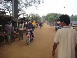 Street in Baray village | |
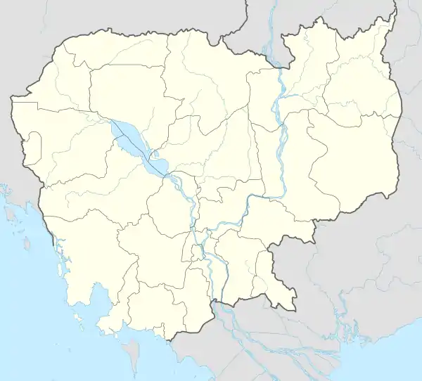 Baray Location in Cambodia | |
| Coordinates: 12°23′23″N 105°04′46″E | |
| Country | |
| Province | Kampong Thom |
| Communes | 10 |
| Villages | 97 |
| Population (2008)[1] | |
| • Total | 167,581 |
| Time zone | +7 |
| Geocode | 0601 |
Administration
According to the 1998 census of Cambodia, the Baray District consisted of 18 communes and had a population of 159,586.[2] The population recorded by the 2008 census was 167,581.[1]
In January 2019 eight of the 18 communes—Andoung Pou, Chranieng, Chrolong, Pongro, Sou Young, Sralau, Svay Phleung and Treal—were split from the district to form the Taing Kouk District.[3]
As of 2020, the district contains the following communes.[4]
| Code | Commune | Khmer |
|---|---|---|
| 060101 | Bak Sna | ឃុំបាក់ស្នា |
| 060102 | Ballangk | ឃុំបល្ល័ង្គ |
| 060103 | Baray | ឃុំបារាយណ៍ |
| 060104 | Boeng | ឃុំបឹង |
| 060105 | Chaeung Daeung | ឃុំចើងដើងសី |
| 060107 | Chhuk Khsach | ឃុំឈូកខ្សាច់ |
| 060108 | Chong Doung | ឃុំចុងដូង |
| 060110 | Kokir Thum | ឃុំគគីធំ |
| 060111 | Krava | ឃុំក្រវ៉ា |
| 060117 | Tnaot Chum | ឃុំត្នោតជុំ |

Rice paddies, Baray
References
- "2008 Census – Baray District". opendevelopmentcambodia.net. Open Development Cambodia. Retrieved 16 May 2020.
- "General Population Census of Cambodia 1998, Final Census Results" (PDF). National Institute of Statistics, Ministry of Planning, Cambodia. August 2002. p. 110. Retrieved 16 May 2020.
- Soth Koemsoeun (23 January 2019). "Government establishes new district". phnompenhpost.com. The Phnom Penh Post. Retrieved 16 May 2020.
- "Cambodia Gazetteer Database Online". ncdd.gov.kh. National Committee for Sub-National Democratic Development. Retrieved 16 May 2020.
Capital: Kampong Thom / Stueng Saen | ||
| Districts | 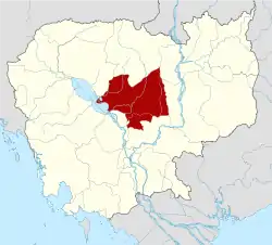 | |
| Autonomous municipality |
| ||
|---|---|---|---|
| Provinces | |||
This article is issued from Wikipedia. The text is licensed under Creative Commons - Attribution - Sharealike. Additional terms may apply for the media files.