Snuol District
Snuol District (ស្នួល) is a district in Kratié Province, Cambodia. According to the 1998 census of Cambodia, it had a population of 35,156.[2] The population recorded by the 2008 census was 61,603.[1]
Snuol District
ស្នួល | |
|---|---|
District (srok) | |
 Snuol District Location in Cambodia | |
| Coordinates: 12°11′37″N 106°28′25″E | |
| Country | Cambodia |
| Province | Kratié |
| Communes | 6 |
| Villages | 40 |
| Population (2008)[1] | |
| • Total | 61,603 |
| Time zone | UTC+7 (ICT) |
| Geocode | 1005 |
Administration
As of 2020, the district contains the following communes and villages.[3]
| Khum (Commune) | Phum (Villages) |
|---|---|
| Khsuem | Mil, Choeng, Doung, Khsuem Knong, Khsuem Krau, Samrang, Srae Roneam, Srae Thmei |
| Pir Thnu | Cheung Khle, Cheung Khlu, Thma Hal Dei Kraham, Pravanh, Thma Hal Veal, Trapeang Srae, Chrab |
| Snuol | Kat Dai, Kbal Snuol, Krong, Preaek Kdei, Snuol Kaeut, Thpong, Snuol Lech |
| Srae Char | Roha, Kbal Trach, Mak Kandal, Mean Chey, Treak, S'at |
| Svay Chreah | Thnal, Voat, Sambuor, Ta Saom, Srae Char, Ta Pum, Doun Mea, Rumpuk |
| Kronhoung Saen Chey | Kronhoung Sen Chey, Vealbei Chakrey Heng, Chros Chrov Pousal, Kronhoung Sen Chey Khang Cheoung |
References
- "2008 Census – Snuol District". opendevelopmentcambodia.net. Open Development Cambodia. Retrieved 20 May 2020.
- "General Population Census of Cambodia 1998, Final Census Results" (PDF). National Institute of Statistics, Ministry of Planning, Cambodia. August 2002. p. 155. Retrieved 16 May 2020.
- "Cambodia Gazetteer Database Online". ncdd.gov.kh. National Committee for Sub-National Democratic Development. Retrieved 20 May 2020.
Capital: Kratié | ||
| Districts | 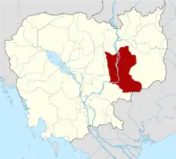 | |
| Autonomous municipality |
| ||
|---|---|---|---|
| Provinces | |||
This article is issued from Wikipedia. The text is licensed under Creative Commons - Attribution - Sharealike. Additional terms may apply for the media files.