Barriere, British Columbia
Barriere (/bəˈrɪər/ bə-REER)[3] is a district municipality in central British Columbia, Canada, located 66 km (41 mi) north of the larger city of Kamloops on Highway 5. It is situated at the confluence of the Barrière River (St́yelltsecwétkwe in Secwepemctsín)[4] and North Thompson Rivers in the Central North Thompson Valley.
Barriere | |
|---|---|
| District of Barriere[1] | |
 | |
 Barriere Location of Barriere in British Columbia  Barriere Barriere (Canada) | |
| Coordinates: 51°10′49″N 120°07′34″W | |
| Country | Canada |
| Province | British Columbia |
| District | Thompson-Nicola District |
| Incorporated | December 2007 |
| Government | |
| • MP | Cathy McLeod (Conservative) |
| • MLA | Peter Milobar (BC Liberal) |
| Area | |
| • Land | 10.77 km2 (4.16 sq mi) |
| Population (2016)[2] | |
| • Total | 1,713 |
| • Density | 164.7/km2 (427/sq mi) |
| Time zone | UTC−08:00 (PST) |
| • Summer (DST) | UTC−07:00 (PDT) |
| Area code(s) | 250 / 778 / 236 |
| Highways | |
| Website | www.districtofbarriere.com |
History
The area has been occupied since time immemorial by the Simpcw who are members of the Secwepemc.[5]
The origin of the name 'Barriere' (originally and alternately, Barrière) is uncertain but dates back to at least 1828. There are two main theories: the name arose either as a description of indigenous fishing techniques or as a description of the difficulty with which the river was crossed by early French-speaking fur traders. George Mercer Dawson noted in an 1877-78 geological survey report that, "[t]he [Barrière River] as its name imports, is sometimes crossed with difficulty in the spring."[6] Difficulty in crossing was also noted by early Hudson's Bay Company traders.[7] Notes at the Kamloops Museum suggest that it was named in 1828 when Archibald McDonald created an early map describing the rocks at the mouth of the river which impeded navigation. A place names file in the Provincial Archives of BC compiled in the 1940s by AG Harvey from various sources notes that it could be as a description of the indigenous fish traps.[8] One such barrier observed in the Barrière River was described by Dawson as "two weirs or fences each of which stretched completely across the stream."[9][10] Samuel Black's map of 1835 shows the Barrière River, as well as showing lines across other rivers near Clearwater that are marked as 'barrière'.[11]:50
The present community dates its beginning from 1914 with the establishment of the post office and railway station.[12] The presence of the grave accent has alternated over the years. In 1915 it was recorded as 'Barriere'. In 1955, it was changed to 'Barrière'. When it was incorporated as a District Municipality in 2007 it was spelled as 'Barriere' in the enabling Letters Patent.[13] Various other locations in the area retain the grave accent including the Barrière River,[14] East Barrière River,[15] Barrière Mountain,[16] East Barrière Lake,[17] North Barrière Lake,[18] South Barrière Lake,[19] and Upper South Barrière Lake.[20]
The people of the Simpcw First Nation,[21] still reside in present-day Chu Chua, just north of Barriere. George Mercer Dawson noted a location of an important old indigenous village site at the mouth of the Barrière River based on observations in 1877, 1888, 1889, and 1890.[10] Dawson also noted that the west branch of the Barrière River was named "Sas'-kum or 'open mouth,' from a story which relates that a dog was there turned to stone, and may still be seen somewhere with mouth open."[22]
Gold was discovered in the area as early as 1861, and was mined using the placer method.[23][24] The August 12, 1861 edition of the British Colonist mentions "...one party of Frenchmen at a place above Kamloops called Barrier (sic). They are fluming the Thompson, and expect to take out $25 per day to the hand, it is also incorpurated (sic)."[25][26]
Depending upon where one resided, $25 could purchase an acre of land,[27] a saddle, or double-barreled shotgun.[28] To give some sense of proportion to these figures: comparing $25 of daily gold production per hired hand to the price of a barrel of crude oil in 1861 ($0.49[29]), the gold production would be the equivalent of more than 50 barrels (7.9 m3) of oil per hand per day.
The gold rush also brought smallpox to the Simpcw population, reducing their numbers significantly.[30][31][32]
2003 fire
In 2003, a major forest fire swept through the area surrounding Barriere and destroyed both homes and industry, most notably the Louis Creek sawmill, a large local employer. The fire burned the mountain above Barriere called Armor Mountain, in the Louis Creek zone. It also burned across the North Thompson river from Barriere, to Bonaparte Lake. At one point up to 3,000 were forced to evacuate the area. On July 26, 2008 a wildfire dragon monument was erected in Louis Creek to commemorate the determination and compassion of those who fought the flames and those who aided in the rebuilding of the community.[33][34]
Climate
Barriere has a humid continental climate (Köppen climate classification Dfb) with cold winters and warm summers. Winters are cold and snowy with a January average of −6.5 °C (20 °F) and an average annual snowfall of 121 cm (48 in).[35] Summers are warm and dry with a July high of 27.9 °C (82.2 °F) although temperatures above 30 °C (86 °F) occur 27 days in a year.[35] The climate is dry, with an average annual precipitation of 486 mm (19 in).[35]
| Climate data for Barriere | |||||||||||||
|---|---|---|---|---|---|---|---|---|---|---|---|---|---|
| Month | Jan | Feb | Mar | Apr | May | Jun | Jul | Aug | Sep | Oct | Nov | Dec | Year |
| Record high °C (°F) | 14.0 (57.2) |
15.5 (59.9) |
24.0 (75.2) |
32.2 (90.0) |
38.0 (100.4) |
39.4 (102.9) |
41.1 (106.0) |
38.9 (102.0) |
34.5 (94.1) |
27.5 (81.5) |
21.7 (71.1) |
12.2 (54.0) |
41.1 (106.0) |
| Average high °C (°F) | −1.7 (28.9) |
2.4 (36.3) |
10.5 (50.9) |
15.9 (60.6) |
21.0 (69.8) |
24.6 (76.3) |
27.8 (82.0) |
27.0 (80.6) |
21.7 (71.1) |
12.2 (54.0) |
3.2 (37.8) |
−2.0 (28.4) |
13.6 (56.5) |
| Daily mean °C (°F) | −5.2 (22.6) |
−2.4 (27.7) |
3.6 (38.5) |
8.2 (46.8) |
13.0 (55.4) |
16.7 (62.1) |
19.2 (66.6) |
18.4 (65.1) |
13.3 (55.9) |
6.4 (43.5) |
−0.2 (31.6) |
−5.1 (22.8) |
7.2 (45.0) |
| Average low °C (°F) | −8.7 (16.3) |
−7.1 (19.2) |
−3.4 (25.9) |
0.5 (32.9) |
4.9 (40.8) |
8.8 (47.8) |
10.4 (50.7) |
9.7 (49.5) |
4.9 (40.8) |
0.6 (33.1) |
−3.5 (25.7) |
−8.1 (17.4) |
0.8 (33.4) |
| Record low °C (°F) | −42.8 (−45.0) |
−34.4 (−29.9) |
−29.4 (−20.9) |
−11.7 (10.9) |
−4.4 (24.1) |
−1.1 (30.0) |
0.6 (33.1) |
−2.2 (28.0) |
−7.0 (19.4) |
−20.0 (−4.0) |
−33.0 (−27.4) |
−39.4 (−38.9) |
−42.8 (−45.0) |
| Average precipitation mm (inches) | 41.0 (1.61) |
26.7 (1.05) |
26.4 (1.04) |
32.3 (1.27) |
44.8 (1.76) |
56.8 (2.24) |
50.9 (2.00) |
50.7 (2.00) |
35.8 (1.41) |
39.3 (1.55) |
53.8 (2.12) |
48.4 (1.91) |
506.9 (19.96) |
| Average rainfall mm (inches) | 13.2 (0.52) |
12.7 (0.50) |
22.0 (0.87) |
31.6 (1.24) |
44.7 (1.76) |
56.8 (2.24) |
50.9 (2.00) |
50.7 (2.00) |
35.8 (1.41) |
37.8 (1.49) |
33.4 (1.31) |
11.9 (0.47) |
401.4 (15.80) |
| Average snowfall cm (inches) | 27.8 (10.9) |
14.1 (5.6) |
4.4 (1.7) |
0.7 (0.3) |
0.1 (0.0) |
0.0 (0.0) |
0.0 (0.0) |
0.0 (0.0) |
0.0 (0.0) |
1.4 (0.6) |
20.4 (8.0) |
36.5 (14.4) |
105.5 (41.5) |
| Average precipitation days (≥ 0.2 mm) | 13.5 | 10.7 | 10.9 | 12.1 | 13.7 | 13.4 | 12.0 | 11.7 | 9.0 | 12.6 | 16.4 | 13.6 | 149.4 |
| Average rainy days (≥ 0.2 mm) | 5.8 | 5.9 | 9.4 | 11.9 | 13.7 | 13.4 | 12.0 | 11.7 | 9.0 | 12.4 | 10.7 | 4.1 | 120.0 |
| Average snowy days (≥ 0.2 cm) | 9.8 | 5.6 | 2.0 | 0.6 | 0.1 | 0.0 | 0.0 | 0.0 | 0.0 | 0.8 | 7.5 | 10.8 | 37.2 |
| Source: [36] | |||||||||||||
Infrastructure
The community voted to become an incorporated municipality in November 2007. Winning the election for the first mayor was Mr. Mike Fennell, a member of one of the founding families of the community.
The closest hospital in the region is the Royal Inland Hospital located to the south in Kamloops and to the north in Clearwater, British Columbia. One of the main reasons for the growing community's existence is its location on the Yellowhead Highway #5, which offers the only viable route in the interior to northern British Columbia, Jasper, and Edmonton. A Canadian National Railway line passes through the town as well.
Industry
Barriere is primarily driven by the forest industry, however the other industries which serve the town are tourism and agriculture, primarily alfalfa. Mining development is on the increase in the North Thompson Valley, and it is predicted that many forestry workers will migrate from forestry to mining as these new developments begin production. There are two industrial parks in the community. One is located in nearby Louis Creek and is the former site of the Tolko Mill, which was destroyed by a fire in 2003. Barriere is just south of the newly discovered Harper Creek Copper deposit, considered to be the 8th largest in the world.
The primary employers in the town are Gilbert Smith Forest Products, with 75% of the town's residents being linked to forestry.[37] Many residents who live in Barriere commute to work in Kamloops, 45 minutes to the south.
Currently there is a community effort to promote the development of a TV, film and new media technology industry in the area.
Barriere is the same latitude as the world famous Stonehenge. In October 2009 it was proposed by Councillor Virginia Smith, that the community erect a scaled-down replica of the 100 m (330 ft) prehistoric monument.
Recreation
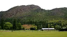
- North of the town centre is Chinook Cove Golf Course.
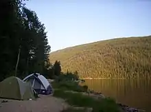
- Several lake resorts are a short driving distance from the community. East of the city is East Barriere Lake, South Barriere Lake as well as North Barriere Lake.
- The ski resort of Sun Peaks is approx a 1 hour drive from Barriere.
- There is a curling rink, antique store, library, post office and Royal Canadian Mounted Police station in the community.
- There are several community parks including ball fields.
- Community halls include the Fall Fair Hall and Lions Club Hall. Other larger facilities include the curling rink and seniors centre. At the Lions Club hall there is a program called 'Cadets'.
- A local community theatre group: Thompson Valley Players Society[38]
- The North Thompson Museum[39]
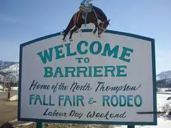
- Every Labour Day weekend the town hosts the North Thompson Fall Fair Rodeo.[40] It is the community's biggest yearly event produced by hundreds of volunteers. About 10,000 people attend annually, over the three-day fair.
- Barriere & the North Thompson Fall Fair have the 3rd oldest Royalty Pageant program in British Columbia.
- Barriere Fall Fair and Rodeo features a large parade.
Schools
There are two schools in Barriere.
- Barriere Elementary School
- Barriere Secondary School
There used to be a primary school called Barriere Ridge Elementary, but it was shut down because of a lack of students. It is now a daycare and the City Hall. In 1967, the Secondary school was burnt down just before final exams and a new one was built. The graduating class of 1968 had to be bused to Kamloops Senior Secondary School while the new school was built.
Religion
There are six houses of worship within the town.[41]
- The Church of St Paul - a worshipping community of Anglicans, Uniteds and Lutherans
- Bethany Baptist Church - affiliated with the Fellowship of Evangelical Baptist Churches'. Located on the corner of Barriere Town Road, and Dixon Cr. Road, Barriere, BC.
- Christian Life Assembly - Member of Pentecostal Assemblies of Canada
- St. George's Roman Catholic Church
- Kingdom Hall of Jehovah's Witnesses
- Barriere Open Door Fellowship
Additionally, the First Nations community of Chu Chua is located 10 minutes north of Barriere on Dunn Lake Road.
References
- "British Columbia Regional Districts, Municipalities, Corporate Name, Date of Incorporation and Postal Address" (XLS). British Columbia Ministry of Communities, Sport and Cultural Development. Archived from the original on July 13, 2014. Retrieved November 2, 2014.
- "Canada Census 2016 (Community profiles)". Retrieved 2017-08-04.
- The Canadian Press (2017), The Canadian Press Stylebook (18th ed.), Toronto: The Canadian Press
- Ignace, Marianne; Ignace, Ronald E. (2017). Secwépemc People, Land, and Laws: Yerí7 re Stsq'ey's-kucw. McGill-Queen's Press - MQUP. p. 161. ISBN 9780773552036.
- "Simpcw.com". Retrieved 2017-08-04.
- Canada, Geological Survey of (1879). Report of Progress to Geological Survey of Canada, 1879 ... - Google Books. Retrieved 2017-07-29 – via Google Books.
- Gibson, James R. (1998). The Lifeline of the Oregon Country: The Fraser-Columbia Brigade System, 1811-47. UBC Press. pp. 83–85. ISBN 978-0-7748-0643-5. Retrieved 29 July 2017.
- "BC Geographical Names". Retrieved 2017-08-04.
- Akrigg, G. P. (Philip) V.; Akrigg, Helen (2011-11-01). British Columbia Place Names 3rd ed ... - Google Books. ISBN 9780774841702. Retrieved 2017-07-29 – via Google Books.
- Dawson, George Mercer (1891). Notes on the Shuswap People of British Columbia... - Google Books. Retrieved 2017-07-29 – via Google Books.
- Hayes, Derek (2012). British Columbia: A New Historical Atlas. Douglas & McIntyre. ISBN 9781926812571.
- "barriere.ca". Retrieved 2017-08-04.
- "BC Geographical Names". Retrieved 2017-08-04.
- "BC Geographical Names". Retrieved 2017-08-04.
- "BC Geographical Names". Retrieved 2017-08-04.
- "BC Geographical Names". Retrieved 2017-08-04.
- "BC Geographical Names". Retrieved 2017-08-04.
- "BC Geographical Names". Retrieved 2017-08-04.
- "BC Geographical Names". Retrieved 2017-08-04.
- "BC Geographical Names". Retrieved 2017-08-04.
- "Simpcw First Nation | Barriere British Columbia". Barrierebc.info. 2010-10-23. Archived from the original on 2011-09-10. Retrieved 2011-09-17.
- Dawson, George Mercer (1891). Notes on the Shuswap People of British Columbia... - Google Books. Retrieved 2017-07-29 – via Google Books.
- Canada, Geological Survey of (1896). Annual Report, vol. 7 Geological Survey of Canada... - Google Books. Retrieved 2017-07-29 – via Google Books.
- Rawlings, Thomas (1865). The Confederation of the British North American Provinces... - Google Books. Retrieved 2017-07-29 – via Google Books.
- "History of Barriere". Britishcolumbia.com. Archived from the original on 2011-09-27. Retrieved 2011-09-17.
- Rawlings, Thomas (1865). The Confederation of the British North American Provinces: Their Past History and Future Prospects; Including Also British Columbia & Hudson's Bay Territory; with a Map, and Suggestions in Reference to the True and Only Practicable Route from the Atlantic to the Pacific Ocean. London: Sampson Low, Son, and Marston. p. 116.
- The history of Linn county, Iowa ... - Google Books. 2008-01-24. Retrieved 2011-09-17 – via Google Books.
- Katcher, Philip R. N. (2002-06-25). Confederate cavalryman, 1861-65 - Google Books. ISBN 9781841763811. Retrieved 2011-09-17 – via Google Books.
- File:Oil Prices 1861 2007.svg
- Dunford, Murial Poulton (2002). "The Simpcw of the North Thompson" (PDF). British Columbia Historical News. 35 (3): 6–8. Retrieved August 10, 2017.
- https://search.proquest.com/openview/351875cea91308da3182df1ff4a6e9ba/1?pq-origsite=gscholar&cbl=28071
- http://docplayer.net/37351582-Historical-news-british-columbia-volume-35-no-3-summer-2002-5-00-issn-journal-of-the-british-columbia-historical-federation.html
- "The Mclure-Barriere Fire August 2003" (PDF). Retrieved 2013-05-10.
- "Thompson-Nicola Regional District (McLure Wildfire 2003) map". Retrieved 27 June 2015.
- Environment Canada—Canadian Climate Normals 1971–2000, accessed 23 August 2012
- "Calculation Information for 1981 to 2010 Canadian Normals Data". Environment Canada. Archived from the original on June 14, 2013. Retrieved July 9, 2013.
- "Barriere". NTValley. Retrieved 2011-09-17.
- Thompson Valley Players Society
- The North Thompson Museum
- North Thompson Fall Fair Rodeo
- "Barriere Churches". Barrierebc.com. Retrieved 2011-09-17.
External links
| Subdivisions | 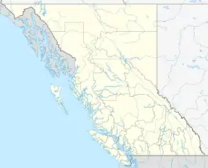 | |
|---|---|---|
| Communities | ||
| Metro areas and agglomerations | ||
| District municipalities |
| |
| ||
| Authority control |
|---|