Vanderhoof, British Columbia
Vanderhoof is a district municipality that lies near the geographical centre[3] of British Columbia, Canada. It has a population of roughly 4,500 residents within town limits. Due to nearby rural communities without services, Vanderhoof actually supports nearly 10,000 people. Vanderhoof's economic drivers are the forest industry, agriculture, and related industries. Tourism is growing, but has yet to challenge any of the established industries. Mining is growing in importance, with a number of mines being developed in the area. Vanderhoof has many elementary schools and one major secondary school — Nechako Valley Secondary School (NVSS), teaching grades 7–12—which are all part of School District 91 Nechako Lakes. The College of New Caledonia has a regional campus in Vanderhoof.
Vanderhoof | |
|---|---|
| District of Vanderhoof[1] | |
 Vanderhoof Location of Vanderhoof in British Columbia | |
| Coordinates: 54°00′52″N 124°00′32″W | |
| Country | |
| Province | |
| Region | Interior Plateau |
| Regional district | Regional District of Bulkley-Nechako |
| Incorporated | 1926 |
| Government | |
| • Mayor | Gerry Thiessen |
| • Chief Administrative Officer | Lori Egli |
| Area | |
| • Total | 54.83 km2 (21.17 sq mi) |
| Elevation | 640 m (2,100 ft) |
| Population (2016) | |
| • Total | 4,439 |
| • Density | 81.0/km2 (210/sq mi) |
| Time zone | UTC-8 (PST) |
| • Summer (DST) | UTC-7 (PDT) |
| Area code(s) | 250 / 778 / 236 |
| Highways | |
| Waterways | Nechako River |
| Climate | Dfb |
| Website | Vanderhoof District Municipality |
Via Rail's Jasper–Prince Rupert train calls at the Vanderhoof railway station.
History
Vanderhoof is named after Herbert Vanderhoof of Chicago, one of the founders of the town. Vanderhoof was an employee of the Grand Trunk Pacific Development Company, a subsidiary of Grand Trunk Pacific Railway.[4][5][6] The municipality's population rapidly expanded until World War II, when many of the town's men left to fight overseas. After the war, an increase in lumber prices and the construction of the Kenney Dam lead to increases in population again. Today Vanderhoof is a service centre in the eastern Bulkley-Nechako for surrounding communities, and it is the second largest municipality in the regional district.[7]
Geography
The municipality is 2.92 square kilometers. The geographic centre of British Columbia marker is at 53.965561N and 123.997089W, approximately 6.5 kilometres south-east of Vanderhoof in the locality of Weneez.
Nearby communities include:
Fort Fraser – 38 km (24 mi) west
Fraser Lake – 59 km (37 mi) west
Fort St. James – 61 km (38 mi) north
Prince George – 96 km (60 mi) east
Burns Lake – 128 km (80 mi) west
Terrace – 475 km (295 mi) west
Dawson Creek – 501 km (311 mi) Northwest
Prince Rupert – 619 km (385 mi) west
Wildlife
Vanderhoof is known for its bird sanctuary along the Nechako River. Many Canada Geese, swans, and other migratory birds pass through Vanderhoof during their annual migration. The Nechako is home to a number of fish species, including salmon and the endangered Nechako White Sturgeon. Many hunters come to Vanderhoof in search of bear, moose, deer, cougar, and elk.
Schools
Elementary:
Evelyn Dickson
W.L. McLeod
Sinkutview
Mapes
Secondary:
Nechako Valley Secondary School (NVSS
Northside Christian School
Valhalla High
Virtual School:
EBUS Academy www.ebus.ca
Culture and recreation
Cultural & recreational facilities include:
- Nechako Valley Exhibition Grounds- home of the Fall Fair (August), 2 riding arenas, and agricultural show facilities
- Vanderhoof Heritage Museum
- Vanderhoof Airport - a 5,018 foot long paved runway and two grass runways (5,200 feet and 3,200 feet)
- Vanderhoof Aquatic Centre - 6-lane 25m lap pool, climbing wall, 30-person hot tub, sauna, and 1500sqft leisure pool
- Vanderhoof Skateboard Park
- Grand Reo Theatre – a restored 175-seat movie theatre
- Omineca Golf Course – par 72, 18-holes
- Disc Golf Course
- Vanderhoof Arena – indoor skating rink in the winter, home to a Figure Skating Club, Speed Skating club, Minor Hockey Club, other adult hockey recreation leagues, & a community centre for hosting various events in the summer
- Vanderhoof Curling Club
- Riverside Park & Campground – birdwatching tower, playground, beach volleyball, picnic shelter, and walking trails
- Ferland Park - playground, waterpark
- Bradley Park, Leiding Park, Vanderview Park - playgrounds
- Community Garden - greenhouse, raised beds, in-ground plots, public washroom
- Rip n' The North Bike Park – mountain bike trails
- Moore's Motocross Track – dirt bike track
- Community trail system
- Nechako White Sturgeon Conservation Centre – identifying, maintaining and potentially restoring critical sturgeon habitat in the Nechako River
- Nechako Valley Sporting Association: Archery, Hand Gun, Fish & Game, Cross-Country Ski, Trap shoot, Wilderness Watch
- Omineca Express – the local weekly newspaper, published Thursdays
- CIAM FM – "The Light 98.5 FM" – community radio station that also is a re-broadcaster for the CIAM radio broadcast network
- CBC Radio 1 - 91.5 FM
- Real Country 910 AM
- Vanderhoof Public Library
- Community Bus - a FREE community transportation service, capacity of 12 passengers and 2 wheelchair spots
Telegraph Trail
A telegraph line, set up in the 1890s to allow communication with the Klondike Gold Rush gold fields, was abandoned in the 1930s and later converted into a series of walking trails. A 10 km trail stretched from Hogsback Lake near Vanderhoof to the Blackwater Road.
Community events
- Wild Goose Chase: held the first Sunday in May, this community 8 km, 5 km, and 3.5 km Fun Run brings out hundreds of participants and volunteers.
- Vanderhoof Chamber of Commerce Biennial Trade Show, scheduled in May on the "odd numbered" years.
- BC Rodeo - held in April
- Stoney Creek Elders Fishing Derby - May
- Hooterville Hoot: an annual classic car show, held in early June.
- Concert In The Park: July - Local talent performs for an afternoon and evening filled with great entertainment.
- Canada Day Celebration: - July 1
- Vanderhoof Farmers' Market: fresh locally grown produce, organic meat products, preserves, crafted goods and much more. Markets run Thursdays from June to September.
- Vanderhoof International Air show: Taking place biennially in August - showcasing many skilled pilots and their aircraft, as well as several static displays.
- Nechako Valley Exhibition: held the third weekend in August. A true country fair that is fun for the whole family.
- Recreation/Leisure Fair: held in early September to introduce clubs and recreational opportunities to the community.
- The Great Pumpkin Walk: Held annually, October 31st - With hand-carved pumpkins and "trick-or-treating" in the park, attended by thousands of residents—a safe and convenient place for families to spend Halloween night. Followed by a fireworks display that lights up the entire Nechako River Valley.
- Parade of Lights and Midnight Madness: Held the first Saturday in December, this kicks off the Christmas time retail season with the light parade and crazy sales at many retail stores.
Climate
Vanderhoof has a humid continental climate (Köppen Dfb) with mild summers and cold winters.
| Climate data for Vanderhoof, 1981–2010 normals, extremes 1916–present | |||||||||||||
|---|---|---|---|---|---|---|---|---|---|---|---|---|---|
| Month | Jan | Feb | Mar | Apr | May | Jun | Jul | Aug | Sep | Oct | Nov | Dec | Year |
| Record high °C (°F) | 13.0 (55.4) |
16.7 (62.1) |
20.0 (68.0) |
28.9 (84.0) |
36.0 (96.8) |
33.9 (93.0) |
35.0 (95.0) |
35.5 (95.9) |
33.0 (91.4) |
28.0 (82.4) |
17.5 (63.5) |
12.5 (54.5) |
36.0 (96.8) |
| Average high °C (°F) | −4.5 (23.9) |
−0.1 (31.8) |
5.9 (42.6) |
12.4 (54.3) |
17.8 (64.0) |
21.3 (70.3) |
23.5 (74.3) |
23.3 (73.9) |
17.9 (64.2) |
10.3 (50.5) |
0.9 (33.6) |
−4.1 (24.6) |
10.4 (50.7) |
| Daily mean °C (°F) | −9.0 (15.8) |
−5.5 (22.1) |
−0.2 (31.6) |
5.6 (42.1) |
10.7 (51.3) |
14.4 (57.9) |
16.3 (61.3) |
15.9 (60.6) |
11.0 (51.8) |
5.0 (41.0) |
−2.8 (27.0) |
−8.1 (17.4) |
4.4 (39.9) |
| Average low °C (°F) | −13.3 (8.1) |
−10.9 (12.4) |
−6.3 (20.7) |
−1.3 (29.7) |
3.5 (38.3) |
7.4 (45.3) |
9.1 (48.4) |
8.3 (46.9) |
4.1 (39.4) |
−0.3 (31.5) |
−6.5 (20.3) |
−12.1 (10.2) |
−1.5 (29.3) |
| Record low °C (°F) | −51.7 (−61.1) |
−51.1 (−60.0) |
−42.8 (−45.0) |
−29.4 (−20.9) |
−9.4 (15.1) |
−6.7 (19.9) |
−3.3 (26.1) |
−5.0 (23.0) |
−16.7 (1.9) |
−28.0 (−18.4) |
−42.2 (−44.0) |
−50.6 (−59.1) |
−51.7 (−61.1) |
| Average precipitation mm (inches) | 44.4 (1.75) |
26.6 (1.05) |
24.4 (0.96) |
25.4 (1.00) |
34.7 (1.37) |
57.0 (2.24) |
52.4 (2.06) |
43.1 (1.70) |
44.3 (1.74) |
50.8 (2.00) |
45.1 (1.78) |
41.3 (1.63) |
489.2 (19.26) |
| Average rainfall mm (inches) | 6.6 (0.26) |
5.4 (0.21) |
7.1 (0.28) |
19.4 (0.76) |
34.2 (1.35) |
56.8 (2.24) |
52.3 (2.06) |
43.1 (1.70) |
44.0 (1.73) |
43.3 (1.70) |
16.1 (0.63) |
3.8 (0.15) |
332.0 (13.07) |
| Average snowfall cm (inches) | 37.8 (14.9) |
21.3 (8.4) |
17.3 (6.8) |
6.0 (2.4) |
0.5 (0.2) |
0.2 (0.1) |
0.0 (0.0) |
0.0 (0.0) |
0.2 (0.1) |
7.5 (3.0) |
29.0 (11.4) |
37.5 (14.8) |
157.2 (61.9) |
| Average precipitation days (≥ 0.2 mm) | 14.1 | 9.5 | 10.0 | 9.7 | 12.6 | 14.1 | 13.8 | 12.5 | 13.0 | 16.3 | 14.5 | 11.8 | 152.1 |
| Average rainy days (≥ 0.2 mm) | 2.9 | 2.8 | 5.0 | 8.0 | 12.5 | 14.1 | 13.8 | 12.5 | 12.9 | 14.7 | 6.4 | 2.0 | 107.7 |
| Average snowy days (≥ 0.2 cm) | 12.1 | 7.2 | 6.0 | 2.5 | 0.4 | 0.0 | 0.0 | 0.0 | 0.2 | 2.7 | 10.1 | 10.3 | 51.4 |
| Source: Environment Canada[8][9][10][11] | |||||||||||||
See also
References
- "British Columbia Regional Districts, Municipalities, Corporate Name, Date of Incorporation and Postal Address" (XLS). British Columbia Ministry of Communities, Sport and Cultural Development. Retrieved 2 November 2014.
- District of Vanderhoof. Mayor and Councillors
- "Vanderhoof". Official Travel Website of British Columbia. Archived from the original on 25 August 2011. Retrieved 30 October 2006.
-
Carla Funk (2 November 2019). "The small towns that make Canadian literature unique". Globe and Mail. Retrieved 28 August 2020.
The town took its name from Herbert Vanderhoof, who envisioned the place as a colony for artists and writers. His dream never took quite took shape, but the town grew and the name stuck.
- "Vanderhoof". BC Geographical Names. Retrieved 17 January 2019.
- "Grand Trunk Pacific Development Company Limited". memorybc.ca. Retrieved 18 December 2020.
- "Vanderhoof". The Canadian Encyclopedia. Historica Canada. Retrieved 18 December 2020.
- "Calculation Information for 1981 to 2010 Canadian Normals Data". Environment Canada. Retrieved 4 March 2017.
- "Vanderhoof". Environment Canada. Retrieved 4 March 2017.
- "Vanderhoof Braeside Rd". Environment Canada. Retrieved 4 March 2017.
- "Vanderhoof BC". Environment Canada. Retrieved 4 March 2017.
External links
- District of Vanderhoof
 Vanderhoof travel guide from Wikivoyage
| Subdivisions | 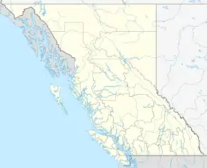 | |
|---|---|---|
| Communities | ||
| Metro areas and agglomerations | ||
| District municipalities |
| |
| ||
| Authority control |
|---|