Beit Ta'mir
Beit Ta'mir (Arabic: خربة بيت تعمر) is a Palestinian village located six kilometers southeast of Bethlehem.The town is in the Bethlehem Governorate central West Bank. According to the Palestinian Central Bureau of Statistics, the village had a population of 1,229 in 2007.[2] The village is named after the 'Arab al-Ta'mira Bedouin tribe of the Bethlehem area, and along with Tuqu' and Za'atara forms the 'Arab al-Ta'mira village cluster.
Beit Ta'mir | |
|---|---|
| Arabic transcription(s) | |
| • Arabic | خربة بيت تعمر |
 Beit Ta'mir Location of Beit Ta'mir within Palestine | |
| Coordinates: 31°40′18″N 35°13′36″E | |
| Palestine grid | 172/120 |
| State | State of Palestine |
| Governorate | Bethlehem |
| Government | |
| • Type | Village council |
| Population (2007) | |
| • Total | 1,229 |
| Name meaning | The house of the T'amirah Arabs[1] |
Location
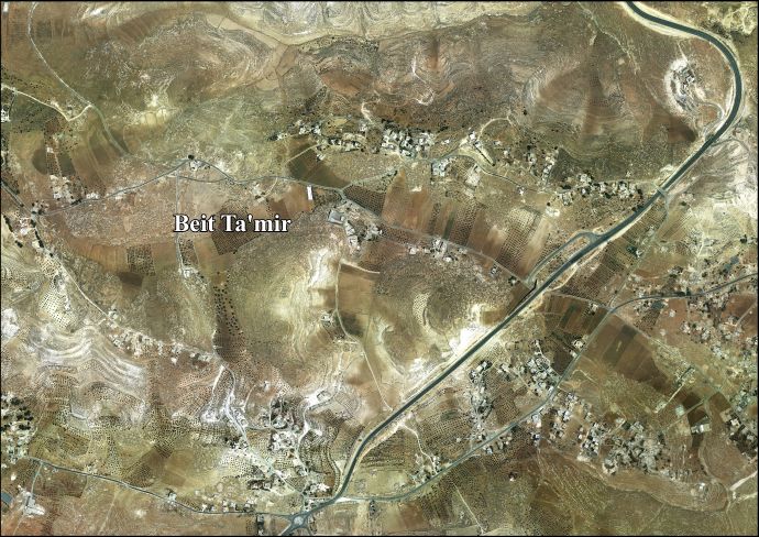
Beit Ta’mir is located 5 kilometers (3.1 mi) south-east of Bethlehem. It is bordered by Za'atara to the east, Hindaza to the west and north, and Jannatah and Tuqu' to the south.[3]
History
The village mosque, the Mosque of Omar, has been tentatively dated to 636 CE.[4]
Ottoman era
Beit Ta'mir was incorporated into the Ottoman Empire in 1517 with all of Palestine, and in 1596 it appeared in the tax registers as being in the nahiya of Al-Quds in the liwa of Al-Quds under the name of Bayt Ta'mar. It had a population of 65 household;[5] who were all Muslims. They paid a fixed tax-rate of 33.3 % on agricultural products, including wheat, barley, vegetable and fruit gardens, goats and beehives, in addition to occasional revenues; a total of 8,100 Akçe. Half of the revenue went to a Waqf.[5]
In 1838, Edward Robinson noted Beit Ta'mar, the village of the Ta'amirah, on his travels in the region,[6] It was also noted as an Arab village, located south of Wadi er-Rahib in the Jerusalem district.[7]
In 1863, Victor Guérin noted it as an ancient site, inhabited by people of the Ta'amereh tribe.[8]
An Ottoman list from about 1870 notes a "sizable" village with a mosque with a small minaret. The villagers were Bedouin.[9]
In 1883 the PEF's Survey of Western Palestine (SWP) described Beit T'amir: "a small village on a hill with wells and a few olives. The name is that of an Arab tribe which was originally settled in the place. The village contains a small mosque named after the Khalif Omar."[10]
In 1896 a population list noted that Beit Ta'mir was "half bedouin".[11]
British Mandate era
In the 1945 statistics the population was counted under the name Arab et Ta'amira together with Arab Ibn Ubeid, Arab et Rashayida and Arab et Sawahira; together they had a population of 7,070 Muslims,[12] with Arab et Ta'amira having a total of 209,888 dunams of land according to an official land and population survey.[13] Of this, 24 dunams were used plantations and irrigable land, 12,424 for cereals,[14] while 197,440 dunams were classified as non-cultitivable land.[15]
Jordanian era
In the wake of the 1948 Arab–Israeli War, and after the 1949 Armistice Agreements, Beit Ta’mir came under Jordanian rule.
In 1961, the population of Ta'amira was 306.[16]
Post 1967
Since the Six-Day War in 1967, Beit Ta'mir has been held under Israeli occupation.
After the 1995 accords, 34.5% of village land was classified as Area A land, 56.2% as Area B, and the remaining 9.3% as Area C.[17]
References
- Palmer, 1881, p. 287
- 2007 PCBS Census Palestinian Central Bureau of Statistics. p.117.
- Beit Ta'mir village profile, ARIJ, p. 4
- Kitchener, 1877, p. 100
- Hütteroth and Abdulfattah, 1977, p. 114
- Robinson and Smith, 1841, vol 2, p. 159
- Robinson and Smith, 1841, vol 3, 2nd appendix, p. 123
- Guérin, 1869, p. 121
- Socin, 1879, p. 147
- Conder and Kitchener, 1883, SWP III, pp. 29-30
- Schick, 1896, p. 125
- Government of Palestine, Department of Statistics, 1945, p. 25
- Government of Palestine, Department of Statistics. Village Statistics, April, 1945. Quoted in Hadawi, 1970, p. 58
- Government of Palestine, Department of Statistics. Village Statistics, April, 1945. Quoted in Hadawi, 1970, p. 104
- Government of Palestine, Department of Statistics. Village Statistics, April, 1945. Quoted in Hadawi, 1970, p. 154
- Government of Jordan, Department of Statistics, 1964, p. 23
- Beit Ta'mir village profile, ARIJ, p. 17
Bibliography
- Conder, C.R.; Kitchener, H.H. (1883). The Survey of Western Palestine: Memoirs of the Topography, Orography, Hydrography, and Archaeology. 3. London: Committee of the Palestine Exploration Fund.
- Government of Jordan, Department of Statistics (1964). First Census of Population and Housing. Volume I: Final Tables; General Characteristics of the Population (PDF).
- Government of Palestine, Department of Statistics (1945). Village Statistics, April, 1945.
- Guérin, V. (1869). Description Géographique Historique et Archéologique de la Palestine (in French). 1: Judee, pt. 3. Paris: L'Imprimerie Nationale.
- Hadawi, S. (1970). Village Statistics of 1945: A Classification of Land and Area ownership in Palestine. Palestine Liberation Organization Research Centre.
- Hütteroth, Wolf-Dieter; Abdulfattah, Kamal (1977). Historical Geography of Palestine, Transjordan and Southern Syria in the Late 16th Century. Erlanger Geographische Arbeiten, Sonderband 5. Erlangen, Germany: Vorstand der Fränkischen Geographischen Gesellschaft. ISBN 3-920405-41-2.
- Kitchener, H.H. (1877). "Lieutenant Kitchener's Report". Quarterly statement - Palestine Exploration Fund. 9: 165–178.
- Palmer, E.H. (1881). The Survey of Western Palestine: Arabic and English Name Lists Collected During the Survey by Lieutenants Conder and Kitchener, R. E. Transliterated and Explained by E.H. Palmer. Committee of the Palestine Exploration Fund.
- Robinson, E.; Smith, E. (1841). Biblical Researches in Palestine, Mount Sinai and Arabia Petraea: A Journal of Travels in the year 1838. 2. Boston: Crocker & Brewster.
- Robinson, E.; Smith, E. (1841). Biblical Researches in Palestine, Mount Sinai and Arabia Petraea: A Journal of Travels in the year 1838. 3. Boston: Crocker & Brewster.
- Schick, C. (1896). "Zur Einwohnerzahl des Bezirks Jerusalem". Zeitschrift des Deutschen Palästina-Vereins. 19: 120–127.
- Socin, A. (1879). "Alphabetisches Verzeichniss von Ortschaften des Paschalik Jerusalem". Zeitschrift des Deutschen Palästina-Vereins. 2: 135–163.
External links
- Welcome to Kh. Bayt Ta'mir
- Beit Ta’mir, Welcome to Palestine
- Survey of Western Palestine, Map 17: IAA, Wikimedia commons
- Beit Ta'mir village (fact sheet), Applied Research Institute–Jerusalem (ARIJ)
- Beit Ta'mir village profile, ARIJ
- Beit Ta'mir aerial photo, ARIJ
- The priorities and needs for development in Beit Ta'mir village based on the community and local authorities' assessment, ARIJ
| Cities |  | |
|---|---|---|
| Municipalities | ||
| Villages |
| |
| Religion | ||
| Refugee camps | ||
| Other | ||