Betka River
The Betka River is a perennial river with no defined major catchment, located in the East Gippsland region of the Australian state of Victoria.
| Betka | |
|---|---|
.jpg.webp) | |
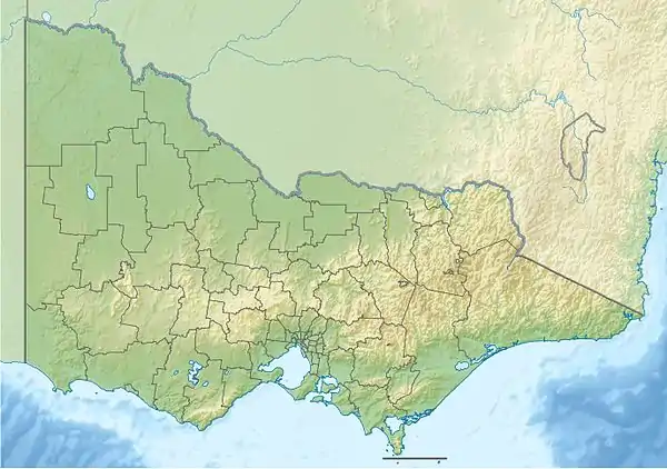 Bekta River in Victoria | |
| Location | |
| Country | Australia |
| State | Victoria |
| Region | South East Corner (IBRA), East Gippsland |
| Local government area | Shire of East Gippsland |
| Physical characteristics | |
| Source | |
| • location | Croajingolong National Park |
| • elevation | 130 m (430 ft) |
| Mouth | Bass Strait |
• location | south of Mallacoota |
• coordinates | 37°35′12″S 149°44′20″E |
• elevation | 0 m (0 ft) |
| Length | 32 km (20 mi) |
| Basin features | |
| National park | Croajingolong NP |
| [1][2] | |
Course and features
The Betka River rises south of Genoa in the Croajingolong National Park, just east of the Princes Highway, and flows generally northeast, then southeast, then east by north, before reaching its mouth with Bass Strait north of the Mallacoota Aerodrome in the Shire of East Gippsland. The river descends 130 metres (430 ft) over its 32 kilometres (20 mi) course.[2]
The scarce Callistemon kenmorrisonii or Betka Bottlebrush, which is found in one place along the river, draws its name from the river.
References
- "Betka River: 10599". Vicnames. Government of Victoria. 2 May 1966. Archived from the original on 8 January 2014. Retrieved 8 January 2014.
- "Map of Betka River, VIC". Bonzle Digital Atlas of Australia. Retrieved 8 January 2014.
External links
Rivers of the East Gippsland catchment, Victoria, Australia | |
|---|---|
| Genoa River | |
| Cann River | |
| Bemm River | |
| Snowy River | |
| Mitchell River | |
| No defined sub-catchment | |
| |
This article is issued from Wikipedia. The text is licensed under Creative Commons - Attribution - Sharealike. Additional terms may apply for the media files.