Richardson River (Victoria)
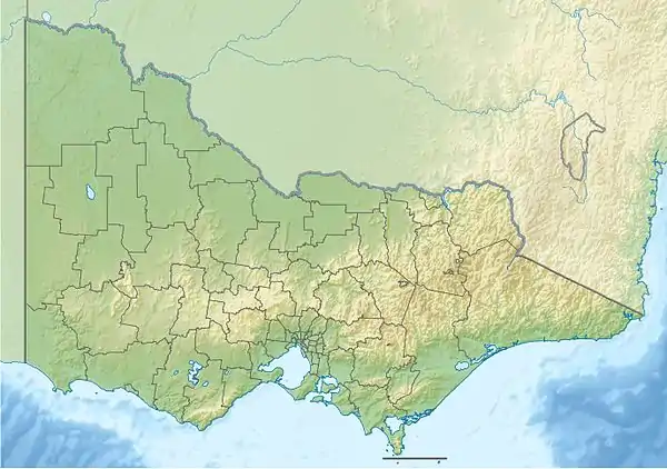
The Richardson River, an inland intermittent river of the Wimmera catchment, located in the Grampians and Wimmera regions of the Australian state of Victoria. Rising on the northern slopes of the Great Dividing Range, the Richardson River flows generally north and drains in Lake Buloke, one of a series of ephemeral lakes that, whilst they do not directly empty into a defined watercourse, they form part of the Murray River catchment of the Murray-Darling basin.
| Richardson | |
|---|---|
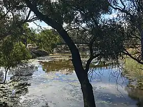 Richardson River at Donald, December 2018 | |
| Native name | Larning, Witjibar, Wallamyer, Barnunung, Kurakibiyal, Willaring, Wirchilleba[1][2][3] |
| Location | |
| Country | Australia |
| State | Victoria |
| Region | Murray Darling Depression (IBRA), Wimmera |
| Local government area | Northern Grampians |
| Towns | Donald |
| Physical characteristics | |
| Source | Great Dividing Range |
| • location | Mori Mori Nature Conservation Reserve |
| • coordinates | 36°50′9.8″S 142°59′40″E |
| • elevation | 295 m (968 ft) |
| Mouth | Lake Buloke |
• location | north of Donald |
• coordinates | 36°18′25.8″S 142°56′54.4″E |
• elevation | 107 m (351 ft) |
| Length | 119 km (74 mi) |
| Basin features | |
| River system | Wimmera catchment |
| Tributaries | |
| • right | Wallaloo Creek, Avon River (Grampians) |
| [1][4] | |
Location and features
The Richardson River rises on the northern slopes of the Great Dividing Range in the Mori Mori Nature Conservation Reserve. The river flows in a highly meandering course generally west by north and then east by north, joined by two tributaries including the Avon River, before reaching its mouth in Lake Buloke; north of Donald. The Richardson River descends 187 metres (614 ft) over its 119-kilometre (74 mi) course.[4]
Etymology
In the indigenous Djadjawurrung and Jardwadjali languages, the river is named Larning, meaning "your camp"; Witjibar, meaning "basket grass river"; and Wallamyer with no defined meaning. In the Djadjawurrung, Jardwadjali, and Wergaia languages, the river is named Barnunung, meaning "smouldering away". In the Djadjawurrung language, the river is named Kurakibiyal with kurak meaning "sand"" and biyal meaning "red gum". In the Jardwadjali language, the river is named Willaring, with wille meaning a "common silver grey possum". And in an undefined indigenous language, the river is called Wirchilleba meaning "a dry watercourse".[1][2][3]
References
- "Richardson River (entry 619947)". VICNAMES. Government of Victoria. Retrieved 21 October 2014.
- Smyth, Robert Brough (1878). The Aborigines of Victoria. Melbourne: Victorian Government Printer. p. 176.
- Clark, Ian; Heydon, Toby (2011). "Richardson River: Traditional Names". Victorian Aboriginal Corporation for Languages.
- "Map of Richardson River, VIC". Bonzle Digital Atlas of Australia. Retrieved 21 October 2014.
External links
![]() Media related to Richardson River at Wikimedia Commons
Media related to Richardson River at Wikimedia Commons
- "Wimmera-Avoca". Murray-Darling Basin Authority. Australian Government. 2014. Archived from the original on 23 October 2014.
- "Avon/Richardson River longitudinal profile" (PDF). Murray-Darling Basin Authority (PDF). Australian Government. Archived from the original (PDF) on 15 February 2014.
- "Wimmera". Our rivers. Environment Victoria.
|