Bir al-Maksur
Bir al-Maksur or Beer el-Maksura (Arabic: بئر المكسور; Hebrew: בִּיר אל-מַכְּסוּר) is an Arab Bedouin[2] local council in the Northern District of Israel located 15 kilometres (9.3 mi) north-west of Nazareth. In 2019 its population was 9,522.[1] The villagers belong to the Arab el-Hujeirat Bedouin tribe, settled there in the 1950s.
Bir al-Maksur
| |
|---|---|
Local council (from 1990) | |
| Hebrew transcription(s) | |
| • ISO 259 | Bir ˀel-Makksur (Jara'zia) |
| • Also spelled | Bir el-Maksur (official) Beer al-Maksura (unofficial) |
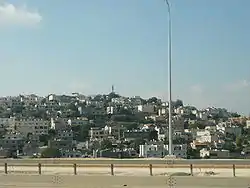 Bir al-Maksur, 2010 | |
 Bir al-Maksur | |
| Coordinates: 32°46′38″N 35°13′15″E | |
| Grid position | 170/242 PAL |
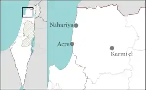
| District | Northern |
| Founded | 1950s |
| Government | |
| • Head of Municipality | Khaled Hujerat |
| Area | |
| • Total | 4,554 dunams (4.554 km2 or 1.758 sq mi) |
| Population (2019)[1] | |
| • Total | 9,522 |
| • Density | 2,100/km2 (5,400/sq mi) |
| Name meaning | The Broken Well |
History
Flint from the Mousterian culture, made with the Levallois technique, in addition to remains from Pre-Pottery Neolithic A and Pre-Pottery Neolithic B have been excavated here.[3][4]
Sherds from Iron age I, and possibly Iron age II have been found here.[2]
A burial cave, with ceramics and artefacts dating to the late Roman era, that is, third–fourth centuries CE, have been excavated here.[5]
In 1881, the PEF's Survey of Western Palestine noted at Kh.el Maksur: "Heaps of stones."[6][7]
Notable residents
- Mohammad Ghadir (born 1991), professional football player who plays for Bnei Yehuda Tel Aviv F.C.
See also
References
- "Population in the Localities 2019" (XLS). Israel Central Bureau of Statistics. Retrieved 16 August 2020.
- Gal, 1992, p. 21
- Malinski-Buller and Aladjem, 2011, Bir el-Maksur Preliminary Report
- Yaroshevich, 2013, Bir el-Maksur Final Report
- Zidan and Mitler, 2014, Bir el-Maksur
- Conder and Kitchener, 1881, SWP I, p. 314
- meaning: The ruin of the broken one, according to Palmer, 1881, p. 112
Bibliography
- Abu Zidan, Fadi; Mitler, Itamar (2014-08-03). "Bir el-Maksur Final Report" (126). Hadashot Arkheologiyot – Excavations and Surveys in Israel. Cite journal requires
|journal=(help) - Conder, C.R.; Kitchener, HH. (1881). The Survey of Western Palestine: Memoirs of the Topography, Orography, Hydrography, and Archaeology. 1. London: Committee of the Palestine Exploration Fund.
- Gal, Zvi (1992). Lower Galilee During the Iron Age. Eisenbrauns. ISBN 0931464692.
- Malinski-Buller, Ariel; Aladjem, Emil (2011-12-27). "Bir el-Maksur Preliminary Report" (123). Hadashot Arkheologiyot – Excavations and Surveys in Israel. Cite journal requires
|journal=(help) - Palmer, E.H. (1881). The Survey of Western Palestine: Arabic and English Name Lists Collected During the Survey by Lieutenants Conder and Kitchener, R. E. Transliterated and Explained by E.H. Palmer. Committee of the Palestine Exploration Fund.
- Yaroshevich, Alla (2013-10-02). "Bir el-Maksur Final Report" (125). Hadashot Arkheologiyot – Excavations and Surveys in Israel. Cite journal requires
|journal=(help)
External links
- Welcome To Bir al-Maksura
- Survey of Western Palestine, Map 5: IAA, Wikimedia commons
.svg.png.webp)