Blue Grass, Iowa
Blue Grass is a city in Muscatine and Scott counties in the U.S. state of Iowa. The population was 1,541 as of 2010.[4]
Blue Grass, Iowa | |
|---|---|
City | |
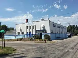 Blue Grass Community Center | |
| Motto(s): A Great Place To Call Home Since 1853 | |
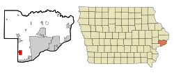 Location of Blue Grass, Iowa | |
| Coordinates: 41°30′43″N 90°45′54″W | |
| Country | USA |
| State | |
| Counties | Muscatine, Scott |
| Government | |
| • Mayor | Tim Brandenburg |
| Area | |
| • City | 2.92 sq mi (7.55 km2) |
| • Land | 2.92 sq mi (7.55 km2) |
| • Water | 0.00 sq mi (0.00 km2) |
| Elevation | 791 ft (241 m) |
| Population | |
| • City | 1,452 |
| • Estimate (2019)[3] | 1,661 |
| • Density | 569.42/sq mi (219.88/km2) |
| • Metro | 382,630 (135th) |
| Time zone | UTC-6 (Central (CST)) |
| • Summer (DST) | UTC-5 (CDT) |
| ZIP code | 52726 |
| Area code(s) | 563 |
| FIPS code | 19-07075 |
| GNIS feature ID | 0454709 |
| Website | www |
Most of Blue Grass is part of the Davenport–Moline–Rock Island, IA-IL Metropolitan Statistical Area, but the Muscatine County portion of the city is considered part of the Muscatine Micropolitan Statistical Area.
Geography
According to the United States Census Bureau, the city has a total area of 2.89 square miles (7.49 km2), all land.[5]
Demographics
| Year | Pop. | ±% |
|---|---|---|
| 1880 | 70 | — |
| 1910 | 223 | +218.6% |
| 1920 | 205 | −8.1% |
| 1930 | 246 | +20.0% |
| 1940 | 287 | +16.7% |
| 1950 | 337 | +17.4% |
| 1960 | 568 | +68.5% |
| 1970 | 1,032 | +81.7% |
| 1980 | 1,377 | +33.4% |
| 1990 | 1,214 | −11.8% |
| 2000 | 1,169 | −3.7% |
| 2010 | 1,452 | +24.2% |
| 2019 | 1,661 | +14.4% |
| Source:"U.S. Census website". United States Census Bureau. Retrieved March 29, 2020. and Iowa Data Center Source: | ||
2010 census
As of the census[2] of 2010, there were 1,452 people, 561 households, and 426 families living in the city. The population density was 502.4 inhabitants per square mile (194.0/km2). There were 597 housing units at an average density of 206.6 per square mile (79.8/km2). The racial makeup of the city was 97.0% White, 1.2% African American, 0.4% Native American, 0.2% Asian, 0.1% from other races, and 1.0% from two or more races. Hispanic or Latino of any race were 1.8% of the population.
There were 561 households, of which 34.8% had children under the age of 18 living with them, 62.9% were married couples living together, 6.4% had a female householder with no husband present, 6.6% had a male householder with no wife present, and 24.1% were non-families. 20.0% of all households were made up of individuals, and 7.7% had someone living alone who was 65 years of age or older. The average household size was 2.59 and the average family size was 2.93.
The median age in the city was 39.4 years. 24.7% of residents were under the age of 18; 6.7% were between the ages of 18 and 24; 26.3% were from 25 to 44; 28% were from 45 to 64; and 14% were 65 years of age or older. The gender makeup of the city was 51.9% male and 48.1% female.
2000 census
As of the census[7] of 2000, there were 1,169 people, 443 households, and 348 families living in the city. The population density was 434.0 people per square mile (167.8/km2). There were 459 housing units at an average density of 170.4 per square mile (65.9/km2). The racial makeup of the city was 97.43% White, 0.26% African American, 0.26% Native American, 0.26% Asian, 0.94% from other races, and 0.86% from two or more races. Hispanic or Latino of any race were 1.80% of the population.
There were 443 households, out of which 35.0% had children under the age of 18 living with them, 62.5% were married couples living together, 12.2% had a female householder with no husband present, and 21.4% were non-families. 16.9% of all households were made up of individuals, and 6.1% had someone living alone who was 65 years of age or older. The average household size was 2.64 and the average family size was 2.95.
Age spread: 25.1% under the age of 18, 8.0% from 18 to 24, 29.9% from 25 to 44, 27.4% from 45 to 64, and 9.7% who were 65 years of age or older. The median age was 37 years. For every 100 females, there were 95.5 males. For every 100 females age 18 and over, there were 95.5 males.
The median income for a household in the city was $51,923, and the median income for a family was $55,208. Males had a median income of $37,135 versus $22,350 for females. The per capita income for the city was $20,811. About 3.8% of families and 4.9% of the population were below the poverty line, including 5.7% of those under age 18 and 4.3% of those age 65 or over.
Education
Residents of the city are zoned to the Davenport Community School District.[8] Zoned schools include Blue Grass Elementary School,[9] Walcott Intermediate School,[10] and Davenport West High School.[11]
Muscatine Community School District operates public schools serving nearby rural areas.[12] Muscatine High School is the district's high school.
See also
- Nebergall "Knoll Crest" Round Barn, situated east of town along Telegraph Rd. (145th St.) and listed on the National Register of Historic Places in Scott County, Iowa
References
- "2019 U.S. Gazetteer Files". United States Census Bureau. Retrieved July 17, 2020.
- "U.S. Census website". United States Census Bureau. Retrieved May 11, 2012.
- "Population and Housing Unit Estimates". United States Census Bureau. May 24, 2020. Retrieved May 27, 2020.
- "US Gazetteer files 2010". United States Census Bureau. Archived from the original on January 12, 2012. Retrieved 2012-05-11.
- "Census of Population and Housing". Census.gov. Retrieved June 4, 2015.
- "U.S. Census website". United States Census Bureau. Retrieved 2008-01-31.
- "Davenport" (PDF). Iowa Department of Education. Retrieved March 28, 2020.
- "DCSD Intermediate Schools (Map)" (PDF). Davenport Community School District. Retrieved March 28, 2020. - Blue Grass Elementary School detail map and Detail map #2
- "DCSD Intermediate Schools (Map)" (PDF). Davenport Community School District. Retrieved March 28, 2020. - Walcott Intermediate School detail map
- "DCSD High Schools (Map)" (PDF). Davenport Community School District. Retrieved March 28, 2020. - West High School detail map
- "District". Muscatine Community School District. Retrieved March 28, 2020.
It also includes the towns of Fairport and Montpelier, as well as portions of the rural areas of Letts and Blue Grass.
- Blue Grass does not appear in the district's map
External links
| Wikimedia Commons has media related to Blue Grass, Iowa. |
- City website
- City-Data Comprehensive statistical data and more about Blue Grass
Municipalities and communities of Muscatine County, Iowa, United States | ||
|---|---|---|
| Cities | Map of Iowa highlighting Muscatine County | |
| Townships | ||
| Unincorporated communities | ||
| Footnotes | ‡This populated place also has portions in an adjacent county or counties | |
| ||
Municipalities and communities of Scott County, Iowa, United States | ||
|---|---|---|
| Cities | Map of Iowa highlighting Scott County | |
| Townships | ||
| CDP | ||
| Unincorporated community |
| |
| Footnotes | ‡This populated place also has portions in an adjacent county or counties | |
| ||
| Authority control |
|---|
