Bouilly-en-Gâtinais
Bouilly-en-Gâtinais is a commune in the Loiret department in north-central France.
Bouilly-en-Gâtinais | |
|---|---|
 The town hall in Bouilly-en-Gâtinais | |
Location of Bouilly-en-Gâtinais 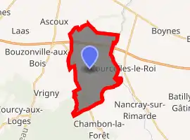
| |
 Bouilly-en-Gâtinais  Bouilly-en-Gâtinais | |
| Coordinates: 48°05′46″N 2°17′07″E | |
| Country | France |
| Region | Centre-Val de Loire |
| Department | Loiret |
| Arrondissement | Pithiviers |
| Canton | Malesherbes |
| Intercommunality | Beauce et du Gâtinais |
| Government | |
| • Mayor (2008–2014) | Gilles Luchard |
| Area 1 | 15.96 km2 (6.16 sq mi) |
| Population (2017-01-01)[1] | 319 |
| • Density | 20/km2 (52/sq mi) |
| Time zone | UTC+01:00 (CET) |
| • Summer (DST) | UTC+02:00 (CEST) |
| INSEE/Postal code | 45045 /45300 |
| Elevation | 98–122 m (322–400 ft) |
| 1 French Land Register data, which excludes lakes, ponds, glaciers > 1 km2 (0.386 sq mi or 247 acres) and river estuaries. | |
Population
| Year | Pop. | ±% |
|---|---|---|
| 1793 | 452 | — |
| 1800 | 452 | +0.0% |
| 1806 | 459 | +1.5% |
| 1821 | 434 | −5.4% |
| 1831 | 517 | +19.1% |
| 1836 | 509 | −1.5% |
| 1841 | 502 | −1.4% |
| 1846 | 514 | +2.4% |
| 1851 | 545 | +6.0% |
| 1856 | 559 | +2.6% |
| 1861 | 523 | −6.4% |
| 1866 | 506 | −3.3% |
| 1872 | 491 | −3.0% |
| 1876 | 491 | +0.0% |
| 1881 | 469 | −4.5% |
| 1886 | 478 | +1.9% |
| 1891 | 456 | −4.6% |
| 1896 | 427 | −6.4% |
| 1901 | 395 | −7.5% |
| 1906 | 378 | −4.3% |
| 1911 | 380 | +0.5% |
| 1921 | 340 | −10.5% |
| 1926 | 328 | −3.5% |
| 1931 | 314 | −4.3% |
| 1936 | 298 | −5.1% |
| 1946 | 302 | +1.3% |
| 1954 | 287 | −5.0% |
| 1962 | 240 | −16.4% |
| 1968 | 247 | +2.9% |
| 1975 | 261 | +5.7% |
| 1982 | 277 | +6.1% |
| 1990 | 260 | −6.1% |
| 1999 | 299 | +15.0% |
| 2006 | 314 | +5.0% |
| 2009 | 335 | +6.7% |
See also
References
- "Populations légales 2017". INSEE. Retrieved 6 January 2020.
| Wikimedia Commons has media related to Bouilly-en-Gâtinais. |
| Authority control |
|---|
This article is issued from Wikipedia. The text is licensed under Creative Commons - Attribution - Sharealike. Additional terms may apply for the media files.