Nesploy
Nesploy is a commune in the Loiret department in north-central France.
Nesploy | |
|---|---|
 The town hall in Nesploy | |
.svg.png.webp) Coat of arms | |
Location of Nesploy 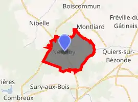
| |
 Nesploy  Nesploy | |
| Coordinates: 47°59′50″N 2°21′45″E | |
| Country | France |
| Region | Centre-Val de Loire |
| Department | Loiret |
| Arrondissement | Montargis |
| Canton | Lorris |
| Intercommunality | Canaux et Forêts en Gâtinais |
| Government | |
| • Mayor (2008–2014) | Nadine Rousseau |
| Area 1 | 12.87 km2 (4.97 sq mi) |
| Population (2017-01-01)[1] | 368 |
| • Density | 29/km2 (74/sq mi) |
| Demonym(s) | Nesployois |
| Time zone | UTC+01:00 (CET) |
| • Summer (DST) | UTC+02:00 (CEST) |
| INSEE/Postal code | 45223 /45270 |
| Elevation | 112–144 m (367–472 ft) |
| Website | http://www.nesploy.fr/ |
| 1 French Land Register data, which excludes lakes, ponds, glaciers > 1 km2 (0.386 sq mi or 247 acres) and river estuaries. | |
Geography
The Bézonde River goes through the commune limits. The commune itself is located in the Orléanais agricultural region. Nearby municipalities are Combreux, Montbarrois, Saint-Loup-des-Vignes, and Fréville-du-Gâtinais.[2]
History
The area of this town has historically been located in the royal forest of the Duke of Orléans. Only one of four castles remain from the past.
Demographics
Population censuses have been recorded since 1793, and as of 2015, the commune had a population of 381.
| 1793 | 1800 | 1806 | 1821 | 1831 | 1836 | 1841 | 1846 | 1851 | 1856 | 1861 | 1866 | 1872 | 1876 | 1881 | 1886 |
|---|---|---|---|---|---|---|---|---|---|---|---|---|---|---|---|
| 315 | 348 | 334 | 365 | 411 | 424 | 437 | 443 | 475 | 482 | 463 | 506 | 481 | 470 | 454 | 486 |
| 1891 | 1896 | 1901 | 1906 | 1911 | 1921 | 1926 | 1931 | 1936 | 1946 | 1954 | 1962 | 1968 | 1975 | 1982 | 1990 |
| 453 | 403 | 401 | 360 | 366 | 304 | 306 | 295 | 288 | 271 | 259 | 246 | 233 | 223 | 218 | 195 |
| 1999 | 2006 | 2011 | 2015 | ||||||||||||
| 298 | 358 | 406 | 381 |
See also
References
- "Populations légales 2017". INSEE. Retrieved 6 January 2020.
- delvarre@yahoo.fr, Lionel Delvarre. "Nesploy". www.lion1906.com. Retrieved 2018-02-19.
- "Recensement de la population-INSEE" (PDF). Retrieved 2018-02-18.
| Wikimedia Commons has media related to Nesploy. |
| Authority control |
|---|
This article is issued from Wikipedia. The text is licensed under Creative Commons - Attribution - Sharealike. Additional terms may apply for the media files.
