Fay-aux-Loges
Fay-aux-Loges is a commune the Loiret department in Centre-Val de Loire region in north-central France and about 120 kilometres (75 mi) southwest of Paris.
Fay-aux-Loges | |
|---|---|
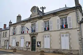 The town hall in Fay-aux-Loges | |
Location of Fay-aux-Loges 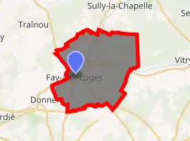
| |
 Fay-aux-Loges  Fay-aux-Loges | |
| Coordinates: 47°55′46″N 2°08′25″E | |
| Country | France |
| Region | Centre-Val de Loire |
| Department | Loiret |
| Arrondissement | Orléans |
| Canton | Châteauneuf-sur-Loire |
| Intercommunality | Communauté de communes des Loges |
| Government | |
| • Mayor (2008–2014) | Anne Besnier |
| Area 1 | 26.48 km2 (10.22 sq mi) |
| Population (2017-01-01)[1] | 3,756 |
| • Density | 140/km2 (370/sq mi) |
| Demonym(s) | Fayciens |
| Time zone | UTC+01:00 (CET) |
| • Summer (DST) | UTC+02:00 (CEST) |
| INSEE/Postal code | 45142 /45450 |
| Elevation | 102–126 m (335–413 ft) |
| Website | www.mairie-fayauxloges.fr |
| 1 French Land Register data, which excludes lakes, ponds, glaciers > 1 km2 (0.386 sq mi or 247 acres) and river estuaries. | |
Geography
Fay-aux-Loges is located in the septentrional bend of the Loire, which crosses from east to west. Fay-aux-Loges belongs to the vallée de la Loire sector between Sully-sur-Loire and Chalonnes-sur-Loire, which was in 2000 inscribed by UNESCO as a World Heritage Site. The capital of Orléanais, 120 kilomètres south-south-west of Paris, it is bordered by the forêt d'Orléans wood and by the Sologne region to the south.
The city is cross by the Canal d'Orléans, which connects to the Canal du Loing and the Canal de Briare at Buges near Montargis.
Climate
Orléans experiences an oceanic climate (Köppen climate classification Cfb), similar to much of central France.
History
References
- "Populations légales 2017". INSEE. Retrieved 6 January 2020.
| Wikimedia Commons has media related to Fay-aux-Loges. |
| Authority control |
|---|