Boy Lake Township, Cass County, Minnesota
Boy Lake Township is a township in Cass County, Minnesota, United States. The population was 132 as of the 2000 census.[3] This township took its name from Boy Lake.[4]
Boy Lake Township, Minnesota | |
|---|---|
 Boy Lake Township Hall, Cass County, MN | |
 Boy Lake Township, Minnesota Location within the state of Minnesota  Boy Lake Township, Minnesota Boy Lake Township, Minnesota (the United States) | |
| Coordinates: 47°5′48″N 94°11′47″W | |
| Country | United States |
| State | Minnesota |
| County | Cass |
| Area | |
| • Total | 36.3 sq mi (94.1 km2) |
| • Land | 27.6 sq mi (71.5 km2) |
| • Water | 8.7 sq mi (22.6 km2) |
| Elevation | 1,296 ft (395 m) |
| Population (2000) | |
| • Total | 132 |
| • Density | 4.8/sq mi (1.8/km2) |
| Time zone | UTC-6 (Central (CST)) |
| • Summer (DST) | UTC-5 (CDT) |
| ZIP code | 56655 |
| Area code(s) | 218 |
| FIPS code | 27-07156[1] |
| GNIS feature ID | 0663642[2] |
Geography
According to the United States Census Bureau, the township has a total area of 36.3 square miles (94 km2), of which 27.6 square miles (71 km2) is land and 8.7 square miles (23 km2) (24.01%) is water.
Unincorporated communities
Lakes
- Aultman Lake
- Boy Lake (west quarter)
- Camp Lake
- Current Lake
- Hougan Lake
- Iverson Lake
- Leech Lake (east edge)
- Mad Dog Lake
- Town Line Lake (north half)
Adjacent townships
- Gould Township (north)
- Boy River Township (northeast)
- Rogers Township (east)
- Inguadona Township (southeast)
- Kego Township (south)
- Pine Lake Township (southwest)
Demographics
As of the census[1] of 2000, there were 132 people, 58 households, and 36 families residing in the township. The population density was 4.8 people per square mile (1.8/km2). There were 204 housing units at an average density of 7.4/sq mi (2.9/km2). The racial makeup of the township was 81.82% White, 0.76% African American, 6.82% Native American, 0.76% Asian, and 9.85% from two or more races. Hispanic or Latino of any race were 1.52% of the population.
There were 58 households, out of which 19.0% had children under the age of 18 living with them, 53.4% were married couples living together, 6.9% had a female householder with no husband present, and 37.9% were non-families. 29.3% of all households were made up of individuals, and 20.7% had someone living alone who was 65 years of age or older. The average household size was 2.28 and the average family size was 2.81.
In the township the population was spread out, with 16.7% under the age of 18, 4.5% from 18 to 24, 22.7% from 25 to 44, 29.5% from 45 to 64, and 26.5% who were 65 years of age or older. The median age was 48 years. For every 100 females, there were 116.4 males. For every 100 females age 18 and over, there were 115.7 males.
The median income for a household in the township was $37,500, and the median income for a family was $36,250. Males had a median income of $34,583 versus $21,250 for females. The per capita income for the township was $20,070. There were 27.8% of families and 26.7% of the population living below the poverty line, including 68.8% of under eighteens and 6.7% of those over 64.
References
- United States National Atlas
- United States Census Bureau 2007 TIGER/Line Shapefiles
- United States Board on Geographic Names (GNIS)
- "U.S. Census website". United States Census Bureau. Retrieved 2008-01-31.
- "US Board on Geographic Names". United States Geological Survey. 2007-10-25. Retrieved 2008-01-31.
- "U.S. Census website". Retrieved 2009-01-02.
- Upham, Warren (1920). Minnesota Geographic Names: Their Origin and Historic Significance. Minnesota Historical Society. p. 87.
Municipalities and communities of Cass County, Minnesota, United States | ||
|---|---|---|
| Cities | 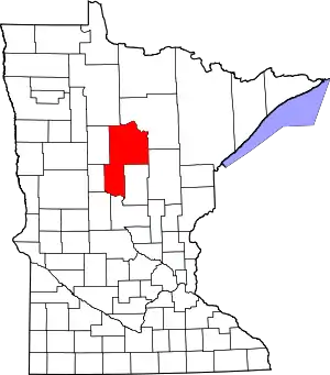 Map of Minnesota highlighting Cass County | |
| Townships |
| |
| Unorganized territories | ||
| CDP | ||
| Unincorporated communities | ||
| Indian reservation | ||
| Ghost town | ||
| Footnotes | ‡This populated place also has portions in an adjacent county or counties | |
| ||