Branson, Missouri micropolitan area
The Branson Micropolitan Statistical Area, as defined by the United States Census Bureau, is an area consisting of two counties in southwestern Missouri, anchored by the city of Branson. After the 2012 estimates the Branson Micropolitan area is part of the Springfield Combined Metropolitan area.[1]
Branson µSA | |
|---|---|
| Branson micropolitan statistical area | |
 | |
| Coordinates: 36°42′N 93°18′W | |
| Country | United States |
| State | Missouri |
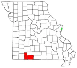
| Counties | Stone, Taney |
| Area | |
| • Total | 1,162 sq mi (3,010 km2) |
| • Land | 1,095 sq mi (2,840 km2) |
| • Water | 67 sq mi (170 km2) |
| Population (2010) | |
| • Total | 83,877 |
| • Density | 70.6/sq mi (27.3/km2) |
| Time zone | UTC-6 (CST) |
| • Summer (DST) | UTC-5 (CDT) |
| Area code(s) | 417 |
As of the 2010 census it had a population of 83,877.[2]
| Historical population | |||
|---|---|---|---|
| Census | Pop. | %± | |
| 2000 | 68,361 | — | |
| 2010 | 83,877 | 22.7% | |
| 2011 (est.) | 84,999 | 1.3% | |
| U.S. Decennial Census | |||
Communities
Places with more than 10,000 inhabitants
- Branson (Principal city) Pop: 10,520
Places with 1,000 to 5,000 inhabitants
- Hollister Pop: 4,426
- Kimberling City Pop: 2,400
- Forsyth Pop: 2,255
- Merriam Woods Pop: 1,761
- Crane Pop: 1,462
- Shell Knob (partial; census-designated place) Pop: 1,379
- Kissee Mills (census-designated place) Pop: 1,109
Places with less than 1,000 inhabitants
- Reeds Spring Pop: 913
- Rockaway Beach Pop: 841
- Bull Creek Pop: 603
- Indian Point Pop: 528
- Branson West Pop: 478
- Galena Pop: 440
- Taneyville Pop: 396
- McCord Bend Pop: 297
- Kirbyville Pop: 207
- Saddlebrooke (partial) Pop: 202
- Hurley Pop: 178
- Blue Eye Pop: 167
- Coney Island Pop: 75
Unincorporated places
|
|
Demographics
As of the census of 2000, there were 68,361 people, 27,980 households, and 19,894 families residing within the area. The racial makeup was 96.82% White, 0.23% African American, 0.76% Native American, 0.28% Asian, 0.05% Pacific Islander, 0.54% from other races, and 1.33% from two or more races. Hispanic or Latino of any race were 1.84% of the population.
The median income for a household in the area was $31,768, and the median income for a family was $36,801. Males had a median income of $25,828 versus $19,423 for females. The per capita income for the area was $17,652.
See also
References
- Bureau, US Census. "2012 Economic Census Reference Maps: Missouri". www.census.gov. Retrieved 2019-06-16.
- Bureau, U. S. Census. "U.S. Census website". United States Census Bureau. Retrieved 2018-12-18.