Busengo, Uganda
Busengo is a settlement in the Western Region of Uganda. It is one of the urban centers in Kisoro District. The town lies across the international border from Busengo, Democratic Republic of the Congo.[1]
Busengo, Uganda | |
|---|---|
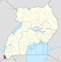
 Busengo, Uganda Map of Uganda showing the location of Busengo. | |
| Coordinates: | |
| Region | Western Region of Uganda |
| Sub-region | Kigezi sub-region |
| District | Kisoro District |
| Elevation | 2,044 m (6,706 ft) |
| Time zone | UTC+3 (EAT) |
Location
Busengo is approximately 28 kilometres (17 mi), by road, northwest of Kisoro, where the district headquarters are located.[2] This is approximately 104 kilometres (65 mi), by road, northwest of Kabale, the largest city in the Kigezi sub-region.[3] The coordinates of Busengo, Uganda are 01°09'43.0"S, 29°35'03.0"E (Latitude:-1.161944; Longitude:29.584167).[4] Busengo, Uganda sits at an average elevation of 2,044 metres (6,706 ft) above sea level.[5]
Overview
At Busengo, Uganda the major road continues into the Democratic Republic of the Congo, through Busengo, DRC and it joins the N2 Road in Rutshuru. A smaller road travels north in the DR Congo from Busengo, Uganda, re-enters Uganda and loops back to Kisoro Town, passing to the east of Lake Mutanda.[6]
Busengo, Uganda is the location of Busengo Primary School.[7]
See also
References
- National Geospatial-Intelligence Agency (12 February 2003). "Geographical Names: Busengo, Uganda". Bethesda, Maryland, United States: Geographic.org Quoting National Geospatial-Intelligence Agency. Retrieved 14 April 2019.
- Globefeed.com (14 April 2019). "Distance between Kisoro, Uganda and Busengo, Kisoro District, Western Region, Uganda". Globefeed.com. Retrieved 14 April 2019.
- Globefeed.com (14 April 2019). "Distance between Kabale, Uganda and Busengo, Kisoro District, Western Region, Uganda". Globefeed.com. Retrieved 14 April 2019.
- Google (14 April 2019). "Location of Busengo, Kisoro District, Western Region, Uganda" (Map). Google Maps. Google. Retrieved 14 April 2019.
- Falling Rain (27 August 2016). "Elevation of Busengo, Uganda". Fallingrain.com. Retrieved 14 April 2019.
- Google (14 April 2019). "Road Network Around Busengo, Uganda" (Map). Google Maps. Google. Retrieved 14 April 2019.
- Uganda Schools Guide (2019). "Busengo Primary School: This School Is Located In Busengo Parish, Nyarubuye Subcounty, Kisoro District Of Uganda". Kampala: Uganda Schools Guide. Retrieved 4 April 2019.
External links
Capital: Kisoro | ||
| Parishes |
|  |
| Towns and villages | ||
| Economy | ||
| Transport | ||
| Notable landmarks | ||
| Health | ||
| Education |
| |
| Notable people | ||