Bunagana, Uganda
Bunagana is a town in the Western Region of Uganda.
Bunagana, Uganda | |
|---|---|
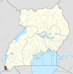
 Bunagana, Uganda Location in Uganda | |
| Coordinates: 01°17′40″S 29°35′59″E | |
| Country | |
| Region | Western Uganda |
| Sub-region | Kigezi sub-region |
| District | Kisoro District |
| Elevation | 6,300 ft (1,920 m) |
Location
The town is located in extreme southwestern Uganda, in Kisoro District, at the international border between Uganda and the Democratic Republic of the Congo (DRC). Bunagana is approximately 54 kilometres (34 mi), by road, west of Kabale, the largest city in the Kigezi sub-region.[1] This is approximately 14 kilometres (8.7 mi), by road, west of Kisoro, the district headquarters.[2] The coordinates of the town are:1°17'40.0"S, 29°35'59.0"E (Latitude:-1.294444; Longitude:29.599722).[3]
Overview
Bunagana lies an altitude of 1,920 metres (6,300 ft) above sea level. It is a major crossing point, for both human and commercial traffic.[4] On the Congolese side, a road leads to Goma, a city of approximately 400,000 people and the capital of North Kivu Province in the DRC. On the Ugandan side, Kabale, with a population estimated at about 50,000, lies to the east of Bunagana and is connected to it by an all-weather bitumen-surfaced road.
Points of interest
The following additional points of interest lie within the town limits or close to the edges of the town:
- offices of Bunagana Town Council
- Bunagana central market
- Bwindi National Park in Uganda is northeast of Bunagana, while Virunga National Park in the DRC is southwest of the town.
- town of Bunagana, DRC is immediately west of Bunagana, Uganda, across the border with the DRC
External links
References
- Road Distance Between Kabale & Bunagana With Map
- Map Showing Kisoro & Bunagana With Distance Marker
- Google (8 July 2015). "Location of Bunagana At Google Maps" (Map). Google Maps. Google. Retrieved 8 July 2015.
- Bunagana Border Post Is Major Crossing Point
Capital: Kisoro | ||
| Parishes |
|  |
| Towns and villages | ||
| Economy | ||
| Transport | ||
| Notable landmarks | ||
| Health | ||
| Education |
| |
| Notable people | ||
