Buthidaung
Buthidaung (Burmese: ဘူးသီးတောင်မြို့; MLCTS: bu:si:taung mrui., pronounced [búðídàʊɰ̃ mjo̰]) is a town in Rakhine State, in the westernmost part of Myanmar (Burma). It is the administrative seat of the Buthidaung Township. Buthidaung lies on the west bank of the Mayu river, and experienced severe flooding in June 2010 and July 2011.[1] Buthidaung is 16 miles south from Maungdaw. The two towns are connected by two tunnels through the Mayu mountains that were built in 1918.
Busidaung
ဘူးသီးတောင်မြို့ | |
|---|---|
Town | |
| Buthidaung | |
| Rakhinese, Rohingya language & Hindi are use transcription(s) | |
_-_panoramio_-_mohigan.jpg.webp) Buthidaung in 2016 | |
 Busidaung Location in Myanmar (Burma) | |
| Coordinates: 20.8690°N 92.528°E | |
| Country | |
| Division | |
| District | Maungdaw District |
| Township | Buthidaung Township |
| Population (2021) | 1-million |
| • Ethnicities | 93% Rohingya 6% Rakhine <1% Others |
| • Religions | Islam Buddhism hindus & others |
| Time zone | UTC+6.30 (MMT) |
| Area code(s) | 42, 43 |
| Website | Coming soon |
| Arabic coins | |
During the 2016–17 Northern Rakhine State clashes, three police stations in Buthidaung were reportedly surrounded by Rohingya insurgents.[2] As a result of the clashes Buthidaung, and much of the surrounding area, many Rohingyas have left their homes.[3]
References
- mizzima.com/news/inside-burma/5650-seven-townships-in-arakan-state-flooded-by-record-heavy-rain.html
- Reuters (August 28, 2017). "Myanmar Army Battles Rohingya Insurgents; Thousands Flee". The New York Times.
A Buthidaung-based reporter, citing police sources directly involved in events, said three police posts in northern Buthidaung had been surrounded by Rohingya insurgents.
- "The book that foresaw the assault on the Rohingyas". The Economist. 12 October 2017.
External links
Capital: Sittwe | ||
| Kyaukpyu District |  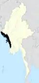 | |
| Maungdaw District | ||
| Sittwe District | ||
| Thandwe District |
| |
| Mrauk-U District | ||
| Main cities and towns | ||
This article is issued from Wikipedia. The text is licensed under Creative Commons - Attribution - Sharealike. Additional terms may apply for the media files.