Thandwe Township
Thandwe Township (Burmese: သံတွဲမြို့နယ်) is a township of Thandwe District in the Rakhine State of Myanmar. The principal town is Thandwe.[2]
Thandwe Township
သံတွဲမြို့နယ် | |
|---|---|
| Coordinates: 18°28′0″N 94°23′00″E | |
| Country | |
| State | Rakhine State |
| District | Thandwe District |
| Elevation | 5 m (18 ft) |
| Population (2014) | 133,484[1] |
| Time zone | UTC+6:30 (MST) |
Location
| No | Township name | North latitude | East longitude | Elevation (ft) | ||
|---|---|---|---|---|---|---|
| 1 | Thandwe Township | 18 28′ 00″ | 18 27′ 50″ | 94 23′ 00″ | 94 22′ 45″ | 18 |
Geo
Thandwe Township is situated the south of Rakhine State. From east to west, it is 28.33 miles wide and from south to north it is 48 miles wide. The area is 1360.16 square miles or 870,504 acres. There are surrounded by hill and above sea level is 18 feet.
| No | Name of township | Town area (square miles) | Country area (square miles) | Total area (square miles) |
|---|---|---|---|---|
| 1 | Thandwe Township | 1.373 (1,805 acres) | 1,358.787 (868,699 acres) | 1,360.16 (870,504 acres) |
Population
| No | Name of township | Male (above 18) | Female (above 18) | Total (above 18) | Male (under 18) | Female (under 18) | Total (under 18) | Total males | Total females | Total | |
|---|---|---|---|---|---|---|---|---|---|---|---|
| 1 | Thandwe | 39378 | 43215 | 82593 | 15645 | 15104 | 30749 | 55023 | 58319 | 113342 |
Family
| No | Name of township | Families in town | Families in village | Total |
|---|---|---|---|---|
| 1 | Thandwe | 2401 | 23075 | 25476 |
House
| No | Name | Houses in town | Houses in village | Total |
|---|---|---|---|---|
| 1 | Thandwe | 2598 | 23544 | 26142 |
Organization
| No | District | Township | No of Town | No of Quarter | No f village group | No of village |
|---|---|---|---|---|---|---|
| 1 | Thandwe | Thandwe | 1 | 7 | 63 | 252 |
Race
In Thandwe township, there are 5 Chinese men and 12 Pakistan men, 6 kachin,3 kayah, 8 kayin, 3663 chin, 554 Burma, 40 mon, 100947 rakhine, 8 shan and other 299 people.
Religious
There are 100871 Buddhists, 8761 Muslims, 3705 Christians and 5 Hindus.
Political party
There are 5 parties.
References
- Census Report. The 2014 Myanmar Population and Housing Census. 2. Naypyitaw: Ministry of Immigration and Population. May 2015. p. 60.
- http://www.themimu.info/docs/MIMU154v01_100816_Thandwe%20Ts-Rakhine%20State_A1.pdf%5B%5D Map of Thandwe Township
Capital: Sittwe | ||
| Kyaukpyu District |  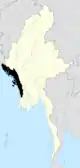 | |
| Maungdaw District | ||
| Sittwe District | ||
| Thandwe District |
| |
| Mrauk-U District | ||
| Main cities and towns | ||
This article is issued from Wikipedia. The text is licensed under Creative Commons - Attribution - Sharealike. Additional terms may apply for the media files.
