California Historical Landmarks in San Bernardino County, California
List table of the properties and districts — listed on the California Historical Landmarks — within San Bernardino County, Southern California.
- Note: Click the "Map of all coordinates" link to the right to view a Google map of all properties and districts with latitude and longitude coordinates in the table below.
Listings
| Image | [1] | Landmark name | Location | City or town | Summary |
|---|---|---|---|---|---|
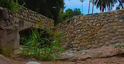
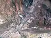
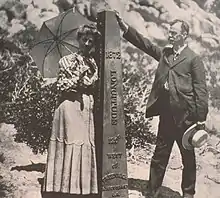
.jpg.webp) Agua Mansa Cemetery |
121 | Agua Mansa Cemetery | Agua Mansa Cemetery, 270 E Agua Mansa Rd. 34°02′31″N 117°21′47″W |
Colton | |
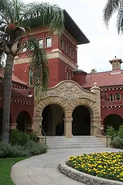 A.K. Smiley Public Library |
994 | A.K. Smiley Public Library | 125 West Vine St. 34°03′16″N 117°11′03″W |
Redlands | Also U.S. National Register of Historic Places |
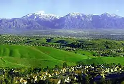
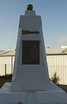
 Arrowhead |
977 | Arrowhead | Wildwood Park 34°10′07″N 117°16′42″W |
San Bernardino | |
 Calico |
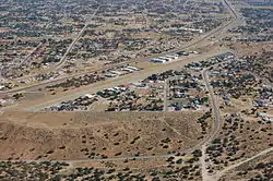
782 | Calico | Ghost Town Road 34°56′56″N 116°51′51″W |
Yermo, California | |
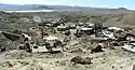
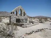
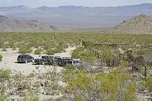
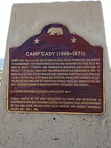 Camp Cady |
963 | Camp Cady | 24 mi N. of Barstow take Harvard Rd. offramp from I-15, turn right, go .8 mi. to Cherokee Rd., turn left and go 2.5 mi. and turn right at 2nd fence line. At the end of a dirt road. 34°56′42″N 116°35′57″W |
Newberry Springs | |
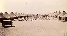 Camp Clipper |
985 | Camp Clipper | Desert Training Center 34°48′29″N 115°13′11″W |
Fenner | |
Camp Ibis |
985 | Camp Ibis | Desert Training Center 34°58′10″N 114°49′58″W |
Needles | |
 Camp Iron Mountain |
985 | Camp Iron Mountain | Desert Training Center 34°04′55″N 115°07′47″W |
Vidal | |
 Chimney Rock |
737 | Chimney Rock | On State Hwy 18 and Rabbit Springs Rd. 34°27′00″N 117°00′14″W |
Lucerne Valley | |
.jpg.webp) Rancho Cucamonga |
490 | Rancho Cucamonga | Cucamonga Winery 8916 Foothill Blvd. 34°06′24″N 117°36′39″W |
Rancho Cucamonga | |
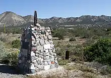
 Daley Toll Road Monument |
579 | Daley Toll Road Monument | On State Hwy 18 at Daley Canyon Rd 34°13′50″N 117°12′57″W |
Rimforest | |
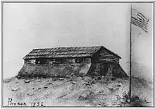 Fort Benson |
617 | Fort Benson | 10600 Hunts Ln. 34°03′41″N 117°17′16″W |
Colton | |
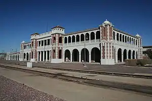 Harvey House |
892 | Harvey House | 685 North 1st Ave. 34°54′17″N 117°01′29″W |
Barstow | |
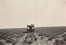
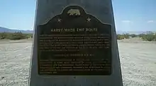 Henry Wade Exit Route |
622 | Henry Wade Exit Route | State Hwy 127 35°37′59″N 116°17′27″W |
Baker | |
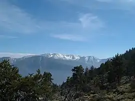
 Holcomb Valley |
619 | Holcomb Valley | Big Bear Valley Historical Society Museum 34°18′05″N 116°53′09″W |
Big Bear City | |
 Hulaville Forest, Folk Art |
939 | Hulaville Forest, Folk Art | Amargosa Rd, 2.0 mi W of I-15 and Phelan Rd. 34°55′31″N 116°53′12″W |
Hesperia | |
 Kimberly Crest |
1019 | Kimberly Crest | 1325 Prospect Dr 34°02′16″N 117°10′21″W |
Redlands | |
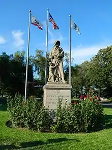 Madonna of the Trail |
1028 | Madonna of the Trail | 1100 Block of North Euclid Ave. 34°06′26″N 117°39′04″W |
Upland | |
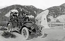
Garcés-Smith Monument |
618 | Garcés-Smith Monument | San Bernardino National Forest 34°14′44″N 117°21′12″W |
Colton | |
 Guachama Rancheria |
95 | Guachama Rancheria | 25894 Mission Rd. 34°03′23″N 117°14′17″W |
Redlands | |
 Mojave Road |
963 | Mojave Road | Midway Rest Area, N-bound I-15 33°47′05″N 118°15′29″W |
Barstow | |
 Mill Creek Zanja |
43 | Mill Creek Zanja | Sylvan Park 34°03′37″N 117°10′04″W |
Redlands | |
Mormon Lumber Road |
96 | Mormon Lumber Road | Waterman Canyon |
Crestline | |
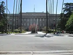 Mormon Stockade |
44 | Mormon Stockade | San Bernardino County Courthouse 34°06′20″N 117°17′21″W |
San Bernardino | |
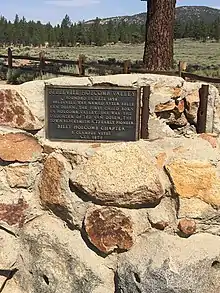
 Mormon Trail Monument |
577 | Mormon Trail Monument | W Cajon Canyon, State Hwy 138 34°21′05″N 117°31′37″W |
San Bernardino | |
 National Old Trail Monument |
781 | National Old Trail Monument | On shoulder of NW corner of Colorado River Bridge, North K St. 34°51′04″N 114°36′35″W |
Needles | |
.jpg.webp) Old Bear Valley Dam |
725 | Old Bear Valley Dam | Big Bear Lake 34°14′31″N 116°58′34″W |
Big Bear Lake | |
 Possum Trot Folk art |
939 | Possum Trot Folk art |
Ghost Town Rd, 1.5 mi N of I-15 34°55′31″N 116°53′12″W |
Yermo | |
 Rancho Santa Ana del Chino |
942 | Rancho Santa Ana del Chino | Chino Fire Station No. 2, 4440 Eucalyptus Ave. 33°59′24″N 117°43′03″W |
Chino | |
 San Bernardino de Sena Estancia |
42 | San Bernardino de Sena Estancia | 26930 Barton Rd. 34°02′40″N 117°13′15″W |
Redlands | |
 Santa Fe And Salt Lake Trail Monument |
576 | Santa Fe And Salt Lake Trail Monument | Cajon Pass S end Wagon Train Rd, SE corner I-15 and State Hwy 138 34°18′22″N 117°28′00″W |
San Bernardino | |
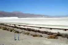 Searles Lake Borax discovery |
774 | Searles Lake Borax discovery | Trona Rd at Center St 35°45′28″N 117°22′38″W |
San Bernardino | |
 Stoddard-Waite Monument |
578 | Stoddard-Waite Monument | Elsie Arey May Nature Center 34°18′13″N 117°28′00″W |
San Bernardino | |
 Sycamore Grove |
573 | Sycamore Grove | Glen Helen Regional Park 34°12′38″N 117°24′23″W |
Devore | |
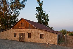
.jpg.webp) Tapia Adobe |
360 | Tapia Adobe | Rancho Cucamonga - 8916 Foothill Blvd. 34°06′24″N 117°36′39″W |
Rancho Cucamonga | |
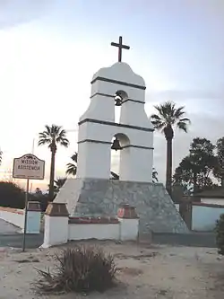
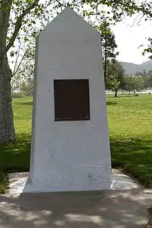
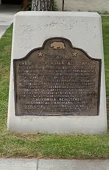 U.S. Rabbit Experimental Station |
950 | U.S. Rabbit Experimental Station | Josephine Knoph Senior Citizen Center of Fontana, 8384 Cypress Ave 34°06′06″N 117°26′40″W |
Fontana | |
 Von Schmidt State Boundary Monument |
859 | Von Schmidt State Boundary Monument | E side of Pew Rd (River Rd), 2.6 mi S of state line 35°00′51″N 114°39′43″W |
Needles | |
 Yorba-Slaughter Adobe |
191 | Yorba-Slaughter Adobe | 17127 Pomona-Rincon Rd. 33°56′25″N 117°39′57″W |
Chino | |
.jpg.webp) Yucaipa Adobe |
528 | Yucaipa Adobe | 32183 Kentucky St. 34°02′31″N 117°21′47″W |
Yucaipa | |
Yucaipa Rancheria |
620 | Yucaipa Rancheria | 32183 Kentucky St. 34°01′21″N 117°06′08″W |
Yucaipa |
See also
| Wikimedia Commons has media related to California Historical Landmarks in San Bernardino County, California. |
References
- "California Historical Landmarks By County". Ohp.parks.ca.gov. Retrieved 2019-04-03.
This article is issued from Wikipedia. The text is licensed under Creative Commons - Attribution - Sharealike. Additional terms may apply for the media files.