California Historical Landmarks in San Mateo County, California
List table of the properties and districts — listed on the California Historical Landmarks — within San Mateo County, California.
- Note: Click the "Map of all coordinates" link to the right to view a Google map of all properties and districts with latitude and longitude coordinates in the table below.
Listings
| Image | [1] | Landmark name | Location | City or town | Summary |
|---|---|---|---|---|---|
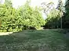
.jpg.webp) Anza Expedition Camp |
47 | Anza Expedition Camp | Banks of San Mateo Creek |
San Mateo | |
| 48 | Anza Expedition Camp | El Camino Real and Ralston |
Burlingame | ||
 Broderick-Terry Dueling Place |
19 | Broderick-Terry Dueling Place | 1100 Lake Merced Blvd. 37°42′29″N 122°29′03″W |
Daly City | |
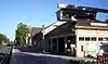
Burlingame Station |
846 | Burlingame Station | 290 California Dr. 37°34′48″N 122°20′42″W |
Burlingame | Also on the NRHP list as NPS-78000769 |
| 939 | Capidro | 262 Princeton Rd. |
Menlo Park | Folk art ornamenting a Menlo Park home, no longer exists. | |
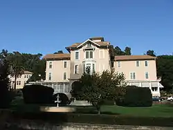
 Carolands |
886 | Carolands | 565 Remillard Rd. 37°33′20″N 122°22′15″W |
Hillsborough | Also on the NRHP list as NPS-75000478 |
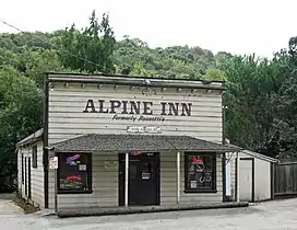 Casa de Tableta |
825 | Casa de Tableta | 3915 Alpine Rd. 37°22′56″N 122°11′37″W |
Portola Valley | Also called Alpine Inn, on the NRHP list as NPS-73000447 |
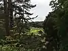
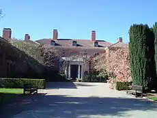 Filoli |
907 | Filoli | Filoli Center, Canada Rd. 37°28′13″N 122°18′39″W |
Woodside | |
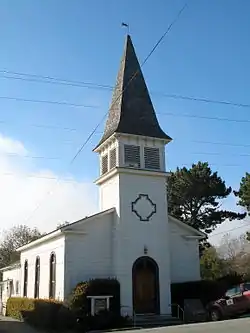 First Congregational Church of Pescadero |
949 | First Congregational Church of Pescadero | San Gregorio St. 37°15′16″N 122°23′00″W |
Pescadero | |
 Menlo Park Station |
955 | Menlo Park Station | 1120 Merrill St. 37°27′17″N 122°10′51″W |
Menlo Park | Also on the NRHP list as NPS-74000556 |
| 393 | Mission Hospice | Baywood and El Camino Real 37°33′55″N 122°19′41″W |
San Mateo | ||
| 343 | Old Store at La Honda | Northwest corner, La Honda Road and Sears Ranch Road |
La Honda | Building no longer exists. | |
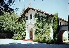 Our Lady of the Wayside Church |
909 | Our Lady of the Wayside Church | 930 Portola Rd. 37°23′02″N 122°14′02″W |
Portola Valley | |
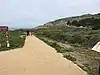
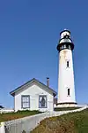 Pigeon Point Lighthouse |
930 | Pigeon Point Lighthouse | 37°10′54″N 122°23′38″W |
Davenport | |
 Portolá Expedition Camp |
22 | Portolá Expedition Camp | Mouth of Purisima Creek |
Half Moon Bay | |
 Portolá Expedition Camp |
23 | Portolá Expedition Camp | Mouth of Gazos Creek |
Pescadero | |
| 24 | Portolá Expedition Camp | Mouth of San Pedro Creek |
Pacifica | ||
 Portolá Expedition Camp |
25 | Portolá Expedition Camp | Foot of Montara Mountain |
Montara | |
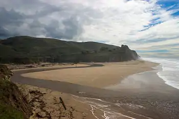 Portolá Expedition Camp |
26 | Portolá Expedition Camp | San Gregorio State Beach 37°19′23″N 122°24′07″W |
San Gregorio | |
| 27 | Portolá Expedition Camp | San Andreas Lake |
Millbrae | ||
| 92 | Portolá Expedition Camp | Pulgas Water Temple |
|||
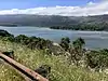 Portolá Expedition Camp |
94 | Portolá Expedition Camp | Upper Crystal Springs Reservoir |
Woodside | |
 Portolá Journey's End |
2 | Portolá Journey's End | E. Creek Dr. and Alma St. |
Menlo Park | |
 Ralston Hall |
856 | Ralston Hall | College of Notre Dame, 1500 Ralston Ave 37°31′03″N 122°17′10″W |
Belmont | Also on the NRHP list as NPS-66000234 |
 Sánchez Adobe |
391 | Sánchez Adobe | Sánchez Adobe Park 37°35′15″N 122°29′33″W |
Pacifica | Also on the NRHP list as NPS-76000525 |
San Francisco Bay Discovery Site |
394 | San Francisco Bay Discovery Site | Sweeney Ridge 37°36′16″N 122°27′28″W |
Pacifica | Also on the NRHP list as NPS-68000022 |
| 478 | San Mateo County's first sawmill | Portola Rd. 37°24′18″N 122°15′19″W |
Woodside | ||
| 474 | Searsville | Sandhill and Portola Rds. 37°24′10″N 122°14′43″W |
Woodside | ||
| 906 | Steele Brothers Dairy Ranches | Año Nuevo State Reserve |
Woodside | ||
 Tanforan Assembly Center |
934 | Tanforan Assembly Center | Tanforan Shopping Center 37°38′10″N 122°25′09″W |
San Bruno | |
| 375 | Tunitas Beach, Indian Village Site | Mouth of Tunitas Creek at Tunitas Beach |
Half Moon Bay | ||
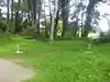
.JPG.webp) Union Cemetery |
816 | Union Cemetery | El Camino Real and Woodside Rd. 37°28′26″N 122°13′23″W |
Redwood City | Also on the NRHP list as NPS-83001237 |
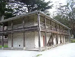
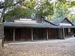 Woodside Store |
93 | Woodside Store | 471 Kings Mountain Rd. 37°25′50″N 122°16′38″W |
Woodside |
References
- "California Historical Landmarks By County". Ohp.parks.ca.gov. Retrieved 2019-04-03.
See also
| Wikimedia Commons has media related to California Historical Landmarks in San Mateo County, California. |
This article is issued from Wikipedia. The text is licensed under Creative Commons - Attribution - Sharealike. Additional terms may apply for the media files.