California Historical Landmarks in Yuba County, California
This list includes properties and districts listed on the California Historical Landmark listing in Yuba County, California. Click the "Map of all coordinates" link to the right to view a Google map of all properties and districts with latitude and longitude coordinates in the table below.
| Image | [1] | Landmark name | Location | City or town | Summary |
|---|---|---|---|---|---|
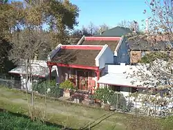 Bok Kai Temple |
889 | Bok Kai Temple | First and D Sts. 39°08′06″N 121°35′13″W |
Marysville | Also on the NRHP list as NPS-75000498 |
 Johnson's Ranch |
493 | Johnson's Ranch | Tomita Park 39°00′37″N 121°25′23″W |
Wheatland | |
 Marysville Assembly Center |
934 | Marysville Assembly Center | Aarboga Community |
Marysville | |
 Overland Emigrant Trail |
799-3 | Overland Emigrant Trail | Spenceville Rd. 39°02′23″N 121°23′06″W |
Wheatland | |
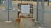
 Smartsville |
321 | Smartsville | 8444 Smartville Rd.
Historic district |
Smartsville, California | California Historic Point of Interest plaque is located at Church of Immaculate Conception.[2] |
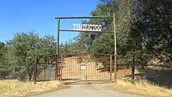 Timbuctoo |
320 | Timbuctoo | Historic district 39°13′01″N 121°19′07″W |
Timbuctoo | |
 Wheatland Hop Riot |
1003 | Wheatland Hop Riot | S. 'A' St. and 6th St. 39°00′46″N 121°25′08″W |
Wheatland |
See also
| Wikimedia Commons has media related to California Historical Landmarks in Yuba County, California. |
References
- "California Historical Landmarks By County". Ohp.parks.ca.gov. Retrieved 2019-04-03.
- "Smartsville (No. 321 California Historical Landmark)". sierranevadageotourism.org. Retrieved August 11, 2019.
Municipalities and communities of Yuba County, California, United States | ||
|---|---|---|
| Cities | 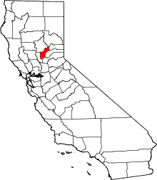 Yuba County map | |
| CDPs | ||
| Unincorporated communities | ||
| Ghost towns |
| |
| Footnotes | ‡This populated place also has portions in an adjacent county or counties | |
| ||
This article is issued from Wikipedia. The text is licensed under Creative Commons - Attribution - Sharealike. Additional terms may apply for the media files.