Calumet Air Force Station
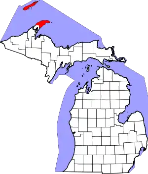
Calumet Air Force Station is a closed United States Air Force General Surveillance Radar station. It is located 5.2 miles (8.4 km) east-northeast of Phoenix, Michigan. It was closed in 1988 by the Air Force, and turned over to the Federal Aviation Administration (FAA).
Calumet Air Force Station | |
|---|---|
| Part of Air Defense Command (ADC) | |
 CalumetAFS Location of Calumet AFS, Michigan | |
| Coordinates | 47°22′16″N 088°10′14″W |
| Type | Air Force Station |
| Code | ADC ID: P-16, NORAD ID: Z-16 |
| Site information | |
| Controlled by | |
| Site history | |
| Built | 1951 |
| In use | 1951–1988 |
| Garrison information | |
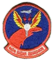
| Garrison | 665th Air Defense Group 665th Aircraft Control and Warning Squadron (later 665th Radar Squadron) |


Today the site is part of the Joint Surveillance System (JSS), designated by NORAD as Eastern Air Defense Sector (EADS) Ground Equipment Facility J-59.
History
In late 1951 Air Defense Command selected the Keweenaw, Michigan site as one of twenty-eight radar stations built as part of the second segment of the permanent radar surveillance network. Prompted by the start of the Korean War, on July 11, 1950, the Secretary of the Air Force asked the Secretary of Defense for approval to expedite construction of the second segment of the permanent network. Receiving the Defense Secretary's approval on July 21, the Air Force directed the Corps of Engineers to proceed with construction.
On 1 May 1951 the 665th Aircraft Control and Warning Squadron[1] began operating AN/FPS-3 and AN/FPS-5 radars at this northern Michigan site in early 1953, and initially the station functioned as a Ground-Control Intercept (GCI) and warning station. As a GCI station, the squadron's role was to guide interceptor aircraft toward unidentified intruders picked up on the unit's radar scopes. On 1 December 1953 the site was re-designated as Calumet Air Force Station.
In 1956 an AN/FPS-6 replaced the AN/FPS-5 height-finder radar. In 1958 an AN/FPS-20 search radar was deployed at Calumet. By 1961 this radar was upgraded and redesignated as an AN/FPS-64. During 1960 Calumet AFS joined the Semi Automatic Ground Environment (SAGE) system, feeding data to DC-14 at K. I. Sawyer AFB, Michigan. After joining, the squadron was re-designated as the 665th Radar Squadron (SAGE) on 15 July 1960.[1] The radar squadron provided information 24/7 the SAGE Direction Center where it was analyzed to determine range, direction altitude speed and whether or not aircraft were friendly or hostile. On 31 July 1963, the site was redesignated as the NORAD ID Z-16.
A turn-over of equipment in 1963 left the site with an AN/FPS-27 search radar along with AN/FPS-26A and AN/FPS-90 height-finder radars. The AN/FPS-90 was removed in the late 1970s.
In addition to the main facility, Calumet operated the following AN/FPS-18 Gap Filler sites:
- Painesdale, MI (P-16A) 47°02′12″N 088°41′43″W
- Upson, WI (P-16B) 46°25′10″N 090°23′06″W
The 665th Radar Sq was inactivated[1] and replaced by the 665th Air Defense Group in March 1970.[2] The upgrade to group status was done because of Calumet AFS' status as a Backup Interceptor Control (BUIC) site. BUIC sites were alternate control sites in the event that SAGE Direction Centers became disabled and unable to control interceptor aircraft. The group was inactivated[2] and replaced by the 655th Radar Squadron[1] as defenses against manned bombers were reduced. The group was disbanded in 1984.[3]
Over the years, the equipment at the station was upgraded or modified to improve the efficiency and accuracy of the information gathered by the radars. Calumet came under Tactical Air Command jurisdiction in October 1979 with the inactivation of Aerospace Defense Command and the formation of ADTAC. The station then underwent cease-operations about that time, and the AN/FPS-26A height-finder radar was removed, but the site closing was soon reversed (Allegedly due to Calumet AFS being the only station to pick up a simulated air incursion). On 30 September 1988, the site finally closed permanently. Calumet was then reconfigured as an Air Force Joint Surveillance System (JSS) site, initially with only the AN/FPS-27. An AN/FPS-91A replaced the AN/FPS-27, and later an AN/FPS-116 height-finder radar was installed.
The former station was used by Keweenaw Academy, a reform school. Today Keweenaw County owns the site. It is now only used for radio communications (cellular, amateur radio, etc.) The facilities are visibly degrading in a very remote area.
Air Force units and assignments
Units
- Constituted as 665th Aircraft Control and Warning Squadron
- Activated on 27 November 1950
- Redesignated 665th Radar Squadron (SAGE) on 15 July 1960
- Inactivated on 1 March 1970
- Redesignated 665th Radar Squadron on 1 January 1974
- Activated on 17 January 1974
- Inactivated on 30 September 1988[1]
- Constituted as 665th Air Defense Group on 13 February 1970
Commanders
- Major Ira E. Mason 1962?–1963
- Major Fred L. McPherson 1963–1965
- Major Roger W. Gottschall 1965–?
- Major David P. Lentz, 1 March 1970 – 1970[4]
- Maj. James H. Bentley, 1970–unknown[5]
- Col. John Morgan Fear 1971–
- Maj David Hershberger 1979–1981
- Capt/Maj Jeff Mogilewicz 1981–1983
- Lt Col Larry Dobbs, 1983–1985
- Lt Col Scott Meyer, 1985–1987 – The men and women of the base earned the Outstanding Unit Award during this time.
- Lt Col Michael Yon, 1987–1988
Assignments
- 541st Aircraft Control and Warning Group, 27 November 1950
- 30th Air Division, 6 February 1952
- 4706th Defense Wing, 16 February 1953
- 37th Air Division, 8 July 1956
- 30th Air Division, 1 April 1959
- Sault Sainte Marie Air Defense Sector, 1 April 1960
- Duluth Air Defense Sector, 1 October 1963
- 29th Air Division, 1 April 1966
- 23d Air Division, 19 November 1969
- 24th Air Division, 1 Apr 1982 – 30 September 1988[1][2]
See also
References
Notes
- Cornett & Johnson, p. 158
- Cornett, & Johnson, p.86
- Department of the Air Force/MPM Letter 575q, 27 Sep 1984, Subject: Disbandment of Units
- "Abstract, History of 665th Air Defense Group, Jan–Mar 1970". Air Force History Index. Retrieved Mar 2012. Check date values in:
|access-date=(help) - "Abstract, History of 665th Air Defense Group, Apr – Jun 1970". Air Force History Index. Retrieved Mar 2012. Check date values in:
|access-date=(help)
Bibliography
![]() This article incorporates public domain material from the Air Force Historical Research Agency website http://www.afhra.af.mil/.
This article incorporates public domain material from the Air Force Historical Research Agency website http://www.afhra.af.mil/.
- Cornett, Lloyd H; Johnson, Mildred W (1980). A Handbook of Aerospace Defense Organization, 1946–1980 (PDF). Peterson AFB, CO: Office of History, Aerospace Defense Center.
Further reading
- Grant, C.L., (1961) The Development of Continental Air Defense to 1 September 1954, USAF Historical Study No. 126
- Leonard, Barry (2009). History of Strategic Air and Ballistic Missile Defense (PDF). Vol I. 1945–1955. Fort McNair, DC: Center for Military History. ISBN 978-1-43792-131-1.
- Leonard, Barry (2009). History of Strategic Air and Ballistic Missile Defense (PDF). Vol II, 1955–1972. Fort McNair, DC: Center for Military History. ISBN 978-1-43792-131-1.
- Redmond, Kent C.; Smith, Thomas M. (2000). From Whirlwind to MITRE: The R&D Story of The SAGE Air Defense Computer. Cambridge, Massachusetts: MIT Press. ISBN 978-0-262-18201-0.
- Winkler, David F.; Webster, Julie L (1997). Searching the skies: The legacy of the United States Cold War Defense Radar Program. Champaign, IL: US Army Construction Engineering Research Laboratories. LCCN 97020912.

