Campohermoso
Campohermoso (Spanish pronunciation: [kampoeɾˈmoso]) is a town and municipality in the Colombian Department of Boyacá, part of the subregion of the Lengupá Province.
Campohermoso | |
|---|---|
Municipality and town | |
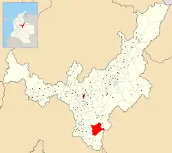 Location of the municipality and town of Campohermoso in the Boyacá Department of Colombia. | |
| Country | |
| Department | Boyacá Department |
| Province | Lengupá Province |
| Government | |
| • Mayor | Jaime Yesid Rodríguez Romero (2020-2023) |
| Area | |
| • Total | 302 km2 (117 sq mi) |
| Elevation | 1,100 m (3,600 ft) |
| Time zone | UTC-5 (Colombia Standard Time) |
Climate
Campohermoso has a tropical monsoon climate (Am) with moderate rainfall from December to March and heavy to very heavy rainfall in the remaining months.
| Climate data for Campohermoso | |||||||||||||
|---|---|---|---|---|---|---|---|---|---|---|---|---|---|
| Month | Jan | Feb | Mar | Apr | May | Jun | Jul | Aug | Sep | Oct | Nov | Dec | Year |
| Average high °C (°F) | 27.1 (80.8) |
27.6 (81.7) |
26.8 (80.2) |
26.1 (79.0) |
25.3 (77.5) |
24.5 (76.1) |
24.0 (75.2) |
24.6 (76.3) |
25.9 (78.6) |
26.4 (79.5) |
26.2 (79.2) |
26.3 (79.3) |
25.9 (78.6) |
| Daily mean °C (°F) | 21.7 (71.1) |
21.9 (71.4) |
21.8 (71.2) |
21.2 (70.2) |
20.8 (69.4) |
20.3 (68.5) |
19.9 (67.8) |
20.2 (68.4) |
20.9 (69.6) |
21.4 (70.5) |
21.4 (70.5) |
21.4 (70.5) |
21.1 (69.9) |
| Average low °C (°F) | 16.6 (61.9) |
17.2 (63.0) |
17.7 (63.9) |
17.9 (64.2) |
17.6 (63.7) |
17.2 (63.0) |
16.7 (62.1) |
16.8 (62.2) |
16.8 (62.2) |
17.2 (63.0) |
17.4 (63.3) |
17.0 (62.6) |
17.2 (62.9) |
| Average rainfall mm (inches) | 45.1 (1.78) |
65.0 (2.56) |
128.2 (5.05) |
275.2 (10.83) |
431.1 (16.97) |
464.0 (18.27) |
451.9 (17.79) |
382.0 (15.04) |
269.3 (10.60) |
256.5 (10.10) |
205.2 (8.08) |
86.7 (3.41) |
3,060.2 (120.48) |
| Average rainy days | 10 | 11 | 18 | 25 | 29 | 29 | 30 | 29 | 26 | 26 | 24 | 15 | 272 |
| Average relative humidity (%) | 84 | 83 | 85 | 87 | 88 | 89 | 90 | 88 | 87 | 86 | 86 | 85 | 87 |
| Source: IDEAM[1] | |||||||||||||
References
- "Data". www.ideam.gov.co. Retrieved 2020-08-23.
This article is issued from Wikipedia. The text is licensed under Creative Commons - Attribution - Sharealike. Additional terms may apply for the media files.