Iza, Boyacá
Iza is a town and municipality in Boyacá Department, Colombia. Iza is located near the Tota Lake and part of the Sugamuxi Province, a subregion of Boyacá. Iza is located in the Eastern Ranges of the Colombian Andes on the Altiplano Cundiboyacense at a distance of 13 kilometres (8.1 mi) from Sogamoso and 90 kilometres (56 mi) from the department capital Tunja. The municipality borders Firavitoba and Sogamoso in the north, Sogamoso and Cuítiva in the east, in the west Pesca and Firavitoba, and in the south Cuítiva.
Iza | |
|---|---|
Municipality and town | |
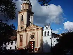 Church of Iza | |
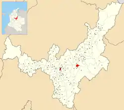 Location of the municipality and town of Iza in the Boyacá Department of Colombia | |
| Country | |
| Department | Boyacá Department |
| Province | Sugamuxi Province |
| Founded | 2 January 1556 |
| Government | |
| • Mayor | Robinson Leandro Salamanca Rincón (2020-2023) |
| Area | |
| • Municipality and town | 34 km2 (13 sq mi) |
| Elevation | 2,560 m (8,400 ft) |
| Population | |
| • Municipality and town | 2,349 |
| • Density | 69/km2 (180/sq mi) |
| • Urban | 1,026 |
| Time zone | UTC-5 (Colombia Standard Time) |
| Website | Official website |
History
Before the Spanish conquest, the area of Iza was inhabited first by indigenous groups during the Herrera Period and later by the Muisca, organized in the Muisca Confederation. Iza was ruled by the iraca of Sugamuxi, modern neighbouring Sogamoso. According to Muisca mythology, the messenger god Bochica is said to have lived outside Iza in a cave.
In the Chibcha language of the Muisca za means "night", and Iza means "place of healing".[1]
Modern Iza was founded on January 2, 1554. The town is nicknamed Nido Verde de Boyacá; "Green Nest of Boyacá".
Economy
Main economical activities of Iza are mining (coal and pozzolan) and agriculture.
Born in Iza
- Jairo Pérez, former professional cyclist
Gallery
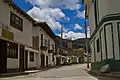 Street view
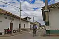 Street view
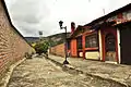 Street view
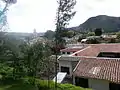 Mountain view
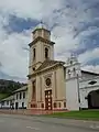 Church of Iza
.JPG.webp) Church
Church Church tower
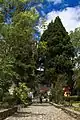 Central park
References
- (in Spanish) Etymology Iza - accessed 06-05-2016
| Wikimedia Commons has media related to Iza, Boyacá. |