Cubará
Cubará is a town and municipality in Boyacá Department, Colombia also referred to as the Boyacá Frontier District for sharing an international border with the Bolivarian Republic of Venezuela.
Cubará | |
|---|---|
Municipality and town | |
 Flag  Seal | |
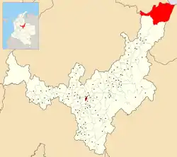 Location of the municipality and town of Cubará in the Boyacá Department of Colombia. | |
 Cubará Location in Colombia | |
| Coordinates: 7°02′N 72°04′W | |
| Country | |
| Department | Boyacá Department |
| Province | Boyacá Frontier District |
| Government | |
| • Mayor | Aura Benilda Tegria Cristancho (2020-2023) |
| Elevation | 380 m (1,250 ft) |
| Time zone | UTC-5 (Colombia Standard Time) |
Climate
Cubará has a very wet tropical rainforest climate (Af).
| Climate data for Cubará | |||||||||||||
|---|---|---|---|---|---|---|---|---|---|---|---|---|---|
| Month | Jan | Feb | Mar | Apr | May | Jun | Jul | Aug | Sep | Oct | Nov | Dec | Year |
| Average high °C (°F) | 29.3 (84.7) |
29.6 (85.3) |
29.6 (85.3) |
29.6 (85.3) |
29.6 (85.3) |
28.8 (83.8) |
28.5 (83.3) |
29.1 (84.4) |
30.0 (86.0) |
30.2 (86.4) |
30.0 (86.0) |
29.5 (85.1) |
29.5 (85.1) |
| Daily mean °C (°F) | 23.9 (75.0) |
24.1 (75.4) |
24.3 (75.7) |
24.5 (76.1) |
24.5 (76.1) |
23.9 (75.0) |
23.7 (74.7) |
24.1 (75.4) |
24.6 (76.3) |
24.9 (76.8) |
24.8 (76.6) |
24.3 (75.7) |
24.3 (75.7) |
| Average low °C (°F) | 19.2 (66.6) |
19.6 (67.3) |
20.2 (68.4) |
20.7 (69.3) |
20.7 (69.3) |
20.4 (68.7) |
20.3 (68.5) |
20.6 (69.1) |
20.5 (68.9) |
20.5 (68.9) |
20.4 (68.7) |
20.1 (68.2) |
20.3 (68.5) |
| Average rainfall mm (inches) | 161.1 (6.34) |
199.4 (7.85) |
228.4 (8.99) |
379.7 (14.95) |
575.7 (22.67) |
659.8 (25.98) |
633.4 (24.94) |
651.3 (25.64) |
519.5 (20.45) |
435.4 (17.14) |
332.3 (13.08) |
225.4 (8.87) |
5,001.4 (196.9) |
| Average rainy days | 12 | 14 | 16 | 21 | 23 | 25 | 25 | 25 | 22 | 21 | 19 | 15 | 238 |
| Average relative humidity (%) | 82 | 82 | 82 | 85 | 86 | 87 | 87 | 87 | 86 | 84 | 84 | 84 | 85 |
| Source: [1] | |||||||||||||
References
- "Data". www.ideam.gov.co. Archived from the original on 2016-08-15. Retrieved 2020-07-06.
External links
- (in Spanish) Cubara official website
This article is issued from Wikipedia. The text is licensed under Creative Commons - Attribution - Sharealike. Additional terms may apply for the media files.