Changhai County
Changhai County (Chinese: 长海县; pinyin: Chánghǎi Xiàn; lit. 'Long-Sea County') is a district under the administration of Dalian, Liaoning province, China. It consists of several islands in the Yellow Sea and is located offshore of the Liaodong Peninsula. There are 112 small islands and reefs in the county, traditionally called the Outer Long Mountains Island Chain (Chinese: 外长山群岛; pinyin: Wàichángshān Qúndǎo) and formerly sometimes called the Elliot Islands. The county has an area of 156.89 square kilometres (60.58 sq mi) and a permanent population as of 2010 of 77,951, making it Dalian's least populous county-level division,[2][3] and the county government is located in the Dongshan neighborhood of the town of Dachangshandao (Chinese: 大长山岛; lit. 'Great Long-Mountain Island').
Changhai
长海县 | ||||||||||||||||||||||||||||||||||
|---|---|---|---|---|---|---|---|---|---|---|---|---|---|---|---|---|---|---|---|---|---|---|---|---|---|---|---|---|---|---|---|---|---|---|
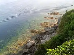 Xiaoshuikou (小水口) Scenic Area in Xiaochangshan Island | ||||||||||||||||||||||||||||||||||
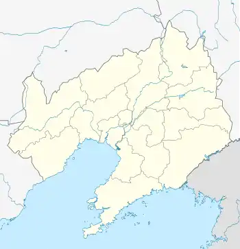 Changhai Location in Liaoning | ||||||||||||||||||||||||||||||||||
| Coordinates: 39°16′19″N 122°35′42″E[1] | ||||||||||||||||||||||||||||||||||
| Country | People's Republic of China | |||||||||||||||||||||||||||||||||
| Province | Liaoning | |||||||||||||||||||||||||||||||||
| Sub-provincial city | Dalian | |||||||||||||||||||||||||||||||||
| Seat | No. 1 Changhai Square, Dachangshandao (大长山岛镇长海广场1号) | |||||||||||||||||||||||||||||||||
| Area | ||||||||||||||||||||||||||||||||||
| • Total | 156.89 km2 (60.58 sq mi) | |||||||||||||||||||||||||||||||||
| Population (2010)[3] | ||||||||||||||||||||||||||||||||||
| • Total | 77,951 | |||||||||||||||||||||||||||||||||
| • Density | 500/km2 (1,300/sq mi) | |||||||||||||||||||||||||||||||||
| Time zone | UTC+8 (China Standard) | |||||||||||||||||||||||||||||||||
| Postal code | 116500 | |||||||||||||||||||||||||||||||||
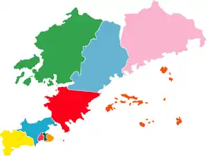
| Dalian district map |
| |||||||||||||||||||||||||||||||||
| Division code | 210224 | |||||||||||||||||||||||||||||||||
| Website | www | |||||||||||||||||||||||||||||||||
Administrative divisions
There are 5 towns in the county.[4]
Towns:
- Dachangshandao (大长山岛镇)
- Zhangzidao (獐子岛镇)
- Guangludao (广鹿岛镇)
- Xiaochangshandao (小长山岛镇)
- Haiyangdao (海洋岛镇)
Transport
References
- Google (2014-07-02). "Changhai" (Map). Google Maps. Google. Retrieved 2014-07-02.
- Dalian Statistical Yearbook 2012 (《大连统计年鉴2012》). Accessed 8 July 2014.
- 2010 Census county-by-county statistics (《中国2010年人口普查分县资料》). Accessed 8 July 2014.
- 大连市-行政区划网. XZQH.
External links
Sub-provincial City of Dalian | ||
|---|---|---|
| Districts |  | |
| County-level cities | ||
| Counties | ||
| Landmarks | ||
| Culture & demographics | ||
| Education | ||
| Transport | ||
^* Not a formal subdivision | ||
| Authority control |
|---|