Changtu County
Changtu County (simplified Chinese: 昌图县; traditional Chinese: 昌圖縣; pinyin: Chāngtú Xiàn) is a county in the northeast of Liaoning province, China, bordering Jilin to the northeast and Inner Mongolia in the northwest. It is under the administration of Tieling City, the downtown of which lies 60 kilometres (37 mi) to the south-southwest, and is 47 kilometres (29 mi) southwest of Siping, Jilin. It is served by both China National Highway 102 and G1 Beijing–Harbin Expressway.
Changtu
昌图县 | |
|---|---|
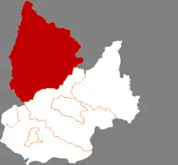 Location in Tieling | |
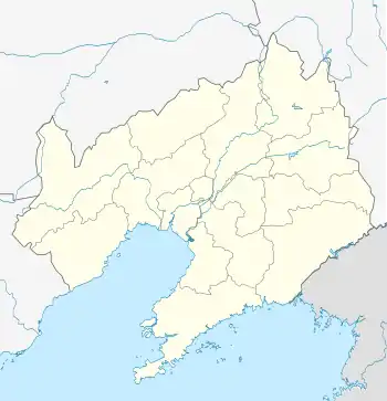 Changtu Location of the seat in Liaoning | |
| Coordinates (Changtu County government): 42°47′09″N 124°06′40″E | |
| Country | People's Republic of China |
| Province | Liaoning |
| Prefecture-level city | Tieling |
| County seat | Changtu Town (昌图镇) |
| Area | |
| • Total | 4,321.7 km2 (1,668.6 sq mi) |
| Elevation | 152 m (499 ft) |
| Population (2016)[1] | |
| • Total | 1,020,819 |
| • Density | 240/km2 (610/sq mi) |
| Time zone | UTC+8 (China Standard) |
| Postal code | 112500 |
| Website | http://www.changtu.gov.cn/ |
Administrative divisions
There are 23 towns and 10 townships under the county's administration.[2]
Towns:
- Changtu (昌图镇)
- Laocheng (老城镇)
- Bamiancheng (八面城镇)
- Sanjiangkou (三江口镇)
- Jinjia (金家镇)
- Baoli (宝力镇)
- Quantou (泉头镇)
- Shuangmiaozi (双庙子镇)
- Liangzhongqiao (亮中桥镇)
- Mazhonghe (马仲河镇)
- Maojiadian (毛家店镇)
- Laosiping (老四平镇)
- Dawa (大洼镇)
- Toudao (头道镇)
- Cilushu (𪉈鹭树镇)
- Fujia (傅家镇)
- Sihe (四合镇)
- Chaoyang (朝阳镇)
- Guyushu (古榆树镇)
- Qijiazi (七家子镇)
- Dongga (东嘎镇)
- Simiancheng (四面城镇)
- Qianshuangjing (前双井镇)
Townships:
- Daxing Township (大兴乡)
- Shibajiazi Township (十八家子乡)
- Tongjiangkou Township (通江口乡)
- Dasijiazi Township (大四家子乡)
- Houyao Township (后窑乡)
- Changfa Township (长发乡)
- Taiping Township (太平乡)
- Xia'ertai Township (下二台乡)
- Ping'anbao Township (平安堡乡)
- Qujiadian Township (曲家店乡)
Demographics
Changtu County has a population of 1,020,819 people as of 2016, of which 31.1% lived in urban settlements, and the remaining 68.9% lived in rural ones.[3] Of this population, 50.6% was male, 49.4% was female, 14.0% were aged 17 and under, 20.9% were between 18 and 34 years old, 43.8% were between 35 and 59, and the remaining 21.3% were aged 60 and older.[3]
Economy
The county's economy is largely dependent on the primary sector, with agriculture, forestry, animal husbandry, and fishery accounting for nearly 85% of the county's GDP.[3] Agriculture in the county consists primarily of grain crops, seed oil, vegetables, and meat production.[3]
Education
As of 2016, the county reported having 93 different schools, serving 80,594 students.[3] There are 44 primary schools, 36 junior high schools, 5 nine-year schools, 3 high schools, and a number of various specialized schools.[3]
High schools
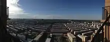
 No.1 Senior High School, Changtu
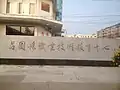 Changtu Vocational Education Center
One of the three high schools serving the county is Changtu No.1 Senior High, which has over 2,500 students.[4] The school's campus covers an area of 90,600 square metres.[4]
Middle schools
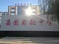 Shiyan Junior High School, Changtu
A school that is close to one-third the size of No.1 Senior High is Shiyan Junior High. This school covers about 28 kilometers squared.
References
- 2016年昌图县国民经济和社会发展统计公报 (in Chinese).
- 2011年统计用区划代码和城乡划分代码:昌图县 (in Chinese). National Bureau of Statistics of the People's Republic of China. Archived from the original on 19 July 2013. Retrieved 17 July 2012.
- 2016年昌图县国民经济和社会发展统计公报 (in Chinese). Changtu County People's Government.
- 学校简介 (in Chinese). Changtu County People's Government.
