Kuandian Manchu Autonomous County
Kuandian Manchu Autonomous County (simplified Chinese: 宽甸满族自治县; traditional Chinese: 寬甸滿族自治縣; pinyin: Kuāndiàn Mǎnzú Zìzhìxiàn; Manchu: ᡴᡠᠸᠠᠨᡩᡳᠶᠠᠨ
ᠮᠠᠨᠵᡠ
ᠪᡝᠶᡝ
ᡩᠠᠰᠠᠩᡤᠠ
ᠰᡳᠶᠠᠨ; Mölendroff: kuwandiyan manju beye dasangga siyan), is a county of eastern Liaoning province, China, bordering North Korea to the southeast and Jilin in the northeast. It is under the administration of Dandong City, the centre of which lies 75 kilometres (47 mi) to the southwest, and is served by China National Highway 201. In Kuandian is the Hushan Great Wall, the most easterly section of the Great Wall of China. A short reconstruction of the wall is open to tourists. The area has an abandoned airstrip that was used by the Chinese airforce during the Korean War.
Kuandian
宽甸县 ᡴᡠᠸᠠᠨᡩᡳᠶᠠᠨ ᠰᡳᠶᠠᠨ | |
|---|---|
宽甸满族自治县 Kuandian Manchu Autonomous County | |
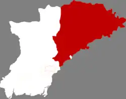 Location in Dandong City | |
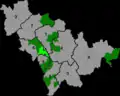
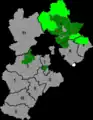
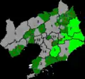
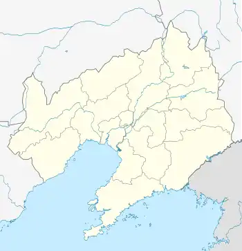 Kuandian Location of the county seat in Liaoning | |
| Coordinates: 40°44′N 124°47′E | |
| Country | People's Republic of China |
| Province | Liaoning |
| Prefecture-level city | Dandong |
| County seat | Kuandian Town (宽甸镇) |
| Area | |
| • Total | 6,193.7 km2 (2,391.4 sq mi) |
| Elevation | 284 m (932 ft) |
| Population (2009) | |
| • Total | 434,900 |
| • Density | 70/km2 (180/sq mi) |
| Time zone | UTC+8 (China Standard) |
| Postal code | 118200 |
As of 2009, the county's population was 434,900 people.[1]
History
The area of present-day Kuandian belonged to the Yan state during the Warring States period, and was then brought under the Liaodong Commandery in the Qin Dynasty.[2]
From the Eastern Han Dynasty until 408 CE, the southern part of the county was incorporated under the rule of various Chinese dynasties.[2] The area became part of Goguryeo in 408 CE, and afterwards became part of the Tang Dynasty's Protectorate General to Pacify the East.[2]
The county's name originates from the Kingdom of Balhae, when the area was known as Kuandianzi (Chinese: 宽甸子).[2]
The area would come under the reign of the Liao dynasty, then the Jin dynasty, and then the Yuan dynasty.[2]
In 1467, the Ming Dynasty built a defensive wall in the eastern part of the region that terminated at the Yalu River.[2] Various forts were added in 1546 and 1573.[2]
Kuandian County was established in 1876 under Fenghuang Ting (Chinese: 凤凰厅).[2] The area belonged to Fengtian Province during the early days of the Republic of China.[2]
The county was put under the jurisdiction of the prefecture-level city of Dandong in 1965.[2] Kuandian County was approved as an autonomous county in September 1989, becoming the Kuandian Manchu Autonomous County.[2]
Administrative divisions
There are 19 towns, 2 townships and 1 ethnic township in the county.[3] The county's seat of government is located in the town of Kuandian.[1]
Towns
The county's 19 towns are Kuandian, Guanshui, Penghai, Hongshi, Maodianzi, Changdian, Yongdian, Taipingshao, Qingshangou, Niumaowu, Dachuantou, Qingyishan, Yangmuchuan, Hushan, Zhenjiang, Budayuan, Daxicha, Bahechuan, and Shuangshanzi.[3]
Townships
The county's 2 townships are Shihugou Township and Gulouzi Township.[3]
Xialuhe Korean Ethnic Township
Xialuhe Korean Ethnic Township is the county's sole ethnic township.[3]
Geography
Kuandian occupies the eastern half of Dandong City and is situated among the Changbai Mountains, on the northwest (right) bank of middle-lower reaches of the Yalu River, across which it borders the North Korean provinces of North Pyongan and Chagang. Domestically, it borders Ji'an (Jilin) to the northeast, Fengcheng to the west, Benxi to the northwest, and Huanren County to the north. It has a total area of 6,193.7 km2 (2,391.4 sq mi) and 216.5 km (134.5 mi) of the Sino-Korean border.[4]
Climate
Kuandian has a monsoon-influenced humid continental climate (Köppen Dwa) characterised by very warm, humid summers, due to the monsoon, and long, cold, and very dry winters, due to the Siberian anticyclone. The four seasons here are distinctive. A majority of the annual rainfall occurs in July and August. The monthly 24-hour average temperatures ranges from −11.5 °C (11.3 °F) in January to 22.5 °C (72.5 °F) in July, while the annual mean is 7.13 °C (44.8 °F). Due to the mountainous location, temperatures tend to be cooler, and summer rainfall is heavier. The average relative humidity is 70%, and the frost-free period is 140 days.[4]
| Climate data for Kuandian (1971−2000) | |||||||||||||
|---|---|---|---|---|---|---|---|---|---|---|---|---|---|
| Month | Jan | Feb | Mar | Apr | May | Jun | Jul | Aug | Sep | Oct | Nov | Dec | Year |
| Record high °C (°F) | 6.4 (43.5) |
14.5 (58.1) |
18.3 (64.9) |
28.3 (82.9) |
33.3 (91.9) |
35.7 (96.3) |
36.5 (97.7) |
35.0 (95.0) |
30.4 (86.7) |
27.0 (80.6) |
18.7 (65.7) |
9.1 (48.4) |
36.5 (97.7) |
| Average high °C (°F) | −4.2 (24.4) |
−0.5 (31.1) |
6.0 (42.8) |
14.9 (58.8) |
21.0 (69.8) |
24.7 (76.5) |
26.8 (80.2) |
27.2 (81.0) |
22.6 (72.7) |
15.6 (60.1) |
5.9 (42.6) |
−1.6 (29.1) |
13.2 (55.8) |
| Daily mean °C (°F) | −11.5 (11.3) |
−7.4 (18.7) |
0.2 (32.4) |
8.3 (46.9) |
14.6 (58.3) |
19.4 (66.9) |
22.5 (72.5) |
22.2 (72.0) |
16.1 (61.0) |
8.8 (47.8) |
0.2 (32.4) |
−7.8 (18.0) |
7.1 (44.8) |
| Average low °C (°F) | −17.7 (0.1) |
−13.6 (7.5) |
−5.4 (22.3) |
1.8 (35.2) |
8.3 (46.9) |
14.3 (57.7) |
18.9 (66.0) |
18.0 (64.4) |
10.4 (50.7) |
3.0 (37.4) |
−4.6 (23.7) |
−13.2 (8.2) |
1.7 (35.0) |
| Record low °C (°F) | −34 (−29) |
−31.5 (−24.7) |
−28.2 (−18.8) |
−9.9 (14.2) |
−1.8 (28.8) |
5.2 (41.4) |
10.4 (50.7) |
5.2 (41.4) |
−1.2 (29.8) |
−8.4 (16.9) |
−22.3 (−8.1) |
−33.1 (−27.6) |
−34 (−29) |
| Average precipitation mm (inches) | 10.4 (0.41) |
12.5 (0.49) |
19.0 (0.75) |
50.7 (2.00) |
74.6 (2.94) |
129.7 (5.11) |
284.7 (11.21) |
274.8 (10.82) |
92.6 (3.65) |
52.2 (2.06) |
34.4 (1.35) |
15.5 (0.61) |
1,051.1 (41.4) |
| Average precipitation days (≥ 0.1 mm) | 5.2 | 4.7 | 5.8 | 8.9 | 10.7 | 13.0 | 16.8 | 13.4 | 9.0 | 7.7 | 7.3 | 5.5 | 108.0 |
| Source: Weather China[4] | |||||||||||||
Demographics
Ethnic groups
The county is majority Manchu as of 2002.[5]
| Ethnic Group | Population | Percentage |
|---|---|---|
| Manchu | 232,248 | 53.42% |
| Han | 195,346 | 44.93% |
| Korean | 4,925 | 1.13% |
| Mongols | 1,562 | 0.35% |
| Hui | 398 | 0.09% |
| Other | 203 | 0.05% |
Historic population
| Year | Pop. | ±% |
|---|---|---|
| 1907 | 176,018 | — |
| 1915 | 197,039 | +11.9% |
| 1932 | 324,680 | +64.8% |
| 1940 | 236,748 | −27.1% |
| 1949 | 302,714 | +27.9% |
| 1953 | 294,594 | −2.7% |
| 1964 | 348,814 | +18.4% |
| 1982 | 431,096 | +23.6% |
| 1985 | 436,001 | +1.1% |
| 1991 | 444,609 | +2.0% |
| 2005 | 437,651 | −1.6% |
Population censuses in the county have been undertaken since 1907.[5] The county's population has declined since its peak of 444,609 people in 1991.[1][5]
Urbanization
During the People's Republic of China, the county's urban population, and proportion of people living in urban environments has grown significantly. In 1949, the year the People's Republic of China was proclaimed, 1.8% of the county's population lived in urban areas.[5] By 1953, this rose to 4.0%.[5] In 1982, 9.2% of the county's population lived in urban areas, which rose to 15.3% by 1985, 23.8% by 1991, and 25.5% by 1995.[5] At 2005, 23.7% of the county's population lived in rural areas.[5]
Economy
Kuandian's mineral deposits include boron, iron, lead, zinc, coal, copper, magnesite, and talc.[1] The county's boron output accounts for about 50% of China's total, and the area is sometimes called "boron sea" (Chinese: 硼海; pinyin: péng hǎi).[1]
Transport
National Highway 201 passes through the county.[1]
The county is served by two railroads: the Tie-Chang railway (Chinese: 铁长铁路), and the Feng-Shang railway.[1]
References
- 宽甸县概况 [Kuandian County Overview]. xzqh.org (in Chinese). 2010-08-05. Archived from the original on 2020-08-18. Retrieved 2020-08-18.
- 宽甸县沿革 [Kuandian County History]. xzqh.org (in Chinese). 2010-08-05. Archived from the original on 2020-08-18. Retrieved 2020-08-18.
- 2019年统计用区划代码 (in Chinese). National Bureau of Statistics of China. 2019. Archived from the original on 2020-08-18. Retrieved 2020-08-18.
- 宽甸 - 气象数据 -中国天气网 (in Chinese). Weather China. Retrieved 2012-07-17.
- 中国宽甸 (in Chinese). Kuandian Manchu Autonomous County People's Government. Archived from the original on 2020-08-18. Retrieved 2020-08-18.