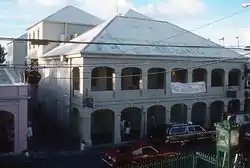
Christiansted Historic District
The Christiansted Historic District is a 135.9 acres (0.550 km2) historic district in Christiansted, Saint Croix, Virgin Islands, which was listed on the National Register of Historic Places in 1976. It included 253 contributing buildings and two contributing sites.[1]
Christiansted Historic District | |
 | |
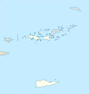 | |
| Location | Roughly bounded by Christiansted Harbor, New, Peter's Farm Hospital, and West Sts., Christiansted, Virgin Islands |
|---|---|
| Coordinates | 17.746111°N 64.704444°W |
| Area | 135.9 acres (55.0 ha) |
| Architectural style | Renaissance Revival, Danish W. Indian vernacular |
| NRHP reference No. | 76002266[1] |
| Added to NRHP | July 30, 1976 |
It includes the Christiansted National Historic Site, also listed on the National Register. It includes Renaissance Revival and Danish West Indian vernacular architecture.
The town of Christiansted was platted in a grid pattern in 1734 by Frederik Moth, who later was the first Danish governor of St. Croix.[2]
References
- "National Register Information System". National Register of Historic Places. National Park Service. July 9, 2010.
- Russell Wright (May 22, 1976). "National Register of Historic Places Inventory/Nomination: Christiansted Historic District". National Park Service. Retrieved May 25, 2017. With 14 photos from 1976.
| Topics | |
|---|---|
| Lists by state |
|
| Lists by insular areas | |
| Lists by associated state | |
| Other areas | |
| Related | |
| |
This article is issued from Wikipedia. The text is licensed under Creative Commons - Attribution - Sharealike. Additional terms may apply for the media files.