National Register of Historic Places listings in Mississippi
This is a list of properties and districts in Mississippi that are listed on the National Register of Historic Places. There are more than 1,400 sites distributed among all of Mississippi's 82 counties.
The locations of National Register properties and districts (at least for all showing latitude and longitude coordinates below), may be seen in an online map by clicking on "Map of all coordinates".[1]
- This National Park Service list is complete through NPS recent listings posted January 29, 2021.[2]
Current listings by county
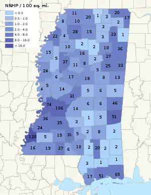
The following are approximate tallies of current listings by county. These counts are based on entries in the National Register Information Database as of March 13, 2009[3] and new weekly listings posted since then on the National Register of Historic Places web site.[4] There are frequent additions to the listings and occasional delistings and the counts here are approximate and not official. New entries are added to the official Register on a weekly basis.[5] Also, the counts in this table exclude boundary increase and decrease listings which modify the area covered by an existing property or district and which carry a separate National Register reference number.
Benton County
| [7] | Name on the Register | Image | Date listed[8] | Location | City or town | Description |
|---|---|---|---|---|---|---|
| 1 | Davis' Mills Battle Site |  Davis' Mills Battle Site |
October 2, 1973 (#73001002) |
Off Mississippi Hwy 7 34°58′43″N 89°15′07″W |
Michigan City | American Civil War battle site, fought December 21, 1862 |
Calhoun County
| [7] | Name on the Register | Image | Date listed[8] | Location | City or town | Description |
|---|---|---|---|---|---|---|
| 1 | New Liberty School |  New Liberty School |
August 15, 1997 (#97000895) |
Junction of County Roads 427 and 428 33°53′08″N 89°13′30″W |
Vardaman | Constructed 1908, used as school until 1952, converted to Community center |
| 2 | West Mound |  West Mound |
December 2, 1992 (#92001626) |
Address Restricted |
Slate Springs | Prehistoric ceremonial site, 1499-500 AD[9] |
Chickasaw County
| [7] | Name on the Register | Image | Date listed[8] | Location | City or town | Description |
|---|---|---|---|---|---|---|
| 1 | Bynum Mound and Village Site (22CS501) | Bynum Mound and Village Site (22CS501) |
July 16, 1989 (#89000783) |
Mile 232.4 on the Natchez Trace Parkway[10] 33°53′53″N 88°56′53″W |
Houston | |
| 2 | Elliott-Donaldson House | September 15, 1980 (#80002203) |
109 Church Street 34°00′24″N 88°45′24″W |
Okolona | Constructed c. 1850 | |
| 3 | Houston Carnegie Library | 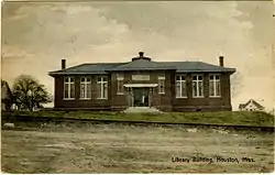 Houston Carnegie Library |
December 22, 1978 (#78001593) |
Madison and Huddleston Streets 33°53′47″N 89°00′03″W |
Houston | Constructed in 1909 |
| 4 | Houston Historic District |  Houston Historic District |
May 14, 2013 (#13000300) |
Depot, Monroe, Madison & Pontotoc Sts. 33°53′49″N 89°00′00″W |
Houston | |
| 5 | Judge Bates House | 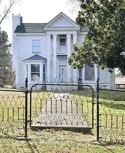 Judge Bates House |
May 6, 1982 (#82003097) |
330 South Monroe Street 33°53′46″N 89°00′01″W |
Houston | Constructed c. 1845 |
| 6 | Merchants and Farmers Bank Building | May 14, 1987 (#87000733) |
423 Main Street 34°00′15″N 88°44′56″W |
Okolona | Constructed in 1903 | |
| 7 | Okolona College | 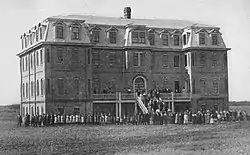 Okolona College |
August 9, 2002 (#02000853) |
Mississippi Highway 245, N., 1.1 miles north of its junction with Mississippi Highways 32 and 41 34°01′04″N 88°45′27″W |
Okolona | A former college for African-Americans |
| 8 | Okolona Historic District | February 5, 2002 (#01001561) |
Roughly bounded by Fleming, Monroe, Buchanan, and Washington Sts. 34°00′18″N 88°45′03″W |
Okolona | ||
| 9 | Owl Creek Site | August 1, 1975 (#75001042) |
Along Davis Lake Rd., off the Natchez Trace Parkway and southwest of Tupelo[11] 34°03′23″N 88°55′28″W |
Old Houlka | ||
| 10 | Thelma Mound Archaeological Site | November 3, 1994 (#94001222) |
Address Restricted |
Houston |
Choctaw County
| [7] | Name on the Register | Image | Date listed[8] | Location | City or town | Description |
|---|---|---|---|---|---|---|
| 1 | Choctaw Lake Ranger House | July 25, 2001 (#01000753) |
Address Restricted |
Ackerman | Constructed c. 1936 | |
| 2 | Colonel James Drane House | July 21, 1983 (#83000950) |
Natchez Trace Parkway 33°17′43″N 89°24′02″W |
French Camp | Constructed c. 1847 | |
| 3 | Janet's Mound | January 11, 1991 (#90002125) |
Address Restricted |
French Camp | ||
| 4 | Old Natchez Trace (230-3H) | November 7, 1976 (#76000159) |
South of Mathiston at Natchez Trace Parkway milepost 198 33°28′32″N 89°12′04″W |
Mathiston | Segment of the Natchez Trace located at a Natchez Trace Parkway interpretive stop.[12] | |
| 5 | Col. John Weir House | November 7, 1997 (#97001378) |
102 Ann Street 33°15′28″N 89°17′19″W |
Weir | Constructed in 1878 |
Covington County
| [7] | Name on the Register | Image | Date listed[8] | Location | City or town | Description |
|---|---|---|---|---|---|---|
| 1 | Carver Central High School | January 24, 2019 (#100003344) |
104 Carver Dr. 31°38′48″N 89°33′54″W |
Collins | ||
| 2 | Covington County Courthouse | 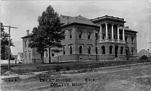 Covington County Courthouse |
December 31, 1991 (#91001894) |
Dogwood Avenue 31°38′37″N 89°33′24″W |
Collins | Constructed in 1907 |
| 3 | Mount Olive Historic District | October 8, 2019 (#100004507) |
Roughly bounded by the N. & S. sides of Main St., extending from the jct. of Jaynesville Rd. to Old Hwy 49 31°45′49″N 89°39′48″W |
Mount Olive |
Franklin County
| [7] | Name on the Register | Image | Date listed[8] | Location | City or town | Description |
|---|---|---|---|---|---|---|
| 1 | Charles Walton Beam House | March 21, 1990 (#90000437) |
Junction of Bogue Chitto-Meadville Road and Upper Meadville-Summit Road, 7 miles (11 kilometers) south of McCall Creek 31°25′10″N 90°40′54″W |
McCall Creek | Constructed c. 1857 | |
| 2 | Clear Springs Recreation Area | October 28, 1999 (#99001282) |
Area of Clear Springs Lake 31°25′27″N 90°59′12″W |
Roxie | Constructed c. 1937 | |
| 3 | Eddiceton Bridge | November 16, 1988 (#88002404) |
Spans the Homochitto River on a county road 31°29′35″N 90°47′22″W |
Eddiceton | Constructed in 1909, brings Burris Road across Homochitto River in two spans: a 151-foot (46 m) Pratt through truss and a 186-foot (57 m) Camelback through truss.[13] | |
| 4 | Franklin County Courthouse |  Franklin County Courthouse |
December 17, 1981 (#81000327) |
Courthouse Square 31°28′20″N 90°53′35″W |
Meadville | Constructed from 1913 to 1914 |
| 5 | Lucien Bridge | June 16, 2005 (#05000611) |
Over McCall Creek, on Stewart Road, at Lucien 31°30′40″N 90°39′59″W |
Lucien | Constructed in 1938 |
George County
| [7] | Name on the Register | Image | Date listed[8] | Location | City or town | Description |
|---|---|---|---|---|---|---|
| 1 | Bilbo Basin Shell Deposit Site | February 25, 1992 (#92000039) |
Eastern side of the Pascagoula River, southwest of Lucedale[14] 30°49′21″N 88°44′34″W |
Lucedale |
Greene County
| [7] | Name on the Register | Image | Date listed[8] | Location | City or town | Description |
|---|---|---|---|---|---|---|
| 1 | Leaf River Bridge |  Leaf River Bridge |
November 16, 1988 (#88002478) |
Spans the Leaf River north of McClain on a county road 31°07′39″N 88°49′01″W |
McLain | Constructed in 1907 |
| 2 | Vernal Presbyterian Church | 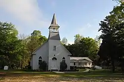 Vernal Presbyterian Church |
November 18, 2002 (#02001389) |
455 McInnis-Vernal Road 31°02′04″N 88°36′42″W |
Lucedale | Constructed 1906 to 1908 |
Humphreys County
| [7] | Name on the Register | Image | Date listed[8] | Location | City or town | Description |
|---|---|---|---|---|---|---|
| 1 | Belzoni Mound (22HU500) | April 13, 1988 (#88000305) |
Southeastern quarter of the northwestern quarter of Section 2, Township 15 North, Range 3 West[15]:58 33°10′39″N 90°28′50″W |
Belzoni | ||
| 2 | Humphreys County Courthouse | 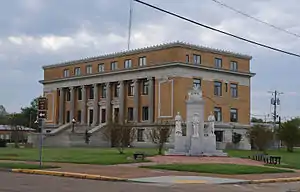 Humphreys County Courthouse |
January 15, 2014 (#13001082) |
102 Castleman St. 33°10′32″N 90°29′17″W |
Belzoni | |
| 3 | Jaketown Site | 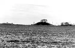 Jaketown Site |
June 19, 1973 (#73001017) |
Western side of Mississippi Highway 7, approximately 4 miles north of Belzoni[16] 33°14′12″N 90°29′13″W |
Belzoni | |
| 4 | Midnight Mound Site (22HU509) | April 25, 1986 (#86000870) |
Northwestern quarter of the southeastern quarter of Section 14, Township 14 North, Range 4 West[15]:58 33°03′20″N 90°34′42″W |
Midnight | ||
| 5 | Parker-Summerfield Mound Archeological Site | March 21, 1997 (#97000251) |
Northeastern quarter of the southeastern quarter of Section 18, Township 14 North, Range 4 West[15]:58 33°03′27″N 90°38′38″W |
Midnight | ||
| 6 | Slate Archeological Site | July 8, 1982 (#82003102) |
Address Restricted |
Lake City |
Issaquena County
| [7] | Name on the Register | Image | Date listed[8] | Location | City or town | Description |
|---|---|---|---|---|---|---|
| 1 | Aden Site (22Is509;22M3) | December 14, 1988 (#88002698) |
Address Restricted |
Valley Park | ||
| 2 | Grace Archeological Site | March 21, 2002 (#02000206) |
Address Restricted |
Grace | ||
| 3 | Mayersville Archeological Site | April 29, 1980 (#80002250) |
Address Restricted |
Mayersville | ||
| 4 | Railroad Section Foreman's House | December 30, 1999 (#99001615) |
No. 3 Railroad Road 32°38′10″N 90°51′54″W |
Valley Park | Constructed c. 1882 |
Itawamba County
| [7] | Name on the Register | Image | Date listed[8] | Location | City or town | Description |
|---|---|---|---|---|---|---|
| 1 | Pharr Mounds | 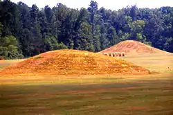 Pharr Mounds |
February 23, 1978 (#78000346) |
Mile 286.7 on the Natchez Trace Parkway[17] 34°27′58″N 88°24′58″W |
Kirkville | Extends into Prentiss County |
Jasper County
| [7] | Name on the Register | Image | Date listed[8] | Location | City or town | Description |
|---|---|---|---|---|---|---|
| 1 | Archeological Site No. 22-Js-572 | November 10, 1993 (#93001150) |
Address Restricted |
Bay Springs | ||
| 2 | Archeological Site No. 22JS587 | March 17, 1994 (#94000175) |
Address Restricted |
Bay Springs | ||
| 3 | Graham House | April 10, 2008 (#08000265) |
36 County Road 1824 32°07′43″N 88°59′28″W |
Rose Hill | Constructed c. 1860 Destroyed by tornado 2011 | |
| 4 | Old Jasper County Jail | March 7, 1994 (#94000147) |
Mississippi Highway 503 32°01′48″N 89°02′11″W |
Paulding | Constructed c. 1895 | |
| 5 | Montrose Presbyterian Church | 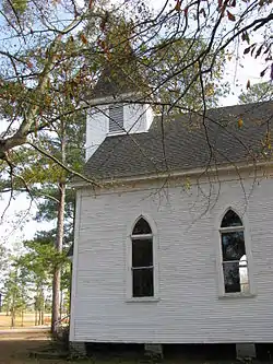 Montrose Presbyterian Church |
May 9, 2003 (#03000388) |
County Road 20 32°07′24″N 89°14′12″W |
Montrose | Constructed c. 1910 |
Jefferson Davis County
| [7] | Name on the Register | Image | Date listed[8] | Location | City or town | Description |
|---|---|---|---|---|---|---|
| 1 | 1907 House | February 14, 1979 (#79001321) |
East of Prentiss on Fort Stephens Road 31°35′34″N 89°51′32″W |
Prentiss | Constructed c. 1820, modified 1907 | |
| 2 | John Fielding Holloway House | October 28, 1994 (#94001252) |
U.S. Route 84, about 450 feet east of its junction with Mississippi Highway 541, in Mount Carmel community 31°38′42″N 89°47′17″W |
Mount Carmel | Constructed c. 1873 | |
| 3 | Jefferson Davis County Courthouse | 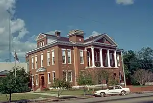 Jefferson Davis County Courthouse |
November 10, 1994 (#94001308) |
Junction of North Columbia Avenue and 3rd Street 31°36′02″N 89°51′55″W |
Prentiss | Constructed in 1907 |
| 4 | Prentiss Normal and Industrial Institute Historic District | May 16, 2016 (#16000282) |
292 J.E. Johnson Rd. 31°35′04″N 89°51′24″W |
Prentiss | ||
| 5 | Stephen H. Wilkes House | December 20, 2006 (#06001176) |
1522 South Williamsburg Road 31°26′06″N 89°44′57″W |
Bassfield | Constructed c. 1825 |
Jones County
| [7] | Name on the Register | Image | Date listed[8] | Location | City or town | Description |
|---|---|---|---|---|---|---|
| 1 | Amos Deason House | 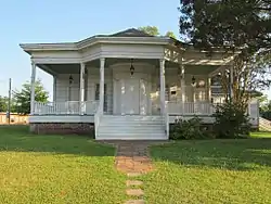 Amos Deason House |
July 5, 1984 (#84002229) |
410 North Deason Street 31°36′33″N 89°11′49″W |
Ellisville | Constructed c. 1855 |
| 2 | Fishtrap Bluff Fishweir | August 15, 1997 (#97000896) |
Address Restricted |
Ellisville | ||
| 3 | G.W.O. Site | November 23, 1999 (#99001361) |
Address Restricted |
Lanham | ||
| 4 | Jones County Courthouse and Confederate Monument at Ellisville | 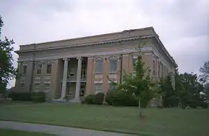 Jones County Courthouse and Confederate Monument at Ellisville |
November 10, 1994 (#94001307) |
Bounded by Court, Holly, Calhoun and Ivy Streets 31°36′14″N 89°11′42″W |
Ellisville | Constructed 1907-08 |
| 5 | Laurel Central Historic District | 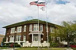 Laurel Central Historic District |
September 4, 1987 (#86001908) |
Roughly bounded by 10th and 13th Sts., 1st Ave., 7th and 5th Sts., and 8th Ave. 31°41′52″N 89°07′54″W |
Laurel | |
| 6 | New Orleans and Northeastern Railroad Depot | 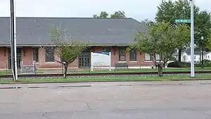 New Orleans and Northeastern Railroad Depot |
October 31, 1995 (#95001192) |
Maple Street 31°41′32″N 89°07′39″W |
Laurel | Constructed c. 1913 |
| 7 | William H. and Marian D. Mason House | September 28, 2017 (#100001680) |
1050 N. 6th Ave. 31°42′07″N 89°08′00″W |
Laurel | ||
| 8 | Oak Park School Complex | March 4, 2020 (#100005034) |
1205 Queensburg Ave. 31°40′23″N 89°08′25″W |
Laurel | ||
| 9 | Newell Rogers House | 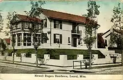 Newell Rogers House |
April 20, 1987 (#87000604) |
706 North 6th Avenue 31°41′49″N 89°08′01″W |
Laurel | Constructed 1909 |
| 10 | Southside Neighborhood Historic District | September 8, 2020 (#100005573) |
Roughly bounded by North Pine and East 5th Sts., North and South Walters, South 4th and South 9th Aves., East Jackson, Limbert, Johnson, and North and South Maple Sts. 31°40′55″N 89°08′00″W |
Laurel |
Former listing
| [7] | Name on the Register | Image | Date listed | Date removed | Location | City or town | Summary |
|---|---|---|---|---|---|---|---|
| 1 | Pinehurst Hotel | March 1, 1984 (#84002234) | October 1, 1987 | 318 5th Ave. |
Laurel | Mostly demolished in 1987. Remaining portion is a contributing property to the Laurel Central Historic District[18] |
Kemper County
| [7] | Name on the Register | Image | Date listed[8] | Location | City or town | Description |
|---|---|---|---|---|---|---|
| 1 | Oliver House | October 31, 1985 (#85003439) |
1 mile (1.6 kilometers) southwest of Moscow off Mississippi Highway 493 32°42′06″N 88°48′54″W |
Moscow | Constructed c. 1885 | |
| 2 | Perkins House | June 24, 1994 (#94000643) |
2709 Townsend Rd. 32°46′51″N 88°34′46″W |
DeKalb | Constructed c. 1870. Originally located on Murphy Hardy Rd., northwest of its junction with Mississippi Highway 493 (32°42′39″N 88°49′27″W); moved to current location in 2012. After the move, the property was relisted on the Register on May 17, 2016. | |
| 3 | Porterville General Store |  Porterville General Store |
March 17, 2006 (#06000195) |
Old U.S. Highway 45 32°41′17″N 88°28′18″W |
Porterville | |
| 4 | Sucarnoochee River Fishweir | March 10, 2010 (#10000065) |
Address Restricted |
Porterville | ||
| 5 | Zion Baptist Church | December 12, 2002 (#02001497) |
Little Zion Church Road West, 2 miles (3.2 kilometers) north of the Lauderdale/Kemper county line 32°36′32″N 88°52′53″W |
Collinsville | Constructed 1910 |
Lamar County
| [7] | Name on the Register | Image | Date listed[8] | Location | City or town | Description |
|---|---|---|---|---|---|---|
| 1 | Old Municipal Courtroom and Jail | April 14, 2000 (#00000379) |
405 Pine Street at Railroad Avenue 31°24′56″N 89°32′40″W |
Sumrall | Constructed in 1907 | |
| 2 | U.S. Post Office |  U.S. Post Office |
April 7, 1981 (#81000328) |
104 Heber Ladner Drive 31°00′01″N 89°27′11″W |
Lumberton | Constructed 1931-32 |
Leake County
| [7] | Name on the Register | Image | Date listed[8] | Location | City or town | Description |
|---|---|---|---|---|---|---|
| 1 | Carthage Historic District | July 25, 2012 (#12000432) |
Roughly bounded by E. & W. Water, Mill, N. & S. Jordan, N. Pearl, & N. & S. White Sts. 32°44′12″N 89°32′00″W |
Carthage | ||
| 2 | Jordan House | November 30, 1982 (#82000576) |
E. Franklin St. 32°44′16″N 89°31′50″W |
Carthage | ||
| 3 | Robinson Road (190-191-3M) | November 7, 1976 (#76000158) |
Southwest of Kosciusko 32°42′37″N 89°42′31″W |
Kosciusko | ||
| 4 | Steep Mound Site (22LK26) | January 14, 1987 (#86003634) |
Address Restricted |
Carthage | ||
| 5 | U.S. Post Office | .jpg.webp) U.S. Post Office |
April 21, 1983 (#83000956) |
201 N. Pearl St. 32°44′15″N 89°32′04″W |
Carthage |
Marion County
| [7] | Name on the Register | Image | Date listed[8] | Location | City or town | Description |
|---|---|---|---|---|---|---|
| 1 | Broad Street-Church Street Historic District |  Broad Street-Church Street Historic District |
July 8, 2008 (#08000672) |
Roughly bounded by High School St. on the west and Pine Ave. on the east along Sumrall Rd. and Broad St. 31°15′16″N 89°49′23″W |
Columbia | |
| 2 | Columbia Country Club | January 14, 2015 (#14001156) |
28 Golf Course Rd. 31°15′57″N 89°49′52″W |
Columbia | ||
| 3 | Columbia North Historic District |  Columbia North Historic District |
August 20, 2009 (#09000625) |
Roughly bounded by High School and N. Main Sts. on the west and Park and Branton Aves. on the east 31°15′15″N 89°49′46″W |
Columbia | |
| 4 | Downtown Columbia Historic District | June 27, 1997 (#97000633) |
Roughly bounded by Broad and Church Sts. and Meak, Honey, and Beef Alleys; also 704 and 706 Honey Alley 31°15′07″N 89°50′06″W |
Columbia | 704/706 Honey Alley represents a boundary increase of September 9, 1998 | |
| 5 | Ford House | 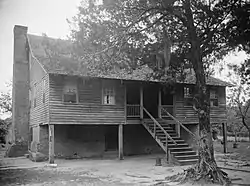 Ford House |
June 21, 1971 (#71000457) |
South of Sandy Hook on Old Columbia-Covington Rd. 31°00′44″N 89°47′11″W |
Sandy Hook | |
| 6 | Keys Hill Historic District | 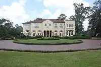 Keys Hill Historic District |
June 14, 1982 (#82004836) |
Broad St. 31°15′06″N 89°48′55″W |
Columbia | |
| 7 | Lampton-Thompson-Bourne House | 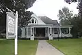 Lampton-Thompson-Bourne House |
November 5, 1998 (#98001335) |
423 Church St. 31°15′13″N 89°49′51″W |
Columbia | |
| 8 | Marion County Courthouse and Jail |  Marion County Courthouse and Jail |
March 3, 1995 (#95000178) |
Courthouse Square 31°15′02″N 89°50′06″W |
Columbia | |
| 9 | Superintendent's Home at Columbia Training School | 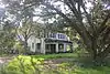 Superintendent's Home at Columbia Training School |
July 14, 1995 (#95000787) |
1730 Mississippi Highway 44 31°15′56″N 89°48′02″W |
Columbia | |
| 10 | U.S. Post Office |  U.S. Post Office |
April 7, 1981 (#81000329) |
815 Main St. 31°15′15″N 89°50′08″W |
Columbia |
Montgomery County
| [7] | Name on the Register | Image | Date listed[8] | Location | City or town | Description |
|---|---|---|---|---|---|---|
| 1 | Immanuel Episcopal Church | 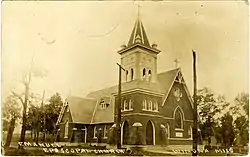 Immanuel Episcopal Church |
July 27, 2005 (#05000740) |
416 Summit St. 33°28′57″N 89°44′02″W |
Winona | |
| 2 | James C. Purnell House | July 12, 1990 (#90001077) |
504 Summit St. 33°28′59″N 89°44′04″W |
Winona | ||
| 3 | Stafford's Wells Hotel | .jpg.webp) Stafford's Wells Hotel |
September 8, 2000 (#00001059) |
38 Stafford Wells Rd 33°26′27″N 89°43′43″W |
Winona | |
| 4 | U.S. Post Office | 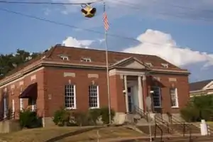 U.S. Post Office |
April 7, 1981 (#81000330) |
306 Summit St. 33°28′57″N 89°43′48″W |
Winona | |
| 5 | Winona Commercial Historic District | July 1, 1994 (#94000659) |
Roughly bounded by Magnolia St., Central Ave., Carrollton St., and Sterling Ave. 33°28′56″N 89°43′41″W |
Winona | ||
| 6 | Winona Community House | March 10, 2009 (#09000113) |
113 Sterling St. 33°28′57″N 89°43′46″W |
Winona | ||
| 7 | Winona Historic District | June 1, 2015 (#15000303) |
Roughly bounded by Oakwood Cemetery, N. Applegate, Raper, Railroad, Branch & Mortimer Sts., Speedway & S. Union Aves. 33°28′56″N 89°43′42″W |
Winona | ||
| 8 | Wisteria Hotel | 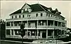 Wisteria Hotel |
December 18, 1979 (#79001332) |
Central Ave. 33°28′56″N 89°43′36″W |
Winona |
Neshoba County
| [7] | Name on the Register | Image | Date listed[8] | Location | City or town | Description |
|---|---|---|---|---|---|---|
| 1 | Downtown Philadelphia Historic District | 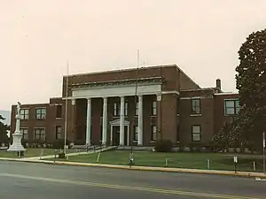 Downtown Philadelphia Historic District |
April 14, 2005 (#05000280) |
Roughly bounded by Myrtle, Peachtree, Walnut, and Pecan 32°46′17″N 89°06′36″W |
Philadelphia | |
| 2 | Mt. Zion Methodist Church | July 13, 2018 (#100001029) |
11191 Cty. Rd. 741 32°46′54″N 88°59′30″W |
Philadelphia | ||
| 3 | Nanih Waiya Cave Mound |  Nanih Waiya Cave Mound |
May 7, 1973 (#73001023) |
Address Restricted |
Philadelphia | |
| 4 | Neshoba County Fair Historic District | 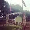 Neshoba County Fair Historic District |
April 22, 1980 (#80002294) |
Northwest of Neshoba on Mississippi Highway 21 32°42′49″N 89°12′47″W |
Neshoba | Entrance into the Neshoba County Fairgrounds |
| 5 | Philadelphia Historic District | .jpg.webp) Philadelphia Historic District |
March 4, 1983 (#83000964) |
Holland and Poplar Aves. and Jefferson, Watkins, and Welsh Sts. 32°46′07″N 89°06′24″W |
Philadelphia | |
| 6 | Old US Post Office (Philadelphia) | .jpg.webp) Old US Post Office (Philadelphia) |
June 30, 1995 (#95000788) |
523 Main Street 32°46′14″N 89°06′32″W |
Philadelphia | Constructed 1935-36, serves as Philadelphia Police Station |
Newton County
| [7] | Name on the Register | Image | Date listed[8] | Location | City or town | Description |
|---|---|---|---|---|---|---|
| 1 | Alabama and Vicksburg Railroad Depot |  Alabama and Vicksburg Railroad Depot |
July 12, 1990 (#90001076) |
S. Main St. 32°19′13″N 89°09′45″W |
Newton | |
| 2 | Boler's Inn | August 2, 1999 (#99000838) |
Jackson Rd. 32°34′22″N 89°07′17″W |
Union | ||
| 3 | Chunky River Bridge | 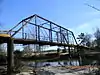 Chunky River Bridge |
March 22, 2004 (#04000217) |
Adams St. 32°19′16″N 88°55′54″W |
Chunky | |
| 4 | Lavelle Site | June 9, 1978 (#78001625) |
Address Restricted |
Enterprise | ||
| 5 | McElroy-Hove House | May 14, 2019 (#100003952) |
400 E. Church St. 32°19′16″N 89°09′33″W |
Newton | ||
| 6 | Newton County American Legion Post No. 89 Hut | March 13, 2007 (#07000148) |
Mississippi Highway 15, N., 0.4 miles north of its junction with Country Club Rd. 32°25′12″N 89°06′37″W |
Decatur | Constructed in 1934 | |
| 7 | Newton West Church Historic District | 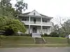 Newton West Church Historic District |
January 20, 1980 (#80002295) |
W. Church St. 32°19′22″N 89°10′09″W |
Newton |
Pearl River County
| [7] | Name on the Register | Image | Date listed[8] | Location | City or town | Description |
|---|---|---|---|---|---|---|
| 1 | Shaw Homestead | January 24, 2019 (#100003345) |
1214 Barth Rd. 30°41′45″N 89°21′03″W |
Poplarville vicinity | ||
| 2 | Tiger Hammock Site 22 PR 594 | August 1, 1985 (#85001679) |
Address Restricted |
Picayune | ||
| 3 | The Hermitage | September 7, 2016 (#16000616) |
1 River Rd. 30°32′29″N 89°41′40″W |
Picayune |
Perry County
| [7] | Name on the Register | Image | Date listed[8] | Location | City or town | Description |
|---|---|---|---|---|---|---|
| 1 | Mahned Bridge | 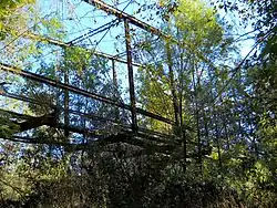 Mahned Bridge |
November 24, 1997 (#97001379) |
Mahned Road over the Leaf River 31°13′28″N 89°05′06″W |
New Augusta | Constructed 1903, closed to vehicle traffic c. 1980s |
| 2 | Old Augusta Historic Site | 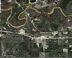 Old Augusta Historic Site |
April 24, 1979 (#79001334) |
Along the Leaf River north of New Augusta[19] 31°13′28″N 89°02′59″W |
New Augusta | Founded 1812, abandoned 1902-06 |
Pontotoc County
| [7] | Name on the Register | Image | Date listed[8] | Location | City or town | Description |
|---|---|---|---|---|---|---|
| 1 | Lochinvar | 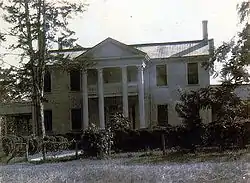 Lochinvar |
March 13, 1986 (#86000331) |
Mississippi Highway 15 south of Pontotoc 34°12′56″N 89°00′22″W |
Pontotoc | A plantation |
| 2 | Pontotoc Historic District | 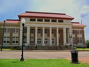 Pontotoc Historic District |
October 29, 1993 (#93001164) |
Roughly, along Main and Liberty Sts. between Reynolds and 8th Sts. 34°14′44″N 88°59′53″W |
Pontotoc | |
| 3 | Treaty of Pontotoc Site | July 27, 1973 (#73001025) |
Address Restricted |
Pontotoc |
Prentiss County
| [7] | Name on the Register | Image | Date listed[8] | Location | City or town | Description |
|---|---|---|---|---|---|---|
| 1 | Downtown Booneville Historic District |  Downtown Booneville Historic District |
November 5, 1998 (#98001337) |
Roughly bounded by Church, College, Court, 1st, Hotel, Main, Market, and Mill Sts. 34°39′21″N 88°33′48″W |
Booneville | |
| 2 | Pharr Mounds | Pharr Mounds |
February 23, 1978 (#78000346) |
Mile 286.7 on the Natchez Trace Parkway[17] 34°27′58″N 88°24′58″W |
Kirkville | Extends into Itawamba County |
Quitman County
| [7] | Name on the Register | Image | Date listed[8] | Location | City or town | Description |
|---|---|---|---|---|---|---|
| 1 | Denton Site | February 2, 1979 (#79001335) |
Northeastern quarter of the southwestern quarter of Section 5, Township 26 North, Range 1 West[15]:54 34°09′08″N 90°19′24″W |
Denton | ||
| 2 | Norman Site | May 2, 1975 (#75001057) |
Northwestern quarter of the northeastern quarter of Section 19, Township 26 North, Range 2 West[15]:53 34°06′57″N 90°26′33″W |
Lambert | ||
| 3 | Posey Site (22QU500) | September 11, 1986 (#86002326) |
Northwestern quarter of the northeastern quarter of Section 4, Township 28 North, Range 1 West[15]:52 34°19′59″N 90°18′09″W |
Marks | ||
| 4 | Shady Grove Site (22QU525) | September 11, 1986 (#86002316) |
Southwestern quarter of the northeastern quarter of Township 27 North, Range 1 West[15]:54 34°11′02″N 90°17′06″W |
Marks |
Scott County
| [7] | Name on the Register | Image | Date listed[8] | Location | City or town | Description |
|---|---|---|---|---|---|---|
| 1 | Forest Downtown Historic District | January 15, 2014 (#13001083) |
Roughly bounded by RR tracks, Front, 3rd, Raleigh & Smith Sts. 32°21′46″N 89°28′27″W |
Forest | ||
| 2 | Hillsboro Methodist Church and Cemetery | June 5, 2017 (#100001030) |
Old Highway 35 N. 32°27′16″N 89°30′47″W |
Hillsboro | ||
| 3 | Lake Railroad Station |  Lake Railroad Station |
July 19, 1984 (#84002346) |
Brook St. 32°20′35″N 89°19′42″W |
Lake | |
| 4 | Moore Lookout Tower | October 28, 1999 (#99001283) |
County Road 503 32°19′07″N 89°29′49″W |
Forest | ||
| 5 | Roosevelt State Park | .jpg.webp) Roosevelt State Park |
December 1, 1997 (#97001436) |
2149 Mississippi Highway 13, S. 32°18′49″N 89°40′45″W |
Morton | |
| 6 | US Post Office-Forest |  US Post Office-Forest |
March 18, 1993 (#80004884) |
313 E. 2nd St. 32°21′46″N 89°28′22″W |
Forest |
Sharkey County
| [7] | Name on the Register | Image | Date listed[8] | Location | City or town | Description |
|---|---|---|---|---|---|---|
| 1 | Cary Site (22Sh507) | December 14, 1988 (#88002705) |
Address Restricted |
Cary | ||
| 2 | Georgianna | January 28, 2019 (#100003353) |
SW of jct. of Powell & Cary-Blanton Rds. Coordinates missing |
Cary vicinity | ||
| 3 | Leist A Site (22Sh520;22N1) | December 14, 1988 (#88002700) |
3 miles (4.8 km) north of the confluence of the Big and Little Sunflower Rivers[20] 32°39′40″N 90°43′48″W |
Rolling Fork | ||
| 4 | Rolling Fork Mounds | October 18, 1974 (#74001065) |
Southwest of Rolling Fork 32°53′47″N 90°52′44″W |
Rolling Fork | ||
| 5 | Savory Site (22-Sh-518) | July 28, 1988 (#88001141) |
Address Restricted |
Holly Bluff | ||
| 6 | Spanish Fort Site (22SH500) | April 6, 1988 (#88000234) |
Spanish Fort Rd., south of Holly Bluff[20] 32°45′17″N 90°43′30″W |
Holly Bluff |
Simpson County
| [7] | Name on the Register | Image | Date listed[8] | Location | City or town | Description |
|---|---|---|---|---|---|---|
| 1 | Gatesville Bridge | November 16, 1988 (#88002482) |
Spans the Pearl River on a county road east of Gatesville 31°59′46″N 90°13′26″W |
Pearl | Extends into Copiah County | |
| 2 | L'Dora Lewis Mound (22SI512) | March 1, 1987 (#87000133) |
Address Restricted |
Pearl | ||
| 3 | Simpson County Courthouse |  Simpson County Courthouse |
August 29, 1985 (#85001898) |
Courthouse Square 31°57′46″N 89°52′10″W |
Mendenhall |
Smith County
| [7] | Name on the Register | Image | Date listed[8] | Location | City or town | Description |
|---|---|---|---|---|---|---|
| 1 | Taylorsville Signal Office and Watkins General Store | November 6, 1986 (#86003056) |
326 Eureka St. 31°49′42″N 89°25′39″W |
Taylorsville |
Stone County
| [7] | Name on the Register | Image | Date listed[8] | Location | City or town | Description |
|---|---|---|---|---|---|---|
| 1 | George Austin McHenry House |  George Austin McHenry House |
November 3, 1988 (#88002223) |
McHenry Avenue at 5th Street 30°42′29″N 89°08′18″W |
McHenry | Constructed 1895-1901, private residence |
Sunflower County
| [7] | Name on the Register | Image | Date listed[8] | Location | City or town | Description |
|---|---|---|---|---|---|---|
| 1 | Dockery Farms Historic District | 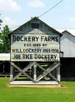 Dockery Farms Historic District |
March 31, 2006 (#06000250) |
Mississippi Highway 8, E. 33°43′44″N 90°36′46″W |
Dockery | |
| 2 | Heathman Plantation Commissary | 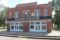 Heathman Plantation Commissary |
November 14, 2012 (#12000923) |
Heathman Rd. 33°26′26″N 90°43′07″W |
Indianola vicinity | |
| 3 | Indianola Historic District | 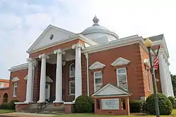 Indianola Historic District |
November 30, 2009 (#09000356) |
Roughly bounded by Percy St. on the north, Front to Adair on the west to Roosevelt, Roosevelt east to Front Extended and north 33°27′02″N 90°39′06″W |
Indianola | |
| 4 | Ruleville Depot | 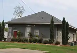 Ruleville Depot |
July 15, 1999 (#99000841) |
Eastern side of the railroad tracks at the junction of East Floyce Street and North Front Street 33°43′38″N 90°33′09″W |
Ruleville | Constructed 1930, closed as railroad depot 1978 |
| 5 | Woodburn Bridge |  Woodburn Bridge |
November 16, 1988 (#88002492) |
Spans the Big Sunflower River on a county road southeast of Indianola 33°23′15″N 90°42′21″W |
Indianola | Constructed c. 1916, abandoned c. 1985 |
Tallahatchie County
| [7] | Name on the Register | Image | Date listed[8] | Location | City or town | Description |
|---|---|---|---|---|---|---|
| 1 | Allison Mound (22Tl1024) | December 14, 1988 (#88002708) |
Address Restricted |
Webb | ||
| 2 | Black Bayou Bridge | March 21, 2011 (#11000112) |
2nd St. 33°49′26″N 90°17′38″W |
Glendora | ||
| 3 | Buford Site (22Tl501) | October 15, 1986 (#86002797) |
Southeastern quarter of the southwestern quarter of Section 36, Township 25 North, Range 2 West[15]:56 33°59′14″N 90°21′28″W |
Sumner | ||
| 4 | Dell Bullion Mound (22Tl998) | December 14, 1988 (#88002706) |
Address Restricted |
Grenada | ||
| 5 | Dr. Tandy and Sarah Harrison House | 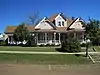 Dr. Tandy and Sarah Harrison House |
January 24, 2019 (#100003346) |
112 S. Panola St. 34°00′23″N 90°03′25″W |
Charleston | |
| 6 | Jacks Site | March 24, 1978 (#78001630) |
Address Restricted |
Philipp | ||
| 7 | Lamb-Fish Bridge | May 17, 1982 (#82004631) |
Northwest of Charleston 34°01′20″N 90°11′32″W |
Charleston | ||
| 8 | Murphey-Jennings House | March 25, 1982 (#82004632) |
307 Walnut St. 33°58′01″N 90°22′10″W |
Sumner | ||
| 9 | Spivey Site | December 6, 1978 (#78001629) |
Address Restricted |
Crowder | ||
| 10 | Tallahatchie County Second District Courthouse |  Tallahatchie County Second District Courthouse |
March 6, 2007 (#07000149) |
108 Main St. 33°58′13″N 90°22′10″W |
Sumner |
Tippah County
| [7] | Name on the Register | Image | Date listed[8] | Location | City or town | Description |
|---|---|---|---|---|---|---|
| 1 | Blue Mountain College Historic District | 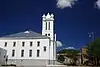 Blue Mountain College Historic District |
May 23, 1979 (#79003383) |
Mississippi Highway 15 34°40′24″N 89°01′46″W |
Blue Mountain | |
| 2 | Old US Post Office-Ripley | 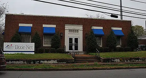 Old US Post Office-Ripley |
September 8, 2000 (#00001056) |
301 North Main Street 34°43′54″N 88°56′58″W |
Ripley | Constructed 1938, vacated as Post Office c. 2000 |
| 3 | Ripley Historic District | 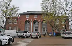 Ripley Historic District |
April 7, 2005 (#05000281) |
Roughly bounded by North St., Siddall St., MS, and Middle St. 34°43′53″N 88°57′00″W |
Ripley |
Tunica County
| [7] | Name on the Register | Image | Date listed[8] | Location | City or town | Description |
|---|---|---|---|---|---|---|
| 1 | Beaverdam Site | August 31, 1978 (#78001631) |
Southeastern quarter of the southeastern quarter of Section 19, Township 5 South, Range 11 West[15]:50 34°37′43″N 90°23′38″W |
Evansville | ||
| 2 | Canon Site (22-Tu-523) | January 7, 1987 (#86003635) |
Southeastern quarter of the southeastern quarter of Section 17, Township 6 South, Range 10 West[15]:51 34°33′27″N 90°16′15″W |
Crenshaw | ||
| 3 | Dundee Site (22TU501) | January 7, 1987 (#86003655) |
Northwestern quarter of the northwestern quarter of Section 34, Township 6 South, Range 12 West[15]:51 34°31′24″N 90°27′40″W |
Dundee | ||
| 4 | Evansville Mounds (22TU502) | January 7, 1987 (#86003632) |
Northwestern quarter of the northwestern quarter of Section 20, Township 5 South, Range 11 West[15]:50 34°38′18″N 90°23′33″W |
Evansville | ||
| 5 | Hollywood Site | May 19, 1972 (#72000701) |
Southeastern quarter of the southwestern quarter of Section 33, Township 3 South, Range 11 West[15]:50 34°46′39″N 90°22′14″W |
Tunica | ||
| 6 | Johnson Cemetery Site (22TU516) | January 7, 1987 (#86003633) |
Northwestern quarter of the northeastern quarter of Section 16, Township 4 South, Range 11 West[15]:51 34°43′51″N 90°21′57″W |
Hollywood | ||
| 7 | Owens Site (22TU512) | January 7, 1987 (#86003657) |
Northwestern quarter of the southeastern quarter of Section 25, Township 5 South, Range 12 West[15]:50 34°37′02″N 90°25′01″W |
Evansville | ||
| 8 | Tunica Historic District |  Tunica Historic District |
March 17, 2006 (#06000194) |
Roughly bounded by Kestevan Alley, Mockingbird St., Cummins Ave., and the Tunica School 34°41′12″N 90°22′28″W |
Tunica |
Union County
| [7] | Name on the Register | Image | Date listed[8] | Location | City or town | Description |
|---|---|---|---|---|---|---|
| 1 | Ingomar Mound | 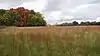 Ingomar Mound |
June 9, 1978 (#78001632) |
Address Restricted |
Ingomar | |
| 2 | New Albany Downtown Historic District |  New Albany Downtown Historic District |
November 1, 1996 (#96001266) |
Roughly bounded by W. and E. Main, Camp St., and the former St. Louis – San Francisco railroad tracks 34°29′38″N 89°00′31″W |
New Albany | |
| 3 | Union County Courthouse | 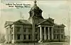 Union County Courthouse |
August 10, 1990 (#90001222) |
Bankhead St. between Court and Camp Aves. 34°29′33″N 89°00′26″W |
New Albany |
Walthall County
| [7] | Name on the Register | Image | Date listed[8] | Location | City or town | Description |
|---|---|---|---|---|---|---|
| 1 | China Grove Methodist Church | 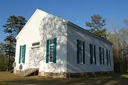 China Grove Methodist Church |
July 5, 1984 (#84002350) |
Mississippi Highway 585 31°12′33″N 90°03′28″W |
Tylertown | |
| 2 | George H. Collins House | March 16, 1992 (#92000102) |
615 Union Rd. 31°07′23″N 90°08′26″W |
Tylertown | ||
| 3 | Mt. Moriah School | June 5, 2017 (#100001031) |
149 Mt. Moriah Rd. 31°03′25″N 90°05′43″W |
Tylertown | ||
| 4 | New Orleans and Great Northern Railroad Depot-Tylertown | 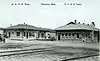 New Orleans and Great Northern Railroad Depot-Tylertown |
April 14, 2000 (#00000378) |
Franklin Highway 31°06′54″N 90°08′26″W |
Tylertown | |
| 5 | Walthall County Courthouse and Jail | 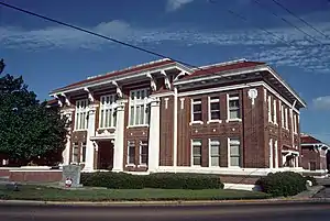 Walthall County Courthouse and Jail |
November 10, 1994 (#94001302) |
200 Ball Ave. 31°07′00″N 90°08′29″W |
Tylertown | |
| 6 | Walthall County Training School |  Walthall County Training School |
June 5, 2017 (#100001032) |
181 Ginntown Rd. 31°04′10″N 90°08′49″W |
Tylertown |
Wayne County
| [7] | Name on the Register | Image | Date listed[8] | Location | City or town | Description |
|---|---|---|---|---|---|---|
| 1 | Downtown Waynesboro Historic District | 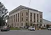 Downtown Waynesboro Historic District |
March 26, 2012 (#12000157) |
Roughly bounded by Station, Spring, Wayne, & Court Sts. 31°40′32″N 88°38′43″W |
Waynesboro | |
| 2 | Yellow Creek Bridge | 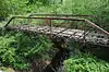 Yellow Creek Bridge |
November 16, 1988 (#88002493) |
Spans Yellow Creek on a county road northwest of Waynesboro 31°41′49″N 88°40′13″W |
Waynesboro |
Former listing
| [7] | Name on the Register | Image | Date listed | Date removed | Location | City or town | Summary |
|---|---|---|---|---|---|---|---|
| 1 | Waynesboro Bridge | November 16, 1988 (#88002494) | April 7, 2004 | Spanned Chickasawhay River on Old US 84 |
Waynesboro vicinity | Collapsed November 2, 2002[21] |
Webster County
| [7] | Name on the Register | Image | Date listed[8] | Location | City or town | Description |
|---|---|---|---|---|---|---|
| 1 | Eupora Historic District | July 20, 2011 (#11000472) |
Roughly along N. Dunn St. & W. Roane Ave. 33°32′27″N 89°16′07″W |
Eupora | ||
| 2 | Pittman Log House | October 7, 2020 (#100005671) |
1316 Pepper Town Rd. 33°38′33″N 89°16′26″W |
Eupora vicinity | ||
| 3 | Wood Home for Boys | April 5, 1984 (#84002448) |
Horton St. 33°32′42″N 89°07′32″W |
Mathiston |
Winston County
| [7] | Name on the Register | Image | Date listed[8] | Location | City or town | Description |
|---|---|---|---|---|---|---|
| 1 | Baptist Church of Christ at Sardis | March 21, 2011 (#11000110) |
Sardis Rd. 33°03′20″N 88°51′13″W |
Louisville vicinity | ||
| 2 | Downtown Louisville Historic District | July 20, 2011 (#11000473) |
Bounded by Church St., W. Park St., Columbus Ave. & Mill St. 33°07′25″N 89°03′16″W |
Louisville | ||
| 3 | Foster-Fair House | November 29, 2000 (#00000332) |
507 S. Columbus Ave. 33°07′04″N 89°03′09″W |
Louisville | ||
| 4 | Legion State Park | November 5, 1998 (#98001333) |
635 Legion State Park Rd. 33°09′05″N 89°02′41″W |
Louisville | ||
| 5 | Old Masonic Hall | February 25, 1994 (#94000065) |
311 W. Park St. 33°07′19″N 89°03′22″W |
Louisville | ||
| 6 | Nanih Waiya Mound And Village | Nanih Waiya Mound And Village |
March 28, 1973 (#73001032) |
Along Mississippi Highway 393 in Nanih Waiya State Park[22] 32°55′15″N 88°56′55″W |
Fearns Springs | |
| 7 | Old Robinson Road | April 3, 1975 (#75001061) |
16.6 miles northeast of Louisville in the Noxubee National Wildlife Refuge 33°16′32″N 88°49′52″W |
Louisville | ||
| 8 | Benjamin Franklin Smyth House | February 25, 1994 (#94000064) |
207 Smyth Rd. 33°05′52″N 89°04′24″W |
Louisville |
Yalobusha County
| [7] | Name on the Register | Image | Date listed[8] | Location | City or town | Description |
|---|---|---|---|---|---|---|
| 1 | Simmons House | March 5, 2020 (#100005035) |
120 McLarty Cir. 34°08′51″N 89°37′55″W |
Water Valley | ||
| 2 | US Post Office-Water Valley |  US Post Office-Water Valley |
April 18, 1985 (#85000845) |
501 N. Main St. 34°09′14″N 89°37′53″W |
Water Valley | |
| 3 | Water Valley Main Street Historic District | Water Valley Main Street Historic District |
March 26, 2012 (#12000158) |
Roughly along Main from Young to Market Sts. 34°09′08″N 89°37′53″W |
Water Valley |
Former listings
| [7] | Name on the Register | Image | Date listed | Date removed | Location | City or town | Summary |
|---|---|---|---|---|---|---|---|
| 1 | Coffeeville Hotel |  Coffeeville Hotel |
March 1, 1982 (#82003123) | January 31, 1992 | Off MS 330 |
Coffeeville | Demolished in 1988[23] |
| 2 | Leopold Newberger House | 1997-11-17[24] (#97001300) | August 26, 2004 | 714 Depot Street |
Coffeeville | Disassembled and relocated to Tishomingo County in 2001[25] |
See also
| Wikimedia Commons has media related to National Register of Historic Places in Mississippi. |
References
- The latitude and longitude information provided in this table was derived originally from the National Register Information System, which has been found to be fairly accurate for about 99% of listings. Some locations in this table may have been corrected to current GPS standards.
- "National Register of Historic Places: Weekly List Actions". National Park Service, United States Department of the Interior. Retrieved on January 29, 2021.
- "National Register Information System". National Register of Historic Places. National Park Service. March 13, 2009.
- "National Register of Historic Places: Weekly List Actions". National Park Service. Retrieved January 2, 2009.
- Weekly List Actions, National Register of Historic Places website
- The following sites are listed in multiple counties: Woodrow Wilson Bridge and Byram Bridge (Hinds and Rankin), Big Black River Battlefield and Big Black River Railroad Bridge (Hinds and Warren), French Site (22HO565) (Carroll and Holmes), Gatesville Bridge (Copiah and Simpson), Pharr Mounds (Itawamba and Prentiss), and Waverly Bridge (Clay and Lowndes).
- Numbers represent an alphabetical ordering by significant words. Various colorings, defined here, differentiate National Historic Landmarks and historic districts from other NRHP buildings, structures, sites or objects.
- The eight-digit number below each date is the number assigned to each location in the National Register Information System database, which can be viewed by clicking the number.
- West Mound
- Location derived from this National Park Service webpage
- Location derived from this National Park Service webpage; the NRIS lists the site as "Address Restricted"
- Old Natchez Trace (No. 230-3H) (Alternate names: Path to Choctaw Nation, Chickasaw Trace, Natchez Trace), National Register of Historic Places Inventory Nomination Form for Federal Properties, prepared October 1, 1974; received March 25, 1976; entered November 7, 1976
- Location derived from this Southern Mississippi Planning and Development District document, page 31; the NRIS lists the site as "Address Restricted"
- Phillips, Philip, et al. Archaeological Survey in the Lower Mississippi Alluvial Valley 1940-1947. Reprint ed. Tuscaloosa: U of Alabama P, 2003.
- Location derived from Indian Mounds of Mississippi — Jaketown Site, National Park Service. Accessed 2009-10-03. The NRIS lists the site as "Address Restricted".
- Location derived from this National Park Service webpage; the NRIS lists the site as "Address Restricted"
- MDAH
- Location derived from its GNIS feature record; the NRIS lists the site as "Address Restricted"
- Location derived from Jackson, H. Edwin. "Little Spanish Fort: An Early Middle Woodland Enclosure in the Lower Yazoo Basin, Mississippi". Midcontinental Journal of Archaeology 23.2 (1998): 199-220: 201. The NRIS lists the site as "Address Restricted".
- MDAH
- Location derived from the GNIS feature record for Nanih Waiya State Park; the NRIS lists the site as "Address Restricted"
- MDAH
- https://www.apps.mdah.ms.gov/nom/prop/30626.pdf
- MDAH
| Topics | |
|---|---|
| Lists by state |
|
| Lists by insular areas | |
| Lists by associated state | |
| Other areas | |
| Related | |
| |
.svg.png.webp)