National Register of Historic Places listings in North Dakota
There are 460 properties and historic districts listed on the National Register of Historic Places in North Dakota. There are listings in 52 of North Dakota's 53 counties.
| Adams | Barnes | Benson | Billings | Bottineau | Bowman | Burke | Burleigh | Cass | Cavalier | Dickey | Divide | Dunn | Eddy | Emmons | Foster | Golden Valley | Grand Forks | Grant | Griggs | Hettinger | Kidder | La Moure | Logan | McHenry | McIntosh | McKenzie | McLean | Mercer | Morton | Mountrail | Nelson | Oliver | Pembina | Pierce | Ramsey | Ransom | Renville | Richland | Rolette | Sargent | Sheridan | Sioux | Slope | Stark | Steele | Stutsman | Towner | Traill | Walsh | Ward | Wells | Williams |
- This National Park Service list is complete through NPS recent listings posted January 29, 2021.[1]
Current listings by county
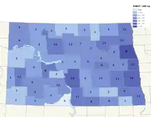
The following are approximate tallies of current listings by county. These counts are based on entries in the National Register Information Database as of April 24, 2008[2] and new weekly listings posted since then on the National Register of Historic Places web site.[3] There are frequent additions to the listings and occasional delistings and the counts here are approximate and not official. New entries are added to the official Register on a weekly basis.[4] Also, the counts in this table exclude boundary increase and decrease listings which modify the area covered by an existing property or district and which carry a separate National Register reference number. The numbers of NRHP listings in each county are documented by tables in each of the individual county list-articles.
| County | # of Sites | Region | |
|---|---|---|---|
| 1 | Adams | 3 | Missouri Plateau |
| 2 | Barnes | 13 | Drift Prairie |
| 3 | Benson | 7 | Drift Prairie |
| 4 | Billings | 11 | Missouri Plateau |
| 5 | Bottineau | 4 | Drift Prairie |
| 6 | Bowman | 2 | Missouri Plateau |
| 7 | Burke | 4 | Drift Prairie |
| 8 | Burleigh | 25 | Missouri Plateau |
| 9 | Cass | 36 | Red River Valley |
| 10 | Cavalier | 3 | Drift Prairie |
| 11 | Dickey | 8 | Drift Prairie |
| 12 | Divide | 5 | Missouri Plateau |
| 13 | Dunn | 4 | Missouri Plateau |
| 14 | Eddy | 4 | Drift Prairie |
| 15 | Emmons | 17 | Missouri Plateau |
| 16 | Foster | 6 | Drift Prairie |
| 17 | Golden Valley | 3 | Missouri Plateau |
| 18 | Grand Forks | 74 | Red River Valley |
| 19 | Grant | 4 | Missouri Plateau |
| 20 | Griggs | 4 | Drift Prairie |
| 21 | Hettinger | 5 | Missouri Plateau |
| 22 | Kidder | 4 | Missouri Plateau |
| 23 | LaMoure | 2 | Drift Prairie |
| 24 | Logan | 2 | Missouri Plateau |
| 25 | McHenry | 12 | Drift Prairie |
| 26 | McIntosh | 8 | Missouri Plateau |
| 27 | McKenzie | 4 | Missouri Plateau |
| 28 | McLean | 8 | Missouri Plateau |
| 29 | Mercer | 8 | Missouri Plateau |
| 30 | Morton | 10 | Missouri Plateau |
| 31 | Mountrail | 5 | Missouri Plateau |
| 32 | Nelson | 4 | Drift Prairie |
| 33 | Oliver | 1 | Missouri Plateau |
| 34 | Pembina | 13 | Red River Valley |
| 35 | Pierce | 7 | Drift Prairie |
| 36 | Ramsey | 15 | Drift Prairie |
| 37 | Ransom | 9 | Drift Prairie |
| 38 | Renville | 2 | Drift Prairie |
| 39 | Richland | 12 | Red River Valley |
| 40 | Rolette | 3 | Drift Prairie |
| 41 | Sargent | 1 | Drift Prairie |
| 42 | Sheridan | 2 | Missouri Plateau |
| 43 | Sioux | 0 | Missouri Plateau |
| 44 | Slope | 2 | Missouri Plateau |
| 45 | Stark | 5 | Missouri Plateau |
| 46 | Steele | 3 | Drift Prairie |
| 47 | Stutsman | 11 | Drift Prairie |
| 48 | Towner | 1 | Drift Prairie |
| 49 | Traill | 22 | Red River Valley |
| 50 | Walsh | 16 | Red River Valley |
| 51 | Ward | 15 | Drift Prairie |
| 52 | Wells | 6 | Drift Prairie |
| 53 | Williams | 8 | Missouri Plateau |
| (duplicates) | (3)[5] | ||
| TOTAL | 460 | ||
Adams County
| [6] | Name on the Register[2] | Image | Date listed[7] | Location | City or town | Description |
|---|---|---|---|---|---|---|
| 1 | Adams County Courthouse | .jpg.webp) Adams County Courthouse |
November 14, 1985 (#85002977) |
600 Adams Ave. 46°00′05″N 102°38′04″W |
Hettinger | |
| 2 | Cedar Creek Bridge | Cedar Creek Bridge |
February 27, 1997 (#97000168) |
Unnamed county road across Cedar Creek, approximately 6 miles north and 11 miles east of Haynes 46°03′02″N 102°13′37″W |
Haynes | |
| 3 | US Post Office-Hettinger | November 1, 1989 (#89001751) |
Lake St. and Adams Ave. 46°00′05″N 102°38′10″W |
Hettinger |
Benson County
| [6] | Name on the Register | Image | Date listed[7] | Location | City or town | Description |
|---|---|---|---|---|---|---|
| 1 | Benson County Courthouse | 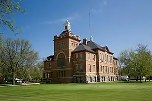 Benson County Courthouse |
November 2, 1978 (#78001988) |
B Ave. 48°04′08″N 99°14′59″W |
Minnewaukan | |
| 2 | Fort Totten | 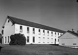 Fort Totten |
December 9, 1971 (#71000629) |
South of Fort Totten off ND 57 47°58′39″N 98°59′35″W |
Fort Totten | |
| 3 | Grace Episcopal Church | September 9, 1994 (#94001072) |
210 C Ave., S. 48°04′14″N 99°14′51″W |
Minnewaukan | ||
| 4 | Pierson Farm | August 29, 1985 (#85001939) |
3.5 miles south of York off U.S. Route 2 48°15′42″N 99°34′06″W |
York | ||
| 5 | St. Boniface Cemetery, Wrought-Iron Cross Site | October 23, 1989 (#89001686) |
Address Restricted |
Selz | ||
| 6 | Viking Lutheran Church | 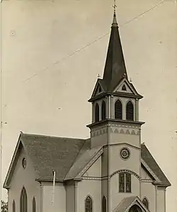 Viking Lutheran Church |
November 14, 1979 (#79001768) |
Southeast of Maddock 47°51′44″N 99°29′23″W |
Maddock | |
| 7 | West Antelope Bridge | February 27, 1997 (#97000171) |
Unnamed county road across the Sheyenne River, approximately 30 miles southeast of the junction of U.S. Route 2 and ND 30 47°53′12″N 99°23′05″W |
Flora |
Billings County
| [6] | Name on the Register | Image | Date listed[7] | Location | City or town | Description |
|---|---|---|---|---|---|---|
| 1 | Billings County Courthouse | 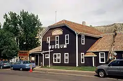 Billings County Courthouse |
December 16, 1977 (#77001016) |
4th St. and 4th Ave. 46°54′46″N 103°31′20″W |
Medora | part of the North Dakota County Courthouses Thematic Resource (TR) |
| 2 | Chateau de Mores | 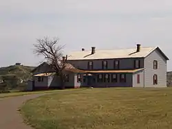 Chateau de Mores |
April 16, 1975 (#75001299) |
Southwest of Medora on the western bank of the Little Missouri River 46°54′40″N 103°31′57″W |
Medora | |
| 3 | Custer Military Trail Historic Archaeological District |  Custer Military Trail Historic Archaeological District |
June 5, 2009 (#08001293) |
Multiple locations south of Medora Coordinates missing |
Medora | Includes sites in Golden Valley County. |
| 4 | De Mores Memorial Park | March 4, 2019 (#100003204) |
SE corner of Main St. & 3rd Ave. 46°54′49″N 103°31′17″W |
Medora | ||
| 5 | De Mores Packing Plant Ruins | 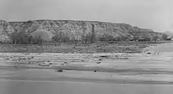 De Mores Packing Plant Ruins |
February 18, 1975 (#75001300) |
Northwest of the Medora boundary 46°55′01″N 103°31′41″W |
Medora | Now Chimney Park |
| 6 | Initial Rock |  Initial Rock |
November 7, 1976 (#76002271) |
Southeast of Medora in Little Missouri National Grassland 46°48′28″N 103°24′39″W |
Medora | |
| 7 | Myers School Timbered Lodge (32BI401) | August 6, 1980 (#80002906) |
Address Restricted |
Medora | ||
| 8 | Peaceful Valley Ranch | 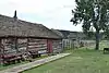 Peaceful Valley Ranch |
July 13, 1994 (#94000731) |
North of Medora near the Little Missouri River in Theodore Roosevelt National Park 46°57′32″N 103°30′13″W |
Medora | |
| 9 | Theodore Roosevelt's Elkhorn Ranch and Greater Elkhorn Ranchlands |  Theodore Roosevelt's Elkhorn Ranch and Greater Elkhorn Ranchlands |
September 28, 2012 (#12000252) |
Off Bear Lake Road, 35 miles north of Medora 47°14′22″N 103°37′27″W |
Medora | Now a unit of Theodore Roosevelt National Park. |
| 10 | St. Mary's Catholic Church |  St. Mary's Catholic Church |
December 2, 1977 (#77001017) |
4th St. and 3rd Ave. 46°54′52″N 103°31′20″W |
Medora | |
| 11 | Von Hoffman House | 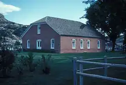 Von Hoffman House |
November 21, 1977 (#77001018) |
Broadway and 5th St. 46°54′50″N 103°31′17″W |
Medora |
Bottineau County
| [6] | Name on the Register | Image | Date listed[7] | Location | City or town | Description |
|---|---|---|---|---|---|---|
| 1 | Ole Crogen Farm District | October 16, 1987 (#87001779) |
4 miles northwest of Bottineau 48°53′00″N 100°31′45″W |
Carbury & Bottineau | ||
| 2 | Old Main, North Dakota School of Forestry | 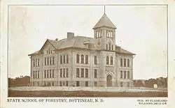 Old Main, North Dakota School of Forestry |
September 1, 2006 (#06000532) |
Alexander St. (north of terminus with 2nd St.) 48°50′03″N 100°26′25″W |
Bottineau | |
| 3 | State Bank of Antler | April 15, 2019 (#100003620) |
Antler Sq. 48°59′10″N 100°37′18″W |
Antler | Possible relisting of previously listed building (refnum 88000986), or the listing of a different bank building in the same area. | |
| 4 | Swedish Zion Lutheran Church | April 1, 2013 (#13000138) |
32 rods from NE. corner of SE. corner T164N, R77W, sec34. 48°59′10″N 100°37′18″W |
Souris |
Former listing
| [6] | Name on the Register | Image | Date listed | Date removed | Location | City or town | Summary |
|---|---|---|---|---|---|---|---|
| 1 | State Bank of Antler | 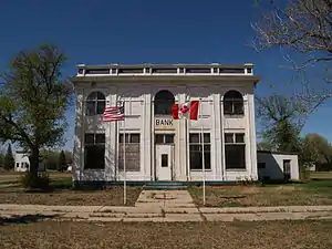 State Bank of Antler |
June 30, 1988 (#88000986) | July 11, 2016 | Antler Sq. 48°58′15″N 101°16′56″W |
Antler |
Bowman County
| [6] | Name on the Register | Image | Date listed[7] | Location | City or town | Description |
|---|---|---|---|---|---|---|
| 1 | Fort Dilts |  Fort Dilts |
November 10, 1980 (#80002907) |
Fort Dilts Road 46°16′43″N 103°46′33″W |
Rhame | |
| 2 | Emma Petznick and Otto Schade House | April 16, 2008 (#08000313) |
406 W. Divide 46°10′56″N 103°24′04″W |
Bowman |
Burke County
| [6] | Name on the Register | Image | Date listed[7] | Location | City or town | Description |
|---|---|---|---|---|---|---|
| 1 | Burke County Courthouse | 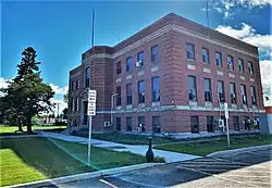 Burke County Courthouse |
November 14, 1985 (#85002979) |
Main St. 48°48′03″N 102°14′53″W |
Bowbells | |
| 2 | Burke County World War Memorial Hall | 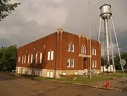 Burke County World War Memorial Hall |
January 4, 2018 (#100001952) |
101 1st St. 48°53′58″N 102°23′36″W |
Flaxton | |
| 3 | William E. Metzger House | August 22, 2007 (#07000841) |
112 Makee St. 48°59′49″N 102°33′11″W |
Portal | ||
| 4 | Portal State Bank | 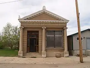 Portal State Bank |
October 3, 1996 (#96001067) |
19 Main St. 48°59′45″N 102°32′54″W |
Portal |
Cavalier County
| [6] | Name on the Register | Image | Date listed[7] | Location | City or town | Description |
|---|---|---|---|---|---|---|
| 1 | Roxy Theatre | .jpg.webp) Roxy Theatre |
November 18, 1998 (#98001341) |
714 3rd St. 48°45′35″N 98°22′06″W |
Langdon | |
| 2 | RSL-3 | 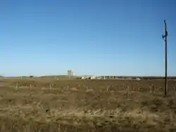 RSL-3 |
October 23, 2018 (#100003053) |
12329 ND 5 48°45′41″N 97°57′00″W |
Concrete vicinity | Remote Sprint Launch facility, part of the Safeguard missile defense program. |
| 3 | US Post Office-Langdon | November 1, 1989 (#89001752) |
323 8th Ave. 48°45′41″N 98°22′08″W |
Langdon |
Dickey County
| [6] | Name on the Register | Image | Date listed[7] | Location | City or town | Description |
|---|---|---|---|---|---|---|
| 1 | Carroll House Hotel | .jpg.webp) Carroll House Hotel |
March 17, 1994 (#94000221) |
19 N. Monroe St. 46°09′44″N 98°25′37″W |
Fullerton | |
| 2 | Dickey County Courthouse | .jpg.webp) Dickey County Courthouse |
November 25, 1980 (#80004283) |
Off U.S. Route 281 46°00′15″N 98°31′24″W |
Ellendale | |
| 3 | Ellendale Opera House Block | .jpg.webp) Ellendale Opera House Block |
April 22, 1992 (#92000354) |
105-111 Main St. 46°00′06″N 98°31′42″W |
Ellendale | |
| 4 | Klein and Sutmar Block | 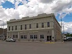 Klein and Sutmar Block |
October 16, 1987 (#87001792) |
419 Main Ave. 46°08′21″N 98°05′38″W |
Oakes | |
| 5 | Walter T. Noonan House | October 16, 1987 (#87001791) |
215 S. 7th St. 46°08′10″N 98°05′28″W |
Oakes | ||
| 6 | Oakes National Bank Block | 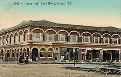 Oakes National Bank Block |
October 16, 1987 (#87001790) |
501 Main Ave. 46°08′21″N 98°05′36″W |
Oakes | |
| 7 | US Post Office-Oakes | 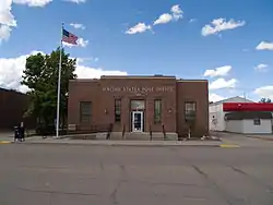 US Post Office-Oakes |
November 1, 1989 (#89001753) |
611 Main Ave. 46°08′21″N 98°05′29″W |
Oakes | |
| 8 | White Stone Hill |  White Stone Hill |
November 5, 2013 (#13000861) |
Address restricted |
Kulm | Federal Relief Construction in North Dakota, 1931-1943, MPS |
Divide County
| [6] | Name on the Register | Image | Date listed[7] | Location | City or town | Description |
|---|---|---|---|---|---|---|
| 1 | Alkabo School | 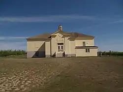 Alkabo School |
December 7, 2010 (#10000997) |
North end of Main St. 48°51′58″N 103°53′12″W |
Alkabo | Federal Relief Construction in North Dakota, 1931-1943, MPS |
| 2 | Divide County Courthouse | 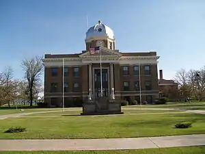 Divide County Courthouse |
November 25, 1980 (#80002910) |
In Crosby 48°54′55″N 103°17′38″W |
Crosby | |
| 3 | Niels Nielsen Fourteen-Side Barn Farm | 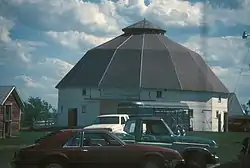 Niels Nielsen Fourteen-Side Barn Farm |
October 7, 1986 (#86002743) |
ND 38 48°49′54″N 102°57′33″W |
Noonan | |
| 4 | Travelers Hotel |  Travelers Hotel |
July 6, 2010 (#10000423) |
121 Main St 48°49′54″N 102°57′33″W |
Noonan | |
| 5 | U.S. Inspection Station-Ambrose, North Dakota | 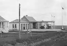 U.S. Inspection Station-Ambrose, North Dakota |
September 10, 2014 (#14000587) |
ND42 48°59′52″N 103°29′14″W |
Ambrose |
Dunn County
| [6] | Name on the Register | Image | Date listed[7] | Location | City or town | Description |
|---|---|---|---|---|---|---|
| 1 | Hutmacher Farm | December 17, 1979 (#79001772) |
Northwest of Manning 47°16′45″N 102°55′39″W |
Manning | ||
| 2 | Independence Congregational Church | July 14, 2015 (#15000422) |
BIA Rd. 13, Fort Berthold Indian Reservation 47°41′40″N 102°22′35″W |
Mandaree vicinity | ||
| 3 | Lynch Quarry Site |  Lynch Quarry Site |
July 13, 2011 (#11000629) |
448 95th Ave., SW.[8] 47°21′09″N 102°33′22″W |
Dunn Center[9] | |
| 4 | Saints Peter and Paul Church |  Saints Peter and Paul Church |
February 3, 1986 (#86000161) |
101 Lafayette St.[10] 47°00′02″N 102°53′01″W |
New Hradec |
Former listing
| [6] | Name on the Register | Image | Date listed | Date removed | Location | City or town | Summary |
|---|---|---|---|---|---|---|---|
| 1 | Dunn County Courthouse | March 26, 1986 (#86000620) | October 21, 2009 | Owens St. 47°13′53″N 102°46′10″W |
Manning |
Eddy County
| [6] | Name on the Register | Image | Date listed[7] | Location | City or town | Description |
|---|---|---|---|---|---|---|
| 1 | Eddy County Courthouse |  Eddy County Courthouse |
November 14, 1985 (#85002981) |
524 Central Ave. 47°40′49″N 99°08′03″W |
New Rockford | |
| 2 | Sylvanus Marriage Octagonal Barn | October 7, 1986 (#86002748) |
ND 38 47°36′50″N 99°05′50″W |
New Rockford | ||
| 3 | New Rockford Bridge | March 13, 1997 (#97000173) |
Across the James River, unnamed county road at its junction with ND 15 47°41′08″N 99°08′05″W |
New Rockford | ||
| 4 | US Post Office-New Rockford |  US Post Office-New Rockford |
November 1, 1989 (#89001750) |
821 N. 1st Ave. 47°40′51″N 99°08′21″W |
New Rockford |
Former listing
| [6] | Name on the Register | Image | Date listed | Date removed | Location | City or town | Summary |
|---|---|---|---|---|---|---|---|
| 1 | Jens Myhre Round Barn | October 1, 1986 (#86002749) | July 14, 2015 | ND 30 47°44′46″N 99°12′11″W |
New Rockford |
Foster County
| [6] | Name on the Register | Image | Date listed[7] | Location | City or town | Description |
|---|---|---|---|---|---|---|
| 1 | Foster County Courthouse | 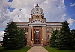 Foster County Courthouse |
November 25, 1980 (#80002911) |
1000 5th St. N. 47°27′18″N 99°07′33″W |
Carrington | |
| 2 | Grace City Bridge | February 27, 1997 (#97000174) |
Across the James River, unnamed county road 1 mile southwest of Grace City 47°32′39″N 98°49′52″W |
Grace City | ||
| 3 | Ralph Hall Farm District | October 1, 1987 (#87001781) |
North of Carrington on the western side of Burlington Northern railroad tracks 47°29′42″N 99°08′27″W |
Carrington | Both the farmhouse and main barn have been demolished since 1997, leaving the garage as the only remaining contributing building. | |
| 4 | McHenry Railroad Loop | October 2, 1986 (#86002751) |
Eastern side of ND 20 47°34′42″N 98°35′44″W |
McHenry | ||
| 5 | Thomas Nichols Putnam House | 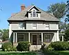 Thomas Nichols Putnam House |
November 24, 1992 (#92001604) |
533 Main St. 47°26′59″N 99°07′10″W |
Carrington | |
| 6 | US Post Office-Carrington | 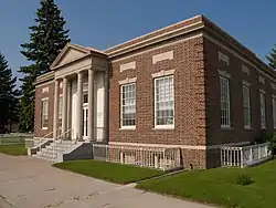 US Post Office-Carrington |
November 1, 1989 (#89001754) |
87 N. 9th Ave. 47°27′01″N 99°07′29″W |
Carrington |
Former listing
| [6] | Name on the Register | Image | Date listed | Date removed | Location | City or town | Summary |
|---|---|---|---|---|---|---|---|
| 1 | Lincoln Building | April 30, 1980 (#80002912) | February 1, 2011 | Off U.S. Route 281 47°27′07″N 99°07′22″W |
Carrington |
Golden Valley County
| [6] | Name on the Register | Image | Date listed[7] | Location | City or town | Description |
|---|---|---|---|---|---|---|
| 1 | Custer Military Trail Historic Archaeological District |  Custer Military Trail Historic Archaeological District |
June 5, 2009 (#08001293) |
Multiple locations south and west of Medora Coordinates missing |
Sentinel Butte | Includes sites in Billings County. |
| 2 | Golden Valley County Courthouse | 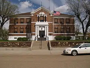 Golden Valley County Courthouse |
November 14, 1985 (#85002983) |
First Ave., SE. 46°54′48″N 104°00′14″W |
Beach | |
| 3 | Sentinel Butte Public School |  Sentinel Butte Public School |
October 21, 1982 (#82001313) |
Byron St. 46°55′03″N 103°50′19″W |
Sentinel Butte |
Grant County
| [6] | Name on the Register | Image | Date listed[7] | Location | City or town | Description |
|---|---|---|---|---|---|---|
| 1 | Carson Roller Mill | 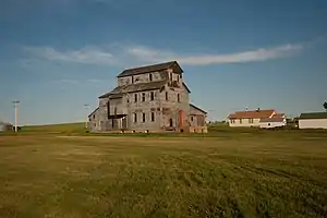 Carson Roller Mill |
April 30, 1980 (#80002915) |
Southern side of Carson 46°25′06″N 101°33′50″W |
Carson | |
| 2 | Evangelisch Lutheraner Dreieinigkeit Gemeinde | 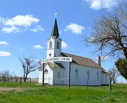 Evangelisch Lutheraner Dreieinigkeit Gemeinde |
September 9, 2009 (#09000530) |
63rd St. in the southwestern part of Section 15, Township 135, Range 90 46°30′04″N 101°58′00″W |
New Leipzig | |
| 3 | Hope Lutheran Church | 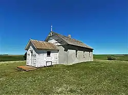 Hope Lutheran Church |
January 16, 1992 (#91001924) |
West of ND 49 south of Lake Tschida 46°30′02″N 101°51′41″W |
Elgin | |
| 4 | Medicine Rock State Historic Site | September 25, 1986 (#86002757) |
Center of Section 31, Township 133 North, Range 88 West[11] 46°17′38″N 101°47′23″W |
Heil |
Griggs County
| [6] | Name on the Register | Image | Date listed[7] | Location | City or town | Description |
|---|---|---|---|---|---|---|
| 1 | Griggs County Courthouse | .jpg.webp) Griggs County Courthouse |
July 21, 1977 (#77001025) |
Rollin Ave. 47°26′31″N 98°07′27″W |
Cooperstown | |
| 2 | Northern Lights Masonic Lodge | 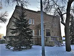 Northern Lights Masonic Lodge |
October 16, 1987 (#87001775) |
9th St. 47°26′36″N 98°07′23″W |
Cooperstown | |
| 3 | Oscar-Zero Missile Alert Facility |  Oscar-Zero Missile Alert Facility |
October 14, 2008 (#08000994) |
ND 45, 4.5 miles north of Cooperstown 47°30′27″N 98°07′55″W |
Cooperstown | Missile launch control center of the U.S. Air Force 321st Missile Wing[12] |
| 4 | Romness Bridge | 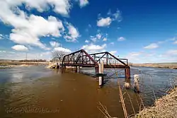 Romness Bridge |
February 27, 1997 (#97000179) |
Unnamed county road across the Sheyenne River, approximately 8 miles north and 1 mile east of Cooperstown 47°34′22″N 98°05′37″W |
Cooperstown |
Hettinger County
| [6] | Name on the Register | Image | Date listed[7] | Location | City or town | Description |
|---|---|---|---|---|---|---|
| 1 | Hettinger County Courthouse | 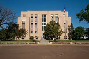 Hettinger County Courthouse |
November 14, 1985 (#85002984) |
336 Pacific St. 46°22′29″N 102°19′43″W |
Mott | |
| 2 | Dr. S. W. Hill Drug Store | 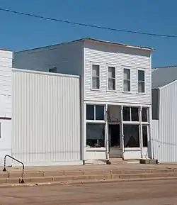 Dr. S. W. Hill Drug Store |
November 10, 1980 (#80002916) |
Off ND 21 46°25′20″N 102°33′18″W |
Regent | |
| 3 | Neuburg Congregational Church | 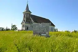 Neuburg Congregational Church |
August 15, 2007 (#07000822) |
83rd Ave., SW. and 57 St., SW. 46°35′16″N 102°09′24″W |
Mott | |
| 4 | Riverside | 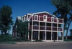 Riverside |
May 12, 1983 (#83001937) |
418 Main St. 46°32′06″N 102°52′03″W |
New England | |
| 5 | John and Fredricka (Roth) Stern Homestead |  John and Fredricka (Roth) Stern Homestead |
September 19, 2008 (#08000902) |
2 miles east of Mott on ND 21 46°22′19″N 102°16′28″W |
Mott |
Kidder County
| [6] | Name on the Register | Image | Date listed[7] | Location | City or town | Description |
|---|---|---|---|---|---|---|
| 1 | Crystal Springs Fountain |  Crystal Springs Fountain |
December 7, 2010 (#10000999) |
1 mile northeast from Crystal Springs on old US 10 46°52′48″N 99°27′26″W |
Crystal Springs | Federal Relief Construction in North Dakota, 1931-1943, MPS |
| 2 | First Presbyterian Church of Steele |  First Presbyterian Church of Steele |
May 19, 2004 (#04000467) |
Mitchell Ave., N., and 1st St. 46°51′23″N 99°54′57″W |
Steele | |
| 3 | Kidder County Courthouse |  Kidder County Courthouse |
November 14, 1985 (#85002985) |
Broadway Ave. 46°51′16″N 99°54′53″W |
Steele | |
| 4 | Robinson Hall |  Robinson Hall |
March 26, 2018 (#100002253) |
118 Main St. 47°08′35″N 99°46′52″W |
Robinson |
LaMoure County
| [6] | Name on the Register | Image | Date listed[7] | Location | City or town | Description |
|---|---|---|---|---|---|---|
| 1 | Dagen's Grocery |  Dagen's Grocery |
July 6, 2005 (#05000659) |
616 Central Ave. 46°31′38″N 98°53′49″W |
Jud | |
| 2 | La Moure County Courthouse |  La Moure County Courthouse |
November 25, 1980 (#80004284) |
In LaMoure 46°21′45″N 98°17′28″W |
LaMoure |
Former listing
| [6] | Name on the Register | Image | Date listed | Date removed | Location | City or town | Summary |
|---|---|---|---|---|---|---|---|
| 1 | Rodman Octagonal Barn | October 7, 1986 (#86002753) | July 14, 2015 | ND 30 46°24′33″N 98°47′17″W |
Edgeley |
Logan County
| [6] | Name on the Register | Image | Date listed[7] | Location | City or town | Description |
|---|---|---|---|---|---|---|
| 1 | Robert Abell Round Barn | October 7, 1986 (#86002754) |
ND 38 46°22′35″N 99°28′29″W |
Burnstad | ||
| 2 | Logan County Courthouse | November 14, 1985 (#85002986) |
301 Broadway 46°30′12″N 99°46′06″W |
Napoleon |
McIntosh County
| [6] | Name on the Register | Image | Date listed[7] | Location | City or town | Description |
|---|---|---|---|---|---|---|
| 1 | Ashley Jewish Homesteaders Cemetery | November 17, 2015 (#15000807) |
48th Ave., SE. 46°04′42″N 99°22′44″W |
Ashley | ||
| 2 | McIntosh County Courthouse | .jpg.webp) McIntosh County Courthouse |
November 25, 1980 (#80002918) |
112 1st St. NE 46°02′09″N 99°22′16″W |
Ashley | |
| 3 | St. Andrews Evangelical German Lutheran Church | July 12, 1990 (#90001027) |
West of ND 3 near the South Branch of Beaver Creek 46°06′53″N 99°46′21″W |
Zeeland | ||
| 4 | St. John's Cemetery, Wrought-Iron Cross Site A | October 23, 1989 (#89001687) |
Address Restricted |
Zeeland | ||
| 5 | St. John's Cemetery, Wrought-Iron Cross Site B | October 23, 1989 (#89001688) |
Address Restricted |
Zeeland | ||
| 6 | St. John's Cemetery, Wrought-Iron Cross Site C | October 23, 1989 (#89001689) |
Address Restricted |
Zeeland | ||
| 7 | St. John's Cemetery, Wrought-Iron Cross Site D | October 23, 1989 (#89001690) |
Address Restricted |
Zeeland | ||
| 8 | Zeeland Hall |  Zeeland Hall |
June 14, 2016 (#16000368) |
211 S. Main Ave. 45°58′19″N 99°49′49″W |
Zeeland |
Former listing
| [6] | Name on the Register | Image | Date listed | Date removed | Location | City or town | Summary |
|---|---|---|---|---|---|---|---|
| 1 | Old Wishek City Hall | 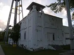 Old Wishek City Hall |
October 4, 2005 (#05001141) | July 14, 2015 | 21 Centennial St. 46°15′30″N 99°33′28″W |
Wishek |
McKenzie County
| [6] | Name on the Register | Image | Date listed[7] | Location | City or town | Description |
|---|---|---|---|---|---|---|
| 1 | Fairview Lift Bridge | 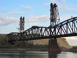 Fairview Lift Bridge |
March 14, 1997 (#97000239) |
Abandoned railroad line over the Yellowstone River, approximately 0.75 miles south of ND 200 47°55′44″N 103°57′55″W |
Cartwright | |
| 2 | Fort Union Trading Post National Historic Site | 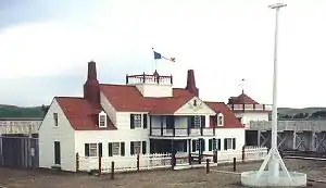 Fort Union Trading Post National Historic Site |
October 15, 1966 (#66000103) |
15550 Highway 1804 47°59′58″N 104°02′13″W |
Williston vicinity | |
| 3 | Grassy Butte Post Office | 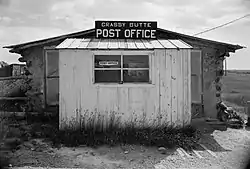 Grassy Butte Post Office |
November 26, 1980 (#80002919) |
Off U.S. Route 85 47°23′39″N 103°14′48″W |
Grassy Butte | |
| 4 | Sandstone School | April 11, 2008 (#08000278) |
29th St., NW. 47°50′27″N 103°19′21″W |
Keene |
McLean County
| [6] | Name on the Register | Image | Date listed[7] | Location | City or town | Description |
|---|---|---|---|---|---|---|
| 1 | Former McLean County Courthouse | 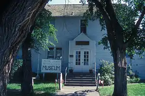 Former McLean County Courthouse |
November 14, 1985 (#85002987) |
Main St. 47°17′23″N 101°01′44″W |
Washburn | |
| 2 | Fort Buford Stage Road | October 25, 2019 (#100004540) |
Fort Buford Stage Rd. Coordinates missing |
Washburn | ||
| 3 | Holy Trinity Ukrainian Greek Orthodox Church | 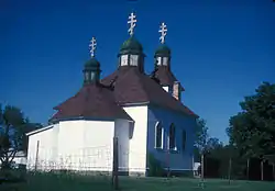 Holy Trinity Ukrainian Greek Orthodox Church |
October 22, 1982 (#82001344) |
Bismarck Ave. and 6th St. 47°09′35″N 100°47′24″W |
Wilton | |
| 4 | Ingersoll School | March 31, 2010 (#10000139) |
11 miles north on Alt 200, right 2 miles on Hwy 200, turn right for .4 mile on gravel 47°27′06″N 100°59′32″W |
Washburn | ||
| 5 | Semevolos Farm | October 16, 1987 (#87001788) |
Southeast of Butte 47°49′47″N 100°36′35″W |
Butte | ||
| 6 | Soo Line Depot | 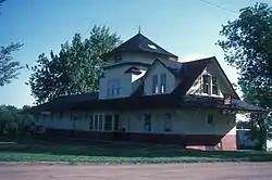 Soo Line Depot |
March 29, 1978 (#78003079) |
1st St. and McLean Ave. 47°09′32″N 100°46′59″W |
Wilton | |
| 7 | Freborg Homestead | September 10, 2014 (#14000625) |
3231 2ndt St. NW 47°26′39″N 101°15′10″W |
Underwood | ||
| 8 | Zion Lutheran Cemetery, Wrought-Iron Cross Site | 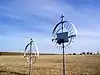 Zion Lutheran Cemetery, Wrought-Iron Cross Site |
October 23, 1989 (#89001684) |
Address Restricted |
Mercer |
Former listing
| [6] | Name on the Register | Image | Date listed | Date removed | Location | City or town | Summary |
|---|---|---|---|---|---|---|---|
| 1 | McLean County Courthouse | 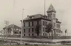 McLean County Courthouse |
November 14, 1985 (#85002998) | June 15, 2013 | 5th Ave. 47°17′27″N 101°01′34″W |
Washburn | Demolished in 2013.[13][14] |
Mercer County
| [6] | Name on the Register | Image | Date listed[7] | Location | City or town | Description |
|---|---|---|---|---|---|---|
| 1 | Beulah School |  Beulah School |
September 30, 1997 (#97001200) |
205 2nd St., NW. 47°15′54″N 101°46′48″W |
Beulah | |
| 2 | Big Hidatsa Village Site | 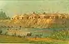 Big Hidatsa Village Site |
October 15, 1966 (#66000600) |
Northern bank of the Knife River, 1 mile north of Stanton 47°21′42″N 101°23′18″W |
Stanton | |
| 3 | Fort Clark Archeological District | 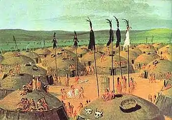 Fort Clark Archeological District |
October 19, 1986 (#86002800) |
ND 200 Alternate 47°15′10″N 101°16′27″W |
Stanton | |
| 4 | High Butte Effigy and Village Site (32ME13) | May 22, 1978 (#78001991) |
Address Restricted |
Riverdale | ||
| 5 | Knife River Bridge near Stanton | April 25, 2001 (#01000428) |
County road 4 miles west and 1 mile north of Stanton 47°19′36″N 101°28′07″W |
Stanton | ||
| 6 | Knife River Indian Villages National Historic Site Archeological District |  Knife River Indian Villages National Historic Site Archeological District |
October 26, 1974 (#74002220) |
North of Stanton on both sides of the Knife River[15] 47°20′23″N 101°22′56″W |
Stanton | |
| 7 | Fred Krause House |  Fred Krause House |
April 14, 1992 (#92000344) |
321 W. Main St. 47°17′39″N 101°37′43″W |
Hazen | |
| 8 | St. Paul's Lutheran Church |  St. Paul's Lutheran Church |
June 25, 2005 (#05000625) |
4474 1st, NW. 47°25′53″N 101°29′54″W |
Hazen |
Former listing
| [6] | Name on the Register | Image | Date listed | Date removed | Location | City or town | Summary |
|---|---|---|---|---|---|---|---|
| 1 | Hazen High School | August 12, 1977 (#77001026) | March 15, 1991 | 400 Central Ave. |
Hazen |
Morton County
| [6] | Name on the Register | Image | Date listed[7] | Location | City or town | Description |
|---|---|---|---|---|---|---|
| 1 | Stuart Dunlap House | June 8, 1992 (#92000587) |
201 7th Ave. 46°49′34″N 100°54′02″W |
Mandan | ||
| 2 | German Evangelical St. Johns Church-Deutsche Evangelische St. Johannes Kirche |  German Evangelical St. Johns Church-Deutsche Evangelische St. Johannes Kirche |
January 11, 2001 (#00001642) |
624 Church Ave. 46°54′13″N 102°02′48″W |
Hebron | |
| 3 | Hotel Brown |  Hotel Brown |
June 23, 2014 (#14000335) |
202 Main St. N. 46°27′15″N 101°13′56″W |
Flasher | |
| 4 | Huff State Historic Site (32MO11) | 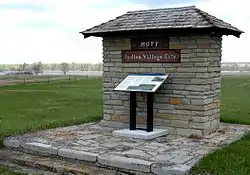 Huff State Historic Site (32MO11) |
July 23, 1980 (#80002920) |
Southeast of Huff 46°37′07″N 100°38′32″W |
Huff | |
| 5 | Lewis and Clark Hotel | .jpg.webp) Lewis and Clark Hotel |
May 9, 1983 (#83001938) |
404 W. Main St. 46°49′33″N 100°53′40″W |
Mandan | |
| 6 | Mandan Commercial Historic District |  Mandan Commercial Historic District |
February 21, 1985 (#85000341) |
Roughly bounded by Main and 1st Sts. between 1st Ave., NE. and 4th Ave., NW. 46°49′36″N 100°53′35″W |
Mandan | |
| 7 | Mandan High School | July 24, 2017 (#100001364) |
406 4th St. 46°49′49″N 100°53′46″W |
Mandan | ||
| 8 | Louis Rehm Barn |  Louis Rehm Barn |
January 31, 1994 (#93001550) |
2.5 miles north of Hebron 46°55′36″N 102°03′48″W |
Hebron | |
| 9 | Sunnyside Farm Barn | January 19, 1996 (#95001550) |
Approximately 1.7 miles west of Mandan, 0.5 miles south of W. Main St. on the southern side of Dead Heart Slough 46°49′14″N 100°56′49″W |
Mandan | ||
| 10 | Welsh House | April 22, 1980 (#80002921) |
208 5th Ave., NW. 46°49′38″N 100°53′49″W |
Mandan |
Former listing
| [6] | Name on the Register | Image | Date listed | Date removed | Location | City or town | Summary |
|---|---|---|---|---|---|---|---|
| 9 | State Training School Historic District | January 19, 1996 (#95001549) | July 16, 2018 | Western bank of the Heart River, 0.5 miles south of W. Main St., on the western edge of Mandan 46°48′32″N 100°54′49″W |
Mandan |
Mountrail County
| [6] | Name on the Register | Image | Date listed[7] | Location | City or town | Description |
|---|---|---|---|---|---|---|
| 1 | Assyrian Muslim Cemetery | July 17, 2018 (#100002693) |
1/4 mi. S of US 2 on 87th Ave. NW 48°18′20″N 102°30′17″W |
Ross vicinity | ||
| 2 | Evans Site | February 8, 1980 (#80002922) |
Address Restricted |
New Town | ||
| 3 | Great Northern Railway Underpass | February 27, 1997 (#97000182) |
Burlington Northern Santa Fe Railway tracks over ND 8 at the northern end of Stanley 48°19′11″N 102°23′24″W |
Stanley | ||
| 4 | Mountrail County Courthouse |  Mountrail County Courthouse |
December 22, 1978 (#78001992) |
N. Main St. 48°19′16″N 102°23′27″W |
Stanley | |
| 5 | Wabek Consolidated School |  Wabek Consolidated School |
October 22, 2019 (#100004541) |
3825 64th Ave. NW 47°58′01″N 101°57′30″W |
Plaza vicinity | Two-room schoolhouse formed by moving two one-room schoolhouses together in 1917 |
Nelson County
| [6] | Name on the Register | Image | Date listed[7] | Location | City or town | Description |
|---|---|---|---|---|---|---|
| 1 | Episcopal Church of the Good Shepard-Lakota |  Episcopal Church of the Good Shepard-Lakota |
October 10, 2017 (#100001743) |
216 D Ave. W. 48°02′37″N 98°20′44″W |
Lakota | |
| 2 | Nesheim Bridge | February 27, 1997 (#97000185) |
Unnamed county road across the Sheyenne River, approximately 2 miles southwest of McVille 47°44′15″N 98°13′06″W |
McVille | ||
| 3 | Old Settler's Pavilion | June 12, 2010 (#10000366) |
63 Pavilion Rd. 47°52′13″N 98°21′20″W |
Pekin | ||
| 4 | Tofthagen Library Museum |  Tofthagen Library Museum |
September 26, 1991 (#91001467) |
116 W. B Ave. 48°02′30″N 98°20′41″W |
Lakota |
Oliver County
| [6] | Name on the Register | Image | Date listed[7] | Location | City or town | Description |
|---|---|---|---|---|---|---|
| 1 | Cross Ranch Archeological District | November 4, 1985 (#85003484) |
Cross Ranch Nature Preserve 47°13′00″N 101°00′00″W |
Hensler |
Pierce County
| [6] | Name on the Register | Image | Date listed[7] | Location | City or town | Description |
|---|---|---|---|---|---|---|
| 1 | Great Northern Passenger Depot |  Great Northern Passenger Depot |
September 26, 1991 (#91001466) |
201 W. Dewey St. 48°22′10″N 99°59′50″W |
Rugby | |
| 2 | Old Mt. Carmel Cemetery, Wrought-Iron Cross Site | 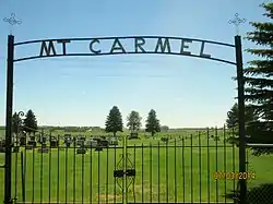 Old Mt. Carmel Cemetery, Wrought-Iron Cross Site |
October 23, 1989 (#89001685) |
Address Restricted |
Balta | |
| 3 | Pierce County Courthouse | 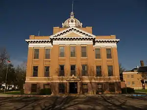 Pierce County Courthouse |
November 25, 1980 (#80002924) |
In Rugby 48°22′06″N 99°59′26″W |
Rugby | |
| 4 | St. Anselm's Cemetery, Wrought-Iron Cross Site | 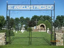 St. Anselm's Cemetery, Wrought-Iron Cross Site |
October 23, 1989 (#89001681) |
Address Restricted |
Berwick | |
| 5 | St. Mathias Cemetery, Wrought-Iron Cross Site | October 23, 1989 (#89001680) |
Address Restricted |
Orrin | ||
| 6 | St. Paul's Episcopal Church | December 3, 1992 (#92001608) |
404 DeSmet St., now 312 2nd Ave., S.W. 48°21′58″N 99°59′55″W |
Rugby | ||
| 7 | US Post Office-Rugby | 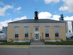 US Post Office-Rugby |
November 1, 1989 (#89001748) |
205 SE. 2nd St. 48°22′12″N 99°59′38″W |
Rugby |
Ransom County
| [6] | Name on the Register | Image | Date listed[7] | Location | City or town | Description |
|---|---|---|---|---|---|---|
| 1 | Biesterfeldt Site (32RM1) | February 8, 1980 (#80002925) |
Southern side of the Sheyenne River along 140th Ave.[16] 46°23′46″N 97°29′11″W |
Lisbon | ||
| 2 | Bradford Hotel | .jpg.webp) Bradford Hotel |
October 1, 1987 (#87001766) |
18 4th Ave. W. 46°26′34″N 97°40′56″W |
Lisbon | |
| 3 | Colton's Crossing Bridge | February 27, 1997 (#97000186) |
Unnamed county road across the Sheyenne River, approximately 2 miles south and 2 miles east of Lisbon 46°23′02″N 97°37′58″W |
Lisbon | ||
| 4 | Lisbon Bridge | 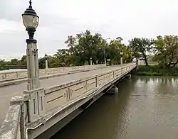 Lisbon Bridge |
February 27, 1997 (#97000184) |
Across the Sheyenne River, ND 32 at the northern end of Lisbon 46°26′49″N 97°40′52″W |
Lisbon | |
| 5 | Lisbon Opera House | 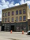 Lisbon Opera House |
October 18, 1979 (#79003727) |
413 Main Ave. 46°26′32″N 97°40′50″W |
Lisbon | |
| 6 | Mizpah Lodge Building | August 24, 2005 (#05000913) |
260 Front St. 46°40′44″N 98°42′53″W |
Sheldon | ||
| 7 | Ransom County Courthouse | 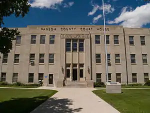 Ransom County Courthouse |
November 25, 1985 (#85002988) |
5th Ave., W. 46°26′32″N 97°41′04″W |
Lisbon | |
| 8 | US Post Office-Lisbon | 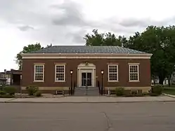 US Post Office-Lisbon |
November 1, 1989 (#89001749) |
17 W. 4th Ave. 46°26′32″N 97°40′55″W |
Lisbon | |
| 9 | T. J. Walker Historic District | 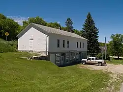 T. J. Walker Historic District |
December 5, 1979 (#79001774) |
At the Sheyenne River 46°31′18″N 97°55′49″W |
Fort Ransom |
Renville County
| [6] | Name on the Register | Image | Date listed[7] | Location | City or town | Description |
|---|---|---|---|---|---|---|
| 1 | McKinney Cemetery | December 28, 1978 (#78001994) |
North of Tolley 48°45′33″N 101°47′01″W |
Tolley | ||
| 2 | Renville County Courthouse | 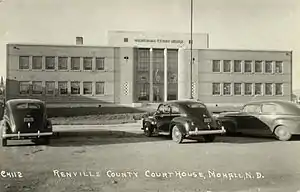 Renville County Courthouse |
November 25, 1985 (#85002989) |
Main St. 48°45′49″N 101°30′32″W |
Mohall |
Rolette County
| [6] | Name on the Register | Image | Date listed[7] | Location | City or town | Description |
|---|---|---|---|---|---|---|
| 1 | Urbain Cote Round Barn | 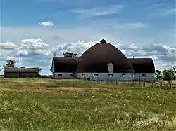 Urbain Cote Round Barn |
October 7, 1986 (#86002755) |
ND 38 47°38′40″N 100°03′30″W |
Dunseith | |
| 2 | Coghlan Castle | 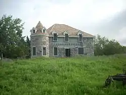 Coghlan Castle |
July 16, 2008 (#08000681) |
Lot 2, SW 1/4 of the NW 1/4 T163N R69W Section 19 48°55′49″N 99°39′18″W |
St. John | |
| 3 | U.S. Inspection Station-St. John, North Dakota |  U.S. Inspection Station-St. John, North Dakota |
September 10, 2014 (#14000588) |
ND 30 48°59′56″N 99°39′31″W |
St. John |
Sargent County
| [6] | Name on the Register | Image | Date listed[7] | Location | City or town | Description |
|---|---|---|---|---|---|---|
| 1 | Sargent County Courthouse | 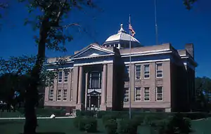 Sargent County Courthouse |
November 25, 1980 (#80002927) |
355 Main St S 46°06′23″N 97°38′13″W |
Forman |
Sheridan County
| [6] | Name on the Register | Image | Date listed[7] | Location | City or town | Description |
|---|---|---|---|---|---|---|
| 1 | Clark House | June 25, 2013 (#13000453) |
322 McKinley Ave 47°28′27″N 100°07′37″W |
Goodrich | ||
| 2 | Sheridan County Courthouse |  Sheridan County Courthouse |
November 25, 1985 (#85002990) |
215 E. 2nd St. 47°29′04″N 100°26′25″W |
McClusky |
Former listing
| [6] | Name on the Register | Image | Date listed | Date removed | Location | City or town | Summary |
|---|---|---|---|---|---|---|---|
| 1 | Winter House | November 29, 1979 (#79001775) | April 1, 2009 | Northeastern Sheridan County 47°38′12″N 100°05′01″W |
Goodrich |
Sioux County
Former listing
| [6] | Name on the Register | Image | Date listed | Date removed | Location | City or town | Summary |
|---|---|---|---|---|---|---|---|
| 1 | Former Sioux County Courthouse | .jpg.webp) Former Sioux County Courthouse |
November 19, 1985 (#85002993) | October 21, 2009 | Belden St. 46°05′08″N 100°37′51″W |
Fort Yates | NRHP nomination termed this "rather plain" but suggested it was worthwhile to list in order to promote local awareness of historic preservation, given no nearby NRHP listings |
Slope County
| [6] | Name on the Register | Image | Date listed[7] | Location | City or town | Description |
|---|---|---|---|---|---|---|
| 1 | H-T Ranch | July 5, 1985 (#85001491) |
10 miles west of Amidon 46°29′22″N 103°31′56″W |
Amidon | ||
| 2 | Mystic Theatre | 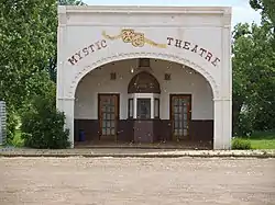 Mystic Theatre |
September 13, 1977 (#77001029) |
Main St. 46°17′49″N 103°55′29″W |
Marmarth |
Former listing
| [6] | Name on the Register | Image | Date listed | Date removed | Location | City or town | Summary |
|---|---|---|---|---|---|---|---|
| 1 | Original Slope County Courthouse | 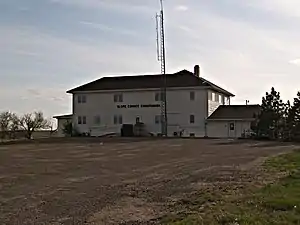 Original Slope County Courthouse |
November 14, 1985 (#85002994) | April 3, 2015 | 2nd St. 46°28′54″N 103°19′19″W |
Amidon | Was the last standing wooden courthouse in North Dakota. Demolished in October 2014.[17] |
Stark County
| [6] | Name on the Register | Image | Date listed[7] | Location | City or town | Description |
|---|---|---|---|---|---|---|
| 1 | Dickinson (Carnegie Area) Public Library | 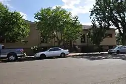 Dickinson (Carnegie Area) Public Library |
July 31, 2008 (#08000735) |
139 3rd St., W. 46°52′55″N 102°47′14″W |
Dickinson | |
| 2 | Dickinson State Normal School Campus District |  Dickinson State Normal School Campus District |
March 28, 1997 (#97000285) |
Roughly bounded by State Ave., Fairway St., 8th Ave., W., and 2nd St., W. 46°52′56″N 102°47′54″W |
Dickinson | |
| 3 | Elks Club and Store Building--Dickenson Lodge#1137 | 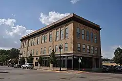 Elks Club and Store Building--Dickenson Lodge#1137 |
April 11, 2008 (#08000280) |
103 1st Ave., W. 46°52′48″N 102°47′13″W |
Dickinson | |
| 4 | Stark County Courthouse | 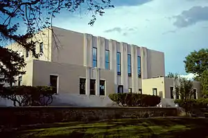 Stark County Courthouse |
November 25, 1985 (#85002991) |
3rd St., N. 46°52′56″N 102°47′02″W |
Dickinson | |
| 5 | US Post Office-Dickinson | 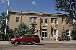 US Post Office-Dickinson |
November 1, 1989 (#89001757) |
15 E. 1st St. 46°52′48″N 102°47′02″W |
Dickinson |
Former listing
| [6] | Name on the Register | Image | Date listed | Date removed | Location | City or town | Summary |
|---|---|---|---|---|---|---|---|
| 1 | Gerhardt Octagonal Pig House | October 7, 1986 (#86002758) | July 14, 2015 | ND 38 46°52′28″N 102°29′37″W |
Gladstone |
Steele County
| [6] | Name on the Register | Image | Date listed[7] | Location | City or town | Description |
|---|---|---|---|---|---|---|
| 1 | Baldwin's Arcade | 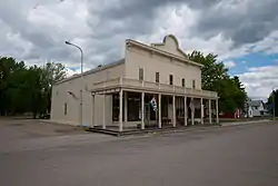 Baldwin's Arcade |
February 18, 1975 (#75001306) |
Steele Ave. and 3rd St. 47°19′21″N 97°43′15″W |
Hope | |
| 2 | Beaver Creek Bridge | February 27, 1997 (#97000183) |
Unnamed county road across Beaver Creek, approximately 13 miles east and 4 miles north of Finley 47°35′16″N 97°33′28″W |
Finley | ||
| 3 | Steele County Courthouse | 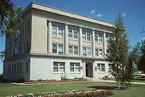 Steele County Courthouse |
November 14, 1985 (#85002995) |
201 Washington Ave. 47°30′52″N 97°50′16″W |
Finley |
Towner County
| [6] | Name on the Register | Image | Date listed[7] | Location | City or town | Description |
|---|---|---|---|---|---|---|
| 1 | Towner County Courthouse | 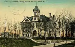 Towner County Courthouse |
November 14, 1985 (#85002996) |
2nd St., S. 48°29′36″N 99°12′20″W |
Cando |
Wells County
| [6] | Name on the Register | Image | Date listed[7] | Location | City or town | Description |
|---|---|---|---|---|---|---|
| 1 | Beiseker Mansion | April 13, 1977 (#77001036) |
2nd St. and Roberts Ave. 47°38′56″N 99°37′17″W |
Fessenden | ||
| 2 | Harvey Power Plant | June 5, 2020 (#100005273) |
SE corner of US 52 Bus. and Judy Blvd. 47°45′56″N 99°55′17″W |
Harvey | ||
| 3 | Hurd Round House | April 11, 1977 (#77001038) |
7 miles southeast of Hurdsfield 47°23′05″N 99°52′28″W |
Hurdsfield vicinity | ||
| 4 | Vang Evangelical Lutheran Church | 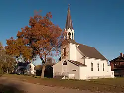 Vang Evangelical Lutheran Church |
June 21, 2001 (#01000674) |
200 W. LeGrand St. 47°41′43″N 99°45′02″W |
Manfred | |
| 5 | Wells County Courthouse | 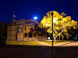 Wells County Courthouse |
September 15, 1977 (#77001037) |
Railway St., N. 47°38′56″N 99°37′29″W |
Fessenden | |
| 7 | Wells County Fairgrounds | February 28, 1991 (#91000073) |
Junction of U.S. Route 52 and ND 15 47°38′38″N 99°37′26″W |
Fessenden |
Williams County
| [6] | Name on the Register | Image | Date listed[7] | Location | City or town | Description |
|---|---|---|---|---|---|---|
| 1 | Creaser Building | July 11, 2016 (#16000442) |
224 Main St. 48°08′44″N 103°37′18″W |
Williston | ||
| 2 | Fort Buford State Historic Site | 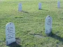 Fort Buford State Historic Site |
April 1, 1975 (#75001308) |
Southwest of Williston at the confluence of the Yellowstone and Missouri Rivers 47°59′02″N 103°59′34″W |
Williston | |
| 3 | Fort Union Trading Post National Historic Site | Fort Union Trading Post National Historic Site |
October 15, 1966 (#66000103) |
15550 Highway 1804 47°59′58″N 104°02′13″W |
Williston | |
| 4 | James Memorial Library |  James Memorial Library |
November 14, 1979 (#79001777) |
621 1st Ave., W. 48°09′00″N 103°37′26″W |
Williston | |
| 5 | Old Armory | 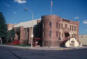 Old Armory |
April 11, 1985 (#85000787) |
320 1st Ave., E. 48°08′51″N 103°37′10″W |
Williston | |
| 6 | Old US Post Office |  Old US Post Office |
October 22, 1979 (#79003729) |
322 Main Ave. 48°08′50″N 103°37′30″W |
Williston | |
| 7 | Ray Opera House |  Ray Opera House |
November 2, 1978 (#78001997) |
111 Main St. 48°20′41″N 103°10′00″W |
Ray | |
| 8 | Williston High School | June 27, 2011 (#11000413) |
612 1st Ave. W. 48°08′58″N 103°37′26″W |
Williston |
See also
References
| Wikimedia Commons has media related to National Register of Historic Places in North Dakota. |
- "National Register of Historic Places: Weekly List Actions". National Park Service, United States Department of the Interior. Retrieved on January 29, 2021.
- "National Register Information System". National Register of Historic Places. National Park Service. April 24, 2008.
- "National Register of Historic Places: Weekly List Actions". National Park Service. Retrieved January 2, 2009.
- Weekly List Actions, National Register of Historic Places website
- Ridge Trail Historic District is listed in both Walsh and Pembina counties. Fort Union Trading Post National Historic Site is listed in both McKenzie and Williams counties (as well as Richland and Roosevelt counties, Montana). Custer Military Trail Historic Archaeological District is listed in Billings and Golden Valley counties.
- Numbers represent an alphabetical ordering by significant words. Various colorings, defined here, differentiate National Historic Landmarks and historic districts from other NRHP buildings, structures, sites or objects.
- The eight-digit number below each date is the number assigned to each location in the National Register Information System database, which can be viewed by clicking the number.
- Hiemstra, Damita. National Historic Landmark Nomination/Registration: Lynch Quarry Site. National Park Service, 2008-06, 1.
- "Archived copy". Archived from the original on 2013-06-02. Retrieved 2011-07-29.CS1 maint: archived copy as title (link)
- Diocese of Bismarck. "Diocese of Bismarck 2013 Catholic Directory", 2013, 10. Accessed 2013-05-01.
- "Medicine Rock". Geographic Names Information System. United States Geological Survey.
- "Oscar Zero Missile Alert Facility & November-33 Missile Launch Facility". State Historical Society of North Dakota. Archived from the original on August 21, 2008. Retrieved January 17, 2009.
- http://www.grandforksherald.com/event/article/id/261681/group/homepage/
- http://bismarcktribune.com/news/state-and-regional/n-d-voters-to-decide-mclean-county-courthouse-s-future/article_07d71cee-d99c-11df-a0f1-001cc4c03286.html
- Weston, Timothy. "Acculturation in the Middle Missouri Valley as Reflected in Modified Bone Assemblages". Plains Anthropologist 38.142 (1993): 79-100: 80.
- Wood, W. Raymond. "Pottery Types from the Biesterfeldt Site, North Dakota". Plains Anthropologist 3 (1955): 3-12: 3.
| Topics | |
|---|---|
| Lists by state |
|
| Lists by insular areas | |
| Lists by associated state | |
| Other areas | |
| Related | |
| |
