National Register of Historic Places listings in Illinois
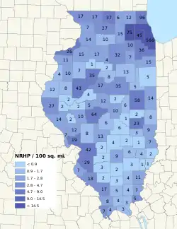
This is a list of properties and districts in Illinois that are on the National Register of Historic Places. There are over 1,800 in total. Of these, 85 are National Historic Landmarks. There are listings in all of the state's 102 counties.
- This National Park Service list is complete through NPS recent listings posted February 5, 2021.[1]
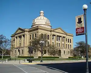
Lincoln Courthouse Square Historic District, Logan County
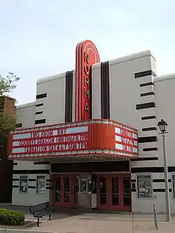
Normal Theatre, McLean County
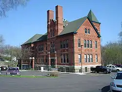
East Dubuque School, Jo Daviess County
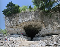
Cave-In-Rock, Hardin County
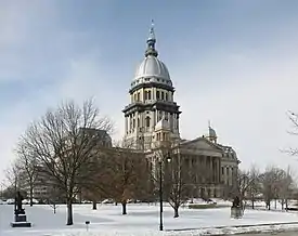
Illinois State Capitol, Sangamon County
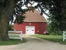
Dennis Otte Round Barn, Stephenson County
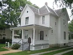
Ronald Reagan Boyhood Home, Lee County
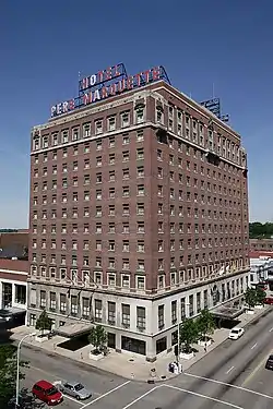
Pere Marquette Hotel, Peoria County
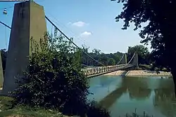
General Dean Suspension Bridge, Clinton County
Numbers of listings by county
| County | # of Sites | |
|---|---|---|
| 1 | Adams | 27 |
| 2 | Alexander | 7 |
| 3 | Bond | 2 |
| 4 | Boone | 6 |
| 5 | Brown | 2 |
| 6 | Bureau | 17 |
| 7 | Calhoun | 7 |
| 8 | Carroll | 7 |
| 9 | Cass | 2 |
| 10 | Champaign | 59 |
| 11 | Christian | 6 |
| 12 | Clark | 9 |
| 13 | Clay | 6 |
| 14 | Clinton | 2 |
| 15 | Coles | 21 |
| 16.1 | Cook: Chicago | 382 |
| 16.2 | Cook: Evanston | 61 |
| 16.3 | Cook: Other | 127 |
| Cook: Duplicates | (2)[2] | |
| Cook: Total | 567 | |
| 17 | Crawford | 7 |
| 18 | Cumberland | 3 |
| 19 | DeKalb | 15 |
| 20 | DeWitt | 2 |
| 21 | Douglas | 3 |
| 22 | DuPage | 48 |
| 23 | Edgar | 9 |
| 24 | Edwards | 1 |
| 25 | Effingham | 2 |
| 26 | Fayette | 4 |
| 27 | Ford | 5 |
| 28 | Franklin | 3 |
| 29 | Fulton | 42 |
| 30 | Gallatin | 6 |
| 31 | Greene | 12 |
| 32 | Grundy | 7 |
| 33 | Hamilton | 4 |
| 34 | Hancock | 13 |
| 35 | Hardin | 5 |
| 36 | Henderson | 4 |
| 37 | Henry | 15 |
| 38 | Iroquois | 6 |
| 39 | Jackson | 17 |
| 40 | Jasper | 1 |
| 41 | Jefferson | 2 |
| 42 | Jersey | 19 |
| 43 | Jo Daviess | 17 |
| 44 | Johnson | 4 |
| 45 | Kane | 75 |
| 46 | Kankakee | 15 |
| 47 | Kendall | 10 |
| 48 | Knox | 7 |
| 49 | LaSalle | 32 |
| 50 | Lake | 96 |
| 51 | Lawrence | 2 |
| 52 | Lee | 10 |
| 53 | Livingston | 13 |
| 54 | Logan | 12 |
| 55 | Macon | 10 |
| 56 | Macoupin | 8 |
| 57 | Madison | 42 |
| 58 | Marion | 8 |
| 59 | Marshall | 2 |
| 60 | Mason | 4 |
| 61 | Massac | 3 |
| 62 | McDonough | 8 |
| 63 | McHenry | 13 |
| 64 | McLean | 34 |
| 65 | Menard | 5 |
| 66 | Mercer | 11 |
| 67 | Monroe | 7 |
| 68 | Montgomery | 13 |
| 69 | Morgan | 10 |
| 70 | Moultrie | 1 |
| 71 | Ogle | 27 |
| 72 | Peoria | 35 |
| 73 | Perry | 2 |
| 74 | Piatt | 6 |
| 75 | Pike | 14 |
| 76 | Pope | 3 |
| 77 | Pulaski | 4 |
| 78 | Putnam | 4 |
| 79 | Randolph | 18 |
| 80 | Richland | 4 |
| 81 | Rock Island | 27 |
| 82 | St. Clair | 30 |
| 83 | Saline | 4 |
| 84 | Sangamon | 64 |
| 85 | Schuyler | 2 |
| 86 | Scott | 2 |
| 87 | Shelby | 6 |
| 88 | Stark | 1 |
| 89 | Stephenson | 16 |
| 90 | Tazewell | 17 |
| 91 | Union | 8 |
| 92 | Vermilion | 13 |
| 93 | Wabash | 1 |
| 94 | Warren | 10 |
| 95 | Washington | 3 |
| 96 | Wayne | 3 |
| 97 | White | 11 |
| 98 | Whiteside | 14 |
| 99 | Will | 36 |
| 100 | Williamson | 5 |
| 101 | Winnebago | 38 |
| 102 | Woodford | 7 |
| (duplicates) | (9)[3] | |
| Total: | 1,901 | |
Bond County
| [4] | Name on the Register | Image | Date listed[5] | Location | City or town | Description |
|---|---|---|---|---|---|---|
| 1 | Greenville Public Library | 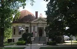 Greenville Public Library |
August 4, 1995 (#95000991) |
414 W. Main Avenue 38°53′30″N 89°24′57″W |
Greenville | |
| 2 | Old Main, Almira College |  Old Main, Almira College |
April 21, 1975 (#75000638) |
315 E. College St. 38°53′36″N 89°24′32″W |
Greenville | Hogue Hall at Greenville College. Demolished in 2008. |
Boone County
| [4] | Name on the Register | Image | Date listed[5] | Location | City or town | Description |
|---|---|---|---|---|---|---|
| 1 | Belvidere North State Street Historic District |  Belvidere North State Street Historic District |
June 6, 2012 (#12000324) |
State Street between Hurlbut Street & Kishwaukee River 42°15′38″N 88°50′39″W |
Belvidere | |
| 2 | Belvidere South State Street Historic District | 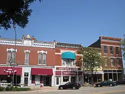 Belvidere South State Street Historic District |
June 6, 2012 (#12000325) |
State Street between Logan Avenue & Madison Street 42°15′21″N 88°50′23″W |
Belvidere | |
| 3 | Belvidere High School | 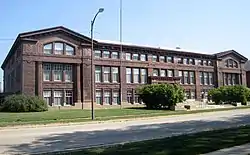 Belvidere High School |
July 25, 1997 (#97000815) |
Jct. of Pearl and First Sts. 42°15′17″N 88°50′27″W |
Belvidere | |
| 4 | Lampert-Wildflower House | 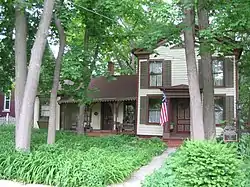 Lampert-Wildflower House |
August 12, 2005 (#05000870) |
410 East Lincoln Avenue 42°15′44″N 88°50′28″W |
Belvidere | |
| 5 | Pettit Memorial Chapel | 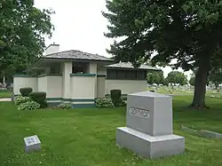 Pettit Memorial Chapel |
December 1, 1978 (#78001112) |
1100 N. Main St. 42°16′10″N 88°50′50″W |
Belvidere | |
| 6 | United States Post Office-Belvidere | 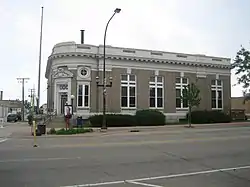 United States Post Office-Belvidere |
May 11, 2000 (#00000473) |
200 S. State St. 42°15′28″N 88°50′27″W |
Belvidere |
Brown County
| [4] | Name on the Register | Image | Date listed[5] | Location | City or town | Description |
|---|---|---|---|---|---|---|
| 1 | La Grange Lock and Dam Historic District | 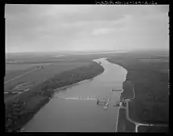 La Grange Lock and Dam Historic District |
March 10, 2004 (#04000170) |
0.75 miles (1.21 km) south of County Road 795N at the Illinois River 39°56′27″N 90°32′02″W |
Versailles | |
| 2 | Mount Sterling Commercial Historic District | 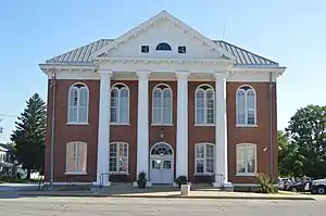 Mount Sterling Commercial Historic District |
May 8, 1987 (#87000724) |
Roughly bounded by Brown Co. Courthouse, Alley E of Capitol, South St., and Alley W of Capitol 39°59′12″N 90°45′51″W |
Mount Sterling |
Former listing
| [4] | Name on the Register | Image | Date listed | Date removed | Location | City or town | Summary |
|---|---|---|---|---|---|---|---|
| 1 | Benjamin Dewitt House | July 28, 1983 (#83000300) | December 8, 1995 | Address Restricted |
Versailles |
Cass County
| [4] | Name on the Register | Image | Date listed[5] | Location | City or town | Description |
|---|---|---|---|---|---|---|
| 1 | Beardstown Grand Opera House | 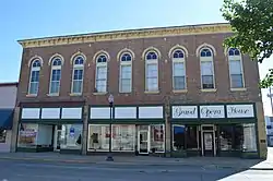 Beardstown Grand Opera House |
May 11, 2000 (#00000471) |
121 State St. 40°01′03″N 90°26′03″W |
Beardstown | |
| 2 | Andrew Cunningham Farm | 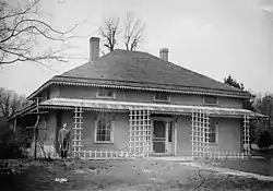 Andrew Cunningham Farm |
May 12, 1975 (#75000641) |
2.5 miles east of Virginia off Gridley Rd. 39°57′05″N 90°09′30″W |
Virginia |
Former listing
| [4] | Name on the Register | Image | Date listed | Date removed | Location | City or town | Summary |
|---|---|---|---|---|---|---|---|
| 1 | Park House | February 10, 1983 (#83000304) | December 8, 1995 | 200 W. 2nd St. |
Beardstown |
Christian County
| [4] | Name on the Register | Image | Date listed[5] | Location | City or town | Description |
|---|---|---|---|---|---|---|
| 1 | Bolivia Road Bridge | 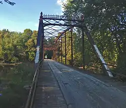 Bolivia Road Bridge |
January 28, 2004 (#03001464) |
Across the North Fork of the Sangamon River 39°46′03″N 89°20′44″W |
Bolivia | Extends into Sangamon County |
| 2 | Illinois State Bank Building | 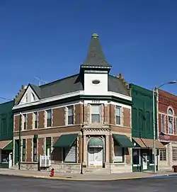 Illinois State Bank Building |
August 16, 1984 (#84000923) |
201 N. Chestnut St. 39°31′14″N 89°02′59″W |
Assumption | |
| 3 | Louis Jehle House |  Louis Jehle House |
April 20, 1995 (#95000490) |
511 E. 5th St. 39°23′02″N 89°04′33″W |
Pana | |
| 4 | Kitchell Park | 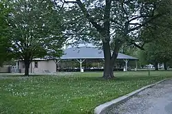 Kitchell Park |
November 5, 1992 (#92001538) |
Junction of 9th and Kitchell Sts. 39°22′43″N 89°04′47″W |
Pana | |
| 5 | Taylorville Chautauqua Auditorium |  Taylorville Chautauqua Auditorium |
January 21, 1988 (#87002519) |
Manners Park 39°32′23″N 89°17′45″W |
Taylorville | |
| 6 | Taylorville Courthouse Square Historic District |  Taylorville Courthouse Square Historic District |
December 2, 1985 (#85003058) |
Roughly bounded by Vine, Walnut, Adams, and Webster Sts. 39°32′53″N 89°17′42″W |
Taylorville |
Clay County
| [4] | Name on the Register | Image | Date listed[5] | Location | City or town | Description |
|---|---|---|---|---|---|---|
| 1 | Baltimore and Ohio Railroad Depot | 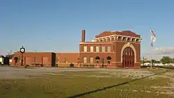 Baltimore and Ohio Railroad Depot |
February 20, 1998 (#98000112) |
225 W. Railroad St. 38°40′04″N 88°29′18″W |
Flora | |
| 2 | Clay County Courthouse | 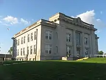 Clay County Courthouse |
May 18, 2015 (#15000224) |
300 Broadway St. 38°46′24″N 88°29′55″W |
Louisville | |
| 3 | Clay County Jail | 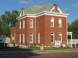 Clay County Jail |
August 6, 1998 (#98000986) |
195 Main St. 38°46′20″N 88°30′03″W |
Louisville | |
| 4 | Pearl and Bess Meyer House |  Pearl and Bess Meyer House |
February 9, 2001 (#01000084) |
233 E. 2nd St. 38°40′14″N 88°29′02″W |
Flora | |
| 5 | Paine House |  Paine House |
November 14, 1985 (#85002843) |
Rt. 1, Box 19 A 38°38′19″N 88°38′05″W |
Xenia | |
| 6 | Shriver House |  Shriver House |
May 9, 1983 (#83000306) |
117 E. 3rd St. 38°40′15″N 88°29′10″W |
Flora |
Clinton County
| [4] | Name on the Register | Image | Date listed[5] | Location | City or town | Description |
|---|---|---|---|---|---|---|
| 1 | General Dean Suspension Bridge | General Dean Suspension Bridge |
April 3, 1973 (#73000693) |
E of Carlyle over the Kaskaskia River 38°36′40″N 89°21′26″W |
Carlyle | |
| 2 | James C. Twiss House |  James C. Twiss House |
February 17, 2010 (#10000020) |
298 N. Page St. 38°36′40″N 89°36′22″W |
Aviston |
Cumberland County
| [4] | Name on the Register | Image | Date listed[5] | Location | City or town | Description |
|---|---|---|---|---|---|---|
| 1 | Cumberland County Courthouse | 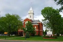 Cumberland County Courthouse |
June 11, 1981 (#81000220) |
Court House Sq. 39°16′21″N 88°14′41″W |
Toledo | |
| 2 | Greenup Commercial Historic District |  Greenup Commercial Historic District |
February 21, 1991 (#91000083) |
122 E.-123 W. Cumberland Street, 102 N.-203 S. Kentucky Street, 101 N. Mill Street and 101 E.-100 W. Illinois St. 39°14′47″N 88°09′51″W |
Greenup | |
| 3 | Thornton Ward Estate | 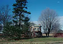 Thornton Ward Estate |
December 4, 2001 (#01001308) |
1387 U.S. Route 40 39°13′40″N 88°12′51″W |
Toledo |
DeWitt County
| [4] | Name on the Register | Image | Date listed[5] | Location | City or town | Description |
|---|---|---|---|---|---|---|
| 1 | Magill House | 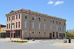 Magill House |
November 28, 2003 (#03001202) |
100 N. Center St. 40°09′12″N 88°57′39″W |
Clinton | |
| 2 | C. H. Moore House |  C. H. Moore House |
March 23, 1979 (#79003112) |
219 E. Woodlawn St. 40°09′38″N 88°57′29″W |
Clinton |
Douglas County
| [4] | Name on the Register | Image | Date listed[5] | Location | City or town | Description |
|---|---|---|---|---|---|---|
| 1 | Arcola Carnegie Public Library |  Arcola Carnegie Public Library |
May 9, 2002 (#02000459) |
407 E. Main St. 39°41′04″N 88°18′12″W |
Arcola | |
| 2 | Henson House | December 31, 2020 (#100005967) |
103 North Henson Rd. 39°51′48″N 88°09′03″W |
Villa Grove | ||
| 3 | Streibich Blacksmith Shop |  Streibich Blacksmith Shop |
February 21, 1991 (#91000086) |
1 N. Howard St. 39°47′53″N 87°58′58″W |
Newman |
Edwards County
| [4] | Name on the Register | Image | Date listed[5] | Location | City or town | Description |
|---|---|---|---|---|---|---|
| 1 | St. John's Episcopal Church |  St. John's Episcopal Church |
February 15, 2012 (#12000027) |
20 E. Cherry St. 38°22′32″N 88°03′27″W |
Albion |
Effingham County
| [4] | Name on the Register | Image | Date listed[5] | Location | City or town | Description |
|---|---|---|---|---|---|---|
| 1 | Effingham County Courthouse |  Effingham County Courthouse |
September 11, 1985 (#85002304) |
110 E. Jefferson St. 39°07′18″N 88°32′28″W |
Effingham | |
| 2 | Dr. Charles M. Wright House |  Dr. Charles M. Wright House |
May 8, 1986 (#86001018) |
3 W. Jackson St. 39°03′57″N 88°44′53″W |
Altamont |
Fayette County
| [4] | Name on the Register | Image | Date listed[5] | Location | City or town | Description |
|---|---|---|---|---|---|---|
| 1 | Floyd and Glenora Dycus House |  Floyd and Glenora Dycus House |
March 2, 2001 (#01000179) |
305 S. Second St. 38°59′41″N 88°57′09″W |
Brownstown | |
| 2 | First Presbyterian Church |  First Presbyterian Church |
March 24, 1982 (#82002534) |
301 W. Main St. 38°57′43″N 89°05′37″W |
Vandalia | |
| 3 | Little Brick House |  Little Brick House |
June 4, 1973 (#73000701) |
621 St. Clair Street 38°57′56″N 89°05′54″W |
Vandalia | |
| 4 | Vandalia Statehouse |  Vandalia Statehouse |
January 21, 1974 (#74000760) |
315 W. Gallatin St. 38°57′40″N 89°05′38″W |
Vandalia |
Former listings
| [4] | Name on the Register | Image | Date listed | Date removed | Location | City or town | Summary |
|---|---|---|---|---|---|---|---|
| 1 | Clarence Forehand Round Barn | December 7, 1982 (#82000394) | December 8, 1995 | West of Vandalia off Illinois Route 185 |
Vandalia | ||
| 2 | PRESIDENT | 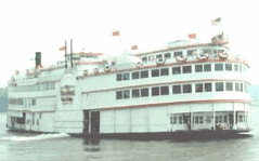 PRESIDENT |
December 20, 1989 (#89002460) | July 13, 2011 | Scattered over two acres in three separate locations around St. Elmo |
St. Elmo | Formerly a National Historic Landmark |
Ford County
| [4] | Name on the Register | Image | Date listed[5] | Location | City or town | Description |
|---|---|---|---|---|---|---|
| 1 | Dunnan-Hampton House | .jpg.webp) Dunnan-Hampton House |
May 22, 2007 (#07000455) |
511 W. Pells St. 40°27′46″N 88°06′15″W |
Paxton | |
| 2 | Paxton Carnegie Public Library | 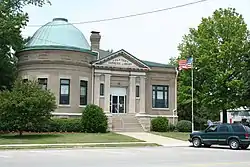 Paxton Carnegie Public Library |
May 9, 2002 (#02000463) |
254 S. Market St. 40°27′38″N 88°05′54″W |
Paxton | |
| 3 | Paxton First Schoolhouse |  Paxton First Schoolhouse |
January 29, 1980 (#80001354) |
406 E. Franklin St. 40°27′17″N 88°05′39″W |
Paxton | |
| 4 | Paxton Water Tower and Pump House |  Paxton Water Tower and Pump House |
November 13, 1984 (#84000302) |
145 S. Market St. 40°27′36″N 88°05′49″W |
Paxton | |
| 5 | Alfred Phillips House |  Alfred Phillips House |
February 5, 1999 (#99000113) |
404 N. Melvin St. 40°28′09″N 88°22′13″W |
Gibson City |
Franklin County
| [4] | Name on the Register | Image | Date listed[5] | Location | City or town | Description |
|---|---|---|---|---|---|---|
| 1 | Franklin County Jail | 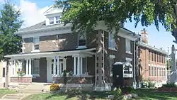 Franklin County Jail |
February 5, 1999 (#99000111) |
209 W. Main St. 37°59′49″N 88°55′21″W |
Benton | |
| 2 | Sesser Opera House | 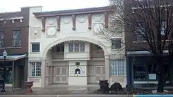 Sesser Opera House |
March 12, 1982 (#82002535) |
106 W. Franklin St. 38°05′31″N 89°03′02″W |
Sesser | |
| 3 | West Frankfort City Hall | 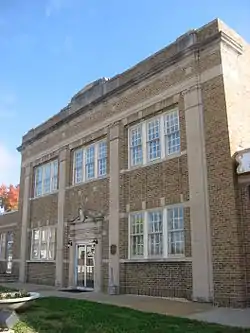 West Frankfort City Hall |
May 9, 2002 (#02000460) |
108 N. Emma St. 37°53′59″N 88°55′35″W |
West Frankfort |
Hamilton County
| [4] | Name on the Register | Image | Date listed[5] | Location | City or town | Description |
|---|---|---|---|---|---|---|
| 1 | Cloud State Bank | 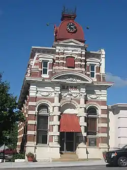 Cloud State Bank |
November 28, 1978 (#78001149) |
108 S. Washington St. 38°05′36″N 88°32′12″W |
McLeansboro | |
| 2 | Aaron G. Cloud House | 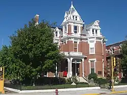 Aaron G. Cloud House |
April 15, 1978 (#78001150) |
164 S. Washington St. 38°05′35″N 88°32′12″W |
McLeansboro | |
| 3 | Chalon Guard and Emma Blades Cloud House | 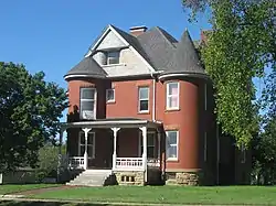 Chalon Guard and Emma Blades Cloud House |
February 18, 2009 (#09000026) |
300 S. Washington St. 38°05′29″N 88°32′13″W |
McLeansboro | |
| 4 | St. James Episcopal Church | 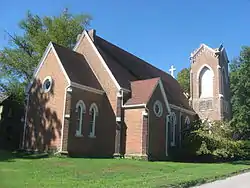 St. James Episcopal Church |
January 24, 1995 (#94001602) |
111 N. Pearl St. 38°05′42″N 88°32′16″W |
McLeansboro |
Hardin County
| [4] | Name on the Register | Image | Date listed[5] | Location | City or town | Description |
|---|---|---|---|---|---|---|
| 1 | Battery Rock |  Battery Rock |
November 5, 1998 (#98001257) |
West Bank, River Mile 860, Ohio River 37°31′46″N 88°04′52″W |
Cave-in-Rock | |
| 2 | Cave-in-Rock | Cave-in-Rock |
August 6, 1998 (#98000984) |
0.5 miles north of the town of Cave-In-Rock 37°28′02″N 88°09′34″W |
Cave-In-Rock | |
| 3 | Illinois Iron Furnace |  Illinois Iron Furnace |
March 7, 1973 (#73000704) |
Shawnee National Forest 37°29′58″N 88°19′41″W |
Rosiclare | |
| 4 | Orr-Herl Mound and Village Site |  Orr-Herl Mound and Village Site |
November 21, 1978 (#78001151) |
Northern bank of the Ohio River midway between Elizabethtown and Rosiclare[6] 37°26′04″N 88°19′39″W |
Rosiclare | |
| 5 | Rose Hotel | 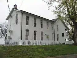 Rose Hotel |
December 26, 1972 (#72000461) |
S. Main St. 37°26′43″N 88°18′16″W |
Elizabethtown |
Henderson County
| [4] | Name on the Register | Image | Date listed[5] | Location | City or town | Description |
|---|---|---|---|---|---|---|
| 1 | Lock and Dam No. 18 Historic District |  Lock and Dam No. 18 Historic District |
March 10, 2004 (#04000178) |
1.5 mi. N of unnamed cty rd. from Gladstone 40°52′55″N 91°01′27″W |
Gladstone | Extends into Des Moines County, Iowa. |
| 2 | Oquawka Wagon Bridge | 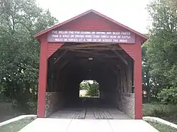 Oquawka Wagon Bridge |
February 24, 1975 (#75000660) |
2.5 miles (4.0 km) south of Oquawka over Henderson Creek 40°53′39″N 90°56′57″W |
Oquawka | |
| 3 | Alexis Phelps House | 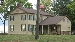 Alexis Phelps House |
April 28, 1982 (#82002537) |
On the Mississippi River 40°56′21″N 90°57′20″W |
Oquawka | |
| 4 | South Henderson Church and Cemetery | 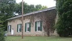 South Henderson Church and Cemetery |
October 14, 1976 (#76000709) |
East of Gladstone 40°52′23″N 90°54′48″W |
Gladstone |
Iroquois County
| [4] | Name on the Register | Image | Date listed[5] | Location | City or town | Description |
|---|---|---|---|---|---|---|
| 1 | Glenwood School | May 29, 2020 (#100005232) |
1398 East 800 North Rd. 40°36′08″N 87°51′42″W |
Cissna Park | ||
| 2 | Old Iroquois County Courthouse | 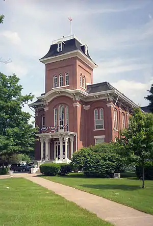 Old Iroquois County Courthouse |
June 13, 1975 (#75000663) |
Cherry Street at 2nd Street 40°46′28″N 87°44′09″W |
Watseka | |
| 3 | Prairie Dell Meetinghouse | 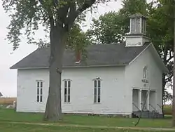 Prairie Dell Meetinghouse |
August 12, 2005 (#05000846) |
Junction of 2550 East and 2150 North Rd. 40°49′34″N 87°38′40″W |
Iroquois | |
| 4 | A. Herr and E. E. Smith Public Library | 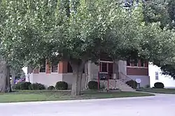 A. Herr and E. E. Smith Public Library |
August 4, 1995 (#95000992) |
105 Adams St. 40°31′04″N 88°04′14″W |
Loda | |
| 5 | St. Mary's Church |  St. Mary's Church |
May 2, 1996 (#96000514) |
308 St. Charles Avenue 40°57′08″N 87°39′09″W |
Beaverville | |
| 6 | Watseka Union Depot | 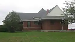 Watseka Union Depot |
December 22, 1999 (#99001595) |
S. 2nd St. 40°46′32″N 87°44′12″W |
Watseka | Originally listed in 1988; Ref #88003467. Delisted in early 1999 when it was moved from Cherry Street to current location. |
Jasper County
| [4] | Name on the Register | Image | Date listed[5] | Location | City or town | Description |
|---|---|---|---|---|---|---|
| 1 | Embarras River Bridge | 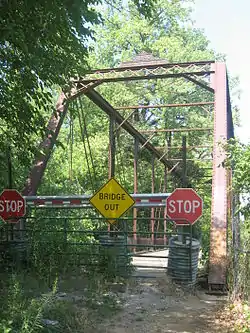 Embarras River Bridge |
May 20, 1998 (#98000472) |
Wade Township Road 164 over the Embarras River 38°59′43″N 88°09′43″W |
Newton |
Jefferson County
| [4] | Name on the Register | Image | Date listed[5] | Location | City or town | Description |
|---|---|---|---|---|---|---|
| 1 | Appellate Court, 5th District | 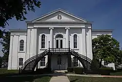 Appellate Court, 5th District |
July 2, 1973 (#73000705) |
14th and Main Sts. 38°19′02″N 88°54′30″W |
Mount Vernon | |
| 2 | C. H. Judd House |  C. H. Judd House |
December 8, 1983 (#83003571) |
Ina-Belle Rive Rd. 38°09′29″N 88°45′56″W |
Belle Rive |
Johnson County
| [4] | Name on the Register | Image | Date listed[5] | Location | City or town | Description |
|---|---|---|---|---|---|---|
| 1 | John Bridges Tavern and Store Site | 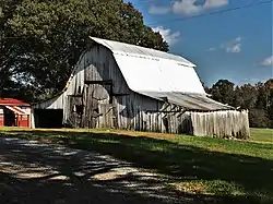 John Bridges Tavern and Store Site |
May 8, 2017 (#100000962) |
Illinois Route 146[7] 37°26′06″N 89°00′54″W |
Buncombe | |
| 2 | John Dupont House | 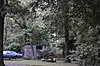 John Dupont House |
January 19, 2016 (#15000979) |
130 W. 5th St. 37°34′38″N 88°46′17″W |
New Burnside | |
| 3 | Johnson County Courthouse | 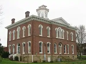 Johnson County Courthouse |
September 9, 2010 (#10000725) |
Courthouse Square 37°24′52″N 88°53′48″W |
Vienna | |
| 4 | Vienna Public Library | 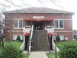 Vienna Public Library |
January 24, 1995 (#94001603) |
401 Poplar St. 37°24′49″N 88°53′47″W |
Vienna |
Lawrence County
| [4] | Name on the Register | Image | Date listed[5] | Location | City or town | Description |
|---|---|---|---|---|---|---|
| 1 | Bridge at Thirteenth Street | 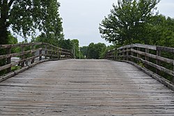 Bridge at Thirteenth Street |
April 26, 2016 (#16000198) |
13th St. between Clark and Johnson Sts. 38°35′34″N 87°39′12″W |
St. Francisville | |
| 2 | Lawrence County Courthouse | 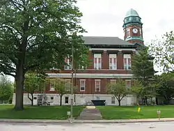 Lawrence County Courthouse |
December 7, 2010 (#10000992) |
1100 State St. 38°43′46″N 87°40′56″W |
Lawrenceville |
Marshall County
| [4] | Name on the Register | Image | Date listed[5] | Location | City or town | Description |
|---|---|---|---|---|---|---|
| 1 | Marshall Site |  Marshall Site |
August 25, 2014 (#14000508) |
Address Restricted |
Chillicothe | |
| 2 | Robert Waugh House | 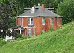 Robert Waugh House |
October 4, 1978 (#78001170) |
202 School Street 41°01′45″N 89°26′24″W |
Sparland |
Mason County
| [4] | Name on the Register | Image | Date listed[5] | Location | City or town | Description |
|---|---|---|---|---|---|---|
| 1 | Clear Lake Site | November 28, 1978 (#78001171) |
Junction of 1200E and 2600N in Sand Ridge State Park[8] 40°26′08″N 89°54′00″W |
Manito | Extends into Tazewell County | |
| 2 | Havana Public Library | 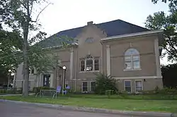 Havana Public Library |
February 16, 1994 (#94000014) |
201 W. Adams St. 40°17′57″N 90°03′45″W |
Havana | |
| 3 | Havana Water Tower | 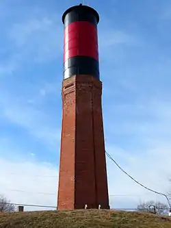 Havana Water Tower |
April 22, 1993 (#93000325) |
Northeastern corner of the junction of Pearl and Main Sts. 40°18′02″N 90°03′31″W |
Havana | |
| 4 | Rockwell Mound | 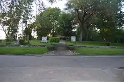 Rockwell Mound |
December 10, 1987 (#87000679) |
Rockwell Park at the northern end of Orange St.[9] 40°18′18″N 90°03′49″W |
Havana |
Massac County
| [4] | Name on the Register | Image | Date listed[5] | Location | City or town | Description |
|---|---|---|---|---|---|---|
| 1 | Elijah P. Curtis House | 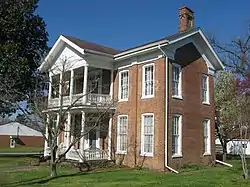 Elijah P. Curtis House |
June 9, 1978 (#78001172) |
405 Market St. 37°09′04″N 88°44′02″W |
Metropolis | |
| 2 | Fort Massac Site | 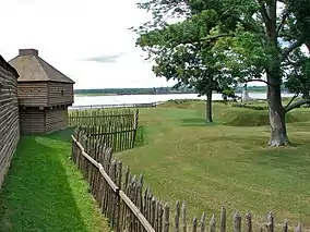 Fort Massac Site |
July 14, 1971 (#71000293) |
Southeast of Metropolis on the Ohio River 37°08′47″N 88°42′32″W |
Metropolis | |
| 3 | Kincaid Site |  Kincaid Site |
October 15, 1966 (#66000326) |
Newcut Rd.[10] 37°04′50″N 88°29′31″W |
Brookport | Extends into Pope County |
Former listing
| [4] | Name on the Register | Image | Date listed | Date removed | Location | City or town | Summary |
|---|---|---|---|---|---|---|---|
| 1 | R.W. McCartney Music Hall | August 13, 1986 (#86001490) | December 8, 1995 | 116-120 E. 4th St. |
Metropolis |
Menard County
| [4] | Name on the Register | Image | Date listed[5] | Location | City or town | Description |
|---|---|---|---|---|---|---|
| 1 | Lincoln's New Salem Village | 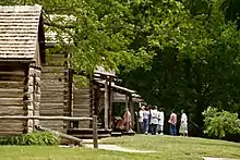 Lincoln's New Salem Village |
June 19, 1972 (#72000464) |
South of Petersburg in New Salem State Park 39°58′43″N 89°50′42″W |
Petersburg | |
| 2 | North Sangamon United Presbyterian Church | 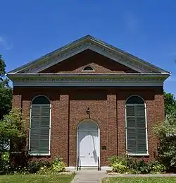 North Sangamon United Presbyterian Church |
March 23, 1979 (#79000858) |
North of Athens on Illinois Route 2 40°00′14″N 89°43′23″W |
Athens | |
| 3 | Petersburg Historic District | .jpg.webp) Petersburg Historic District |
June 17, 1976 (#76000722) |
Illinois Route 97; also the Smoot Hotel at the corner of 6th and Douglas 40°00′40″N 89°51′00″W |
Petersburg | Second set of boundaries represents a boundary increase of January 31, 1986 |
| 4 | Robinson-Bonnett Inn | 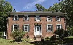 Robinson-Bonnett Inn |
August 3, 1990 (#90001198) |
Whites Crossing Rd., east of Clary Creek 40°04′31″N 89°59′18″W |
Bobtown | |
| 5 | Col. Matthew Rogers Building | 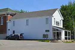 Col. Matthew Rogers Building |
May 22, 2005 (#05000431) |
200 S. Main St. 39°57′36″N 89°43′26″W |
Athens |
Moultrie County
| [4] | Name on the Register | Image | Date listed[5] | Location | City or town | Description |
|---|---|---|---|---|---|---|
| 1 | Moultrie County Courthouse | 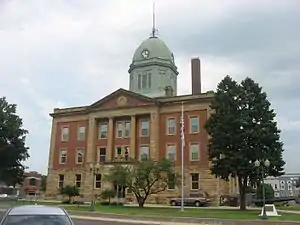 Moultrie County Courthouse |
April 20, 1995 (#95000489) |
10 S. Main St. 39°35′57″N 88°36′25″W |
Sullivan |
Perry County
| [4] | Name on the Register | Image | Date listed[5] | Location | City or town | Description |
|---|---|---|---|---|---|---|
| 1 | Du Quoin State Fairgrounds | 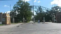 Du Quoin State Fairgrounds |
July 11, 1990 (#90000719) |
U.S. Route 51 north of its junction with Illinois Route 14 37°58′57″N 89°13′37″W |
Du Quoin | |
| 2 | Perry County Jail | 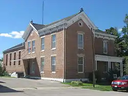 Perry County Jail |
August 10, 2000 (#00000943) |
108 W. Jackson St. 38°04′50″N 89°23′01″W |
Pinckneyville |
Piatt County
| [4] | Name on the Register | Image | Date listed[5] | Location | City or town | Description |
|---|---|---|---|---|---|---|
| 1 | Robert Allerton Estate | 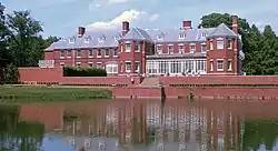 Robert Allerton Estate |
July 18, 2007 (#07000701) |
515 Old Timber Rd. 40°00′22″N 88°38′49″W |
Monticello | |
| 2 | Francis E. Bryant House | 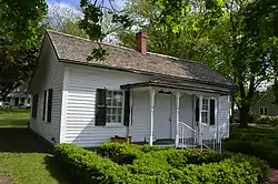 Francis E. Bryant House |
September 5, 2017 (#100001566) |
146 E. Wilson St. 39°55′24″N 88°34′19″W |
Bement | |
| 3 | Monticello Courthouse Square Historic District | 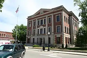 Monticello Courthouse Square Historic District |
November 5, 2009 (#08000400) |
Roughly bounded by Market, the railroad tracks, N. Hamilton, Independence, and Marion Sts. 40°01′30″N 88°34′21″W |
Monticello | |
| 4 | North State Street Historic District |  North State Street Historic District |
August 14, 1998 (#98001045) |
Roughly along N. State St. from the 300 block to the 1100 block 40°01′51″N 88°34′15″W |
Monticello | |
| 5 | South Charter Street Historic District |  South Charter Street Historic District |
January 17, 2002 (#01001464) |
Roughly bounded by Marion and S. Market Sts., Sage Dr., and S. State St. 40°01′17″N 88°34′24″W |
Monticello | |
| 6 | Voorhies Castle |  Voorhies Castle |
June 20, 1979 (#79000861) |
South of Bement 39°52′00″N 88°34′49″W |
Bement |
Pope County
| [4] | Name on the Register | Image | Date listed[5] | Location | City or town | Description |
|---|---|---|---|---|---|---|
| 1 | Golconda Historic District | 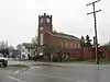 Golconda Historic District |
October 22, 1976 (#76000726) |
Illinois Route 146 37°22′00″N 88°29′04″W |
Golconda | |
| 2 | Kincaid Site |  Kincaid Site |
October 15, 1966 (#66000326) |
Newcut Rd.[10] 37°04′53″N 88°29′22″W |
Brookport | Extends into Massac County |
| 3 | Millstone Bluff |  Millstone Bluff |
October 15, 1973 (#73000716) |
Illinois Route 147 west of its junction with Illinois Route 145[11] 37°28′01″N 88°41′17″W |
Glendale |
Pulaski County
| [4] | Name on the Register | Image | Date listed[5] | Location | City or town | Description |
|---|---|---|---|---|---|---|
| 1 | Illinois Central Railroad Depot |  Illinois Central Railroad Depot |
August 18, 1999 (#99000978) |
Junction of Central Avenue and Ullin Avenue 37°16′38″N 89°11′05″W |
Ullin | |
| 2 | Mound City Civil War Naval Hospital |  Mound City Civil War Naval Hospital |
October 9, 1974 (#74002285) |
Commercial Avenue and Central Street 37°05′04″N 89°09′39″W |
Mound City | Destroyed by fire in 1976 |
| 3 | Mound City National Cemetery | 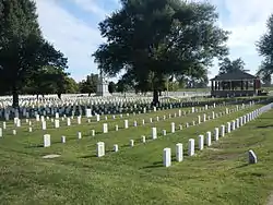 Mound City National Cemetery |
October 8, 1997 (#97001174) |
Junction of U.S. Route 51 and Illinois Route 37 37°05′14″N 89°10′41″W |
Mound City | |
| 4 | Olmstead Depot | 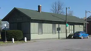 Olmstead Depot |
December 15, 1989 (#89002101) |
Front Street and Caledonia Avenue 37°10′52″N 89°05′20″W |
Olmsted |
Putnam County
| [4] | Name on the Register | Image | Date listed[5] | Location | City or town | Description |
|---|---|---|---|---|---|---|
| 1 | Clear Creek Meeting House | 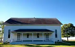 Clear Creek Meeting House |
November 5, 1992 (#92001534) |
14365 North 350th Avenue[12] 41°09′16″N 89°11′36″W |
McNabb | |
| 2 | Cortland Condit House | 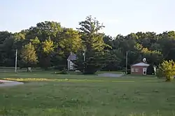 Cortland Condit House |
September 16, 1983 (#83000335) |
Off Illinois Route 29 41°10′53″N 89°23′46″W |
Putnam | |
| 3 | Edward Pulsifer House | 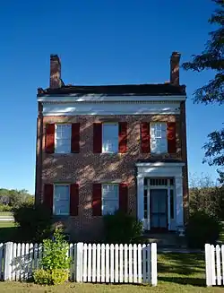 Edward Pulsifer House |
September 4, 1979 (#79000864) |
Illinois Route 71 41°15′27″N 89°20′27″W |
Hennepin | |
| 4 | Putnam County Courthouse | 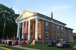 Putnam County Courthouse |
March 4, 1975 (#75000672) |
4th St. 41°15′12″N 89°20′33″W |
Hennepin |
Richland County
| [4] | Name on the Register | Image | Date listed[5] | Location | City or town | Description |
|---|---|---|---|---|---|---|
| 1 | Elliott Street Historic District |  Elliott Street Historic District |
November 26, 1980 (#80001405) |
S. Elliott Street between Chestnut Street and South Avenue 38°43′32″N 88°04′48″W |
Olney | |
| 2 | Ambrose Hopkinson House | 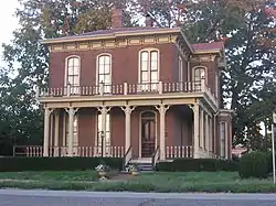 Ambrose Hopkinson House |
February 9, 2001 (#01000083) |
122 W. Elm St. 38°43′44″N 88°05′09″W |
Olney | |
| 3 | Larchmound |  Larchmound |
January 3, 1980 (#80001406) |
1030 S. Morgan St. 38°43′11″N 88°04′53″W |
Olney | |
| 4 | Olney Carnegie Library |  Olney Carnegie Library |
February 14, 2002 (#02000037) |
401 E. Main St. 38°43′51″N 88°04′57″W |
Olney |
Saline County
| [4] | Name on the Register | Image | Date listed[5] | Location | City or town | Description |
|---|---|---|---|---|---|---|
| 1 | Carrier Mills Archeological District |  Carrier Mills Archeological District |
August 25, 1978 (#78001184) |
Along the Saline River south of Carrier Mills[13] 37°39′28″N 88°37′04″W |
Carrier Mills | |
| 2 | Eldorado City Hall |  Eldorado City Hall |
November 7, 1995 (#95001237) |
1604 Locust St. 37°48′45″N 88°26′31″W |
Eldorado | |
| 3 | Harrisburg City Hall | 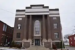 Harrisburg City Hall |
November 12, 1998 (#98001356) |
110 E. Locust 37°44′22″N 88°32′20″W |
Harrisburg | |
| 4 | Saline County Poor Farm | 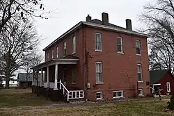 Saline County Poor Farm |
January 22, 2001 (#00001048) |
1600 Feazel Rd. 37°43′08″N 88°33′08″W |
Harrisburg |
Schuyler County
| [4] | Name on the Register | Image | Date listed[5] | Location | City or town | Description |
|---|---|---|---|---|---|---|
| 1 | Phoenix Opera House Block | 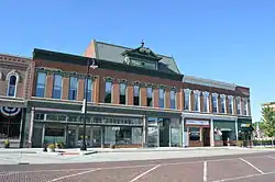 Phoenix Opera House Block |
May 9, 1985 (#85001010) |
112-122 W. Lafayette St. 40°07′14″N 90°33′47″W |
Rushville | |
| 2 | White Oak Hall | _Roads.jpg.webp) White Oak Hall |
February 5, 2003 (#02001757) |
Southeastern corner of the junction of White Oak and Lower Beardstown Rds. 40°06′32″N 90°31′09″W |
Rushville |
Scott County
| [4] | Name on the Register | Image | Date listed[5] | Location | City or town | Description |
|---|---|---|---|---|---|---|
| 1 | Naples Archeological District | December 22, 1979 (#79000869) |
Eastern bank of the Illinois River south of Naples[14] 39°44′18″N 90°37′06″W |
Naples | ||
| 2 | Winchester Historic District | 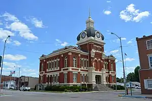 Winchester Historic District |
February 14, 1979 (#79000870) |
Illinois Route 106 39°37′44″N 90°27′19″W |
Winchester |
Shelby County
| [4] | Name on the Register | Image | Date listed[5] | Location | City or town | Description |
|---|---|---|---|---|---|---|
| 1 | Chautauqua Auditorium | 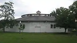 Chautauqua Auditorium |
January 30, 1978 (#78001190) |
Forest Park and NE. 9th St. 39°25′05″N 88°47′26″W |
Shelbyville | |
| 2 | Clarksburg Schoolhouse | 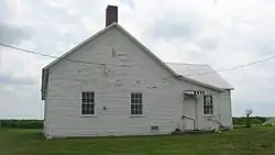 Clarksburg Schoolhouse |
January 25, 2001 (#00000952) |
Clarksburg Rd., 1 mile east of the junction of County Roads 800N and 2025E 39°19′56″N 88°44′59″W |
Clarksburg | |
| 3 | Shelbyville Historic District | 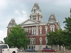 Shelbyville Historic District |
December 22, 1976 (#76000729) |
Roughly bounded by the railroad tracks and Will, N. 8th, and S. 6th Sts. 39°24′30″N 88°47′41″W |
Shelbyville | |
| 4 | Horace M. Tallman House | 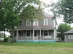 Horace M. Tallman House |
May 6, 1988 (#88000470) |
816 W. Main 39°24′23″N 88°48′11″W |
Shelbyville | |
| 5 | Thompson Mill Covered Bridge | 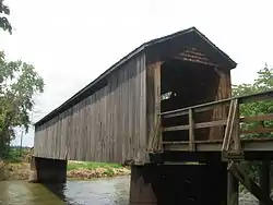 Thompson Mill Covered Bridge |
March 13, 1975 (#75000675) |
0.5 miles northeast of Cowden over the Kaskaskia River 39°15′31″N 88°49′05″W |
Cowden | |
| 6 | Westervelt Christian Church |  Westervelt Christian Church |
February 9, 2006 (#06000009) |
103 W. Main St. 39°28′45″N 88°51′35″W |
Westervelt |
Stark County
| [4] | Name on the Register | Image | Date listed[5] | Location | City or town | Description |
|---|---|---|---|---|---|---|
| 1 | Chicago, Burlington & Quincy Railroad Depot | 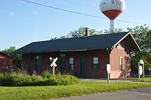 Chicago, Burlington & Quincy Railroad Depot |
April 30, 1987 (#87000650) |
Williams St. 41°03′41″N 89°46′07″W |
Wyoming |
Wabash County
| [4] | Name on the Register | Image | Date listed[5] | Location | City or town | Description |
|---|---|---|---|---|---|---|
| 1 | Beall-Orr House |  Beall-Orr House |
February 4, 1994 (#94000028) |
503 Cherry St. 38°24′43″N 87°45′30″W |
Mt. Carmel |
Washington County
| [4] | Name on the Register | Image | Date listed[5] | Location | City or town | Description |
|---|---|---|---|---|---|---|
| 1 | Louisville and Nashville Depot | 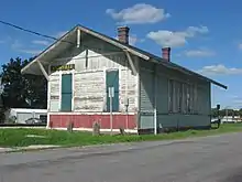 Louisville and Nashville Depot |
March 1, 1985 (#85000496) |
101 E. Railroad St. 38°20′54″N 89°22′57″W |
Nashville | |
| 2 | Original Springs Hotel and Bathhouse | 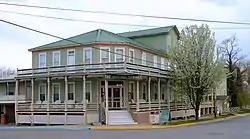 Original Springs Hotel and Bathhouse |
December 22, 1978 (#78001194) |
506 N. Hanover St. 38°26′03″N 89°32′55″W |
Okawville | |
| 3 | Frank Schlosser Complex | 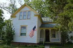 Frank Schlosser Complex |
August 15, 1983 (#83000337) |
W. Walnut St. 38°26′03″N 89°33′06″W |
Okawville |
Wayne County
| [4] | Name on the Register | Image | Date listed[5] | Location | City or town | Description |
|---|---|---|---|---|---|---|
| 1 | G.J. George House |  G.J. George House |
February 9, 2006 (#06000006) |
205 W. Center 38°22′40″N 88°21′46″W |
Fairfield | |
| 2 | Mayberry Mound and Village Site | 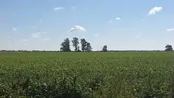 Mayberry Mound and Village Site |
November 21, 1978 (#78001195) |
Northeast of the junction of County Road 900E and the Skillet Fork[15] 38°19′15″N 88°31′30″W |
Sims | |
| 3 | Turney-Hall House | 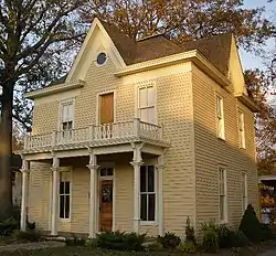 Turney-Hall House |
April 19, 2018 (#100002329) |
502 SE 4th St. 38°22′30″N 88°21′24″W |
Fairfield |
Williamson County
| [4] | Name on the Register | Image | Date listed[5] | Location | City or town | Description |
|---|---|---|---|---|---|---|
| 1 | Willis Allen House |  Willis Allen House |
February 11, 1982 (#82002606) |
514 S. Market St. 37°43′41″N 88°55′39″W |
Marion | |
| 2 | Goddard Chapel |  Goddard Chapel |
November 6, 1986 (#86003157) |
Rose Hill Cemetery, Illinois Route 37 N. 37°44′35″N 88°55′54″W |
Marion | |
| 3 | Marion Veterans Administration Hospital Historic District | 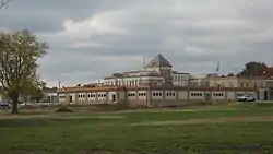 Marion Veterans Administration Hospital Historic District |
January 9, 2013 (#12001146) |
2401 W. Main St. 37°43′28″N 88°57′17″W |
Marion | |
| 4 | Ed M. Stotlar House |  Ed M. Stotlar House |
November 21, 2002 (#02001354) |
1304 W. Main St. 37°43′52″N 88°56′23″W |
Marion | |
| 5 | Williamson County Jail |  Williamson County Jail |
May 30, 2007 (#07000476) |
105 S. Van Buren St. 37°43′49″N 88°55′41″W |
Marion |
See also
| Wikimedia Commons has media related to National Register of Historic Places in Illinois. |
- List of National Historic Landmarks in Illinois
- List of NRHP Multiple Property Submissions in Illinois
- List of archaeological sites on the National Register of Historic Places in Illinois
- List of bridges on the National Register of Historic Places in Illinois
- United States National Register of Historic Places listings
References
- "National Register of Historic Places: Weekly List Actions". National Park Service, United States Department of the Interior. Retrieved on February 5, 2021.
- Chicago Sanitary and Ship Canal Historic District is included in both the West Side of Chicago and the Cook County: Other list. Logan Square Boulevards Historic District is included in both the West Side of Chicago and the North Side of Chicago.
- The following sites are listed in multiple counties: Barrington Historic District (Cook and Lake), Bolivia Road Bridge (Christian and Sangamon), Cahokia Mounds (Madison and St. Clair), Chicago Sanitary and Ship Canal Historic District (Cook, DuPage, and Will), Clear Lake Site (Mason and Tazewell), French Colonial Historic District (Monroe and Randolph), Kincaid Site (Massac and Pope), Lunsford-Pulcher Archeological Site (Monroe and St. Clair).
- Numbers represent an alphabetical ordering by significant words. Various colorings, defined here, differentiate National Historic Landmarks and historic districts from other NRHP buildings, structures, sites or objects.
- The eight-digit number below each date is the number assigned to each location in the National Register Information System database, which can be viewed by clicking the number.
- Maruszak, Kathleen. National Register of Historic Places Inventory/Nomination: Orr-Herl Mound and Village Site. National Park Service, 1976-12, 5.
- Wagner, Mark J. National Register of Historic Places Inventory/Nomination: John Bridges Tavern and Store Site. National Park Service, 2016-11-22, 23.
- Maruszak, Kathleen. National Register of Historic Places Inventory/Nomination: Clear Lake Site. National Park Service, 1977-01, 3.
- McHarry, Hugh W., and Duane Esarey. National Register of Historic Places Inventory/Nomination: Rockwell Mound. National Park Service, 1987-12-12, 5.
- Fairchilde, Jerry D. National Register of Historic Places Inventory/Nomination: Kincaid Site. National Park Service, 1982-03-10, 27.
- Zdzieblowski, Arthur. National Register of Historic Places Inventory/Nomination: Millstone Bluff. National Park Service, n.d., 4.
- "Clear Creek Friends Meeting". Retrieved December 24, 2015.
- Maruszak, Kathleen. National Register of Historic Places Inventory/Nomination: Carrier Mills Archeological District. National Park Service, 1977-08, 2.
- Maruszak, Kathleen A. National Register of Historic Places Inventory/Nomination: Naples Archeological District. National Park Service, 1978-02, 19.
- Bodner, Connie. National Register of Historic Places Inventory/Nomination: Mayberry Mound and Village Site. National Park Service, 1976-07, 4.
| Topics | |
|---|---|
| Lists by state |
|
| Lists by insular areas | |
| Lists by associated state | |
| Other areas | |
| Related | |
| |

This article is issued from Wikipedia. The text is licensed under Creative Commons - Attribution - Sharealike. Additional terms may apply for the media files.