National Register of Historic Places listings in Missouri
This is a list of properties and historic districts in Missouri on the National Register of Historic Places. There are NRHP listings in all of Missouri's 114 counties and the one independent city of St. Louis.
- This National Park Service list is complete through NPS recent listings posted January 29, 2021.[1]
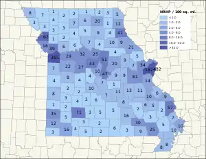
Current listings by county
The following are approximate tallies of current listings by county. These counts are based on entries in the National Register Information Database as of March 13, 2009[2] and new weekly listings posted since then on the National Register of Historic Places web site.[3] There are frequent additions to the listings and occasional delistings and the counts here are approximate and not official. New entries are added to the official Register on a weekly basis.[4] Also, the counts in this table exclude boundary increase and decrease listings which modify the area covered by an existing property or district and which carry a separate National Register reference number.

Andrew County
| [7] | Name on the Register | Image | Date listed[8] | Location | City or town | Description |
|---|---|---|---|---|---|---|
| 1 | Andrew County Courthouse | 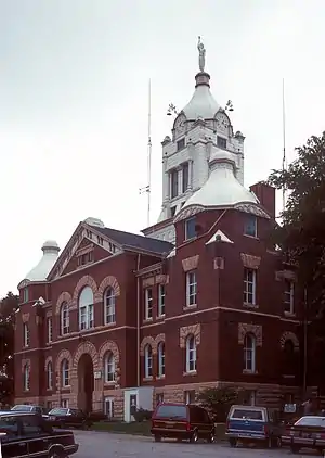 Andrew County Courthouse |
September 11, 1980 (#80002308) |
4th and Main Sts. 39°56′29″N 94°49′45″W |
Savannah | |
| 2 | J. F. Roberts Octagonal Barn | 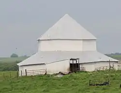 J. F. Roberts Octagonal Barn |
November 18, 1999 (#99001362) |
Jct. MO B and MO 48 40°03′47″N 94°44′44″W |
Rea | |
| 3 | Walnut Park Farm Historic District | 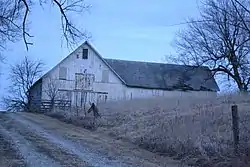 Walnut Park Farm Historic District |
December 22, 1999 (#99001597) |
Jct. of MO 59 and MO 71 39°49′56″N 94°48′46″W |
St. Joseph |
Audrain County
| [7] | Name on the Register | Image | Date listed[8] | Location | City or town | Description |
|---|---|---|---|---|---|---|
| 1 | Audrain County Courthouse | 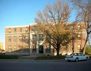 Audrain County Courthouse |
July 25, 2012 (#12000434) |
101 N. Jefferson St. 39°10′21″N 91°52′59″W |
Mexico | |
| 2 | Lincoln School | 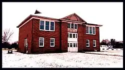 Lincoln School |
February 16, 1996 (#96000060) |
301 Lincoln St. 39°18′17″N 91°29′33″W |
Vandalia | |
| 3 | Ross House | 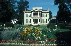 Ross House |
July 26, 1978 (#78001637) |
501 S. Muldrow St. 39°10′06″N 91°53′21″W |
Mexico | |
| 4 | Arthur Simmons Stables Historic District | 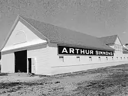 Arthur Simmons Stables Historic District |
December 4, 2004 (#04001286) |
621 and 701 W. Boulevard St. 39°09′51″N 91°53′25″W |
Mexico |
Barton County
| [7] | Name on the Register | Image | Date listed[8] | Location | City or town | Description |
|---|---|---|---|---|---|---|
| 1 | Harry Truman Birthplace Memorial | 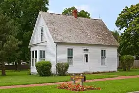 Harry Truman Birthplace Memorial |
June 23, 1969 (#69000089) |
N corner, 11th St. and Truman Ave. 37°29′40″N 94°16′17″W |
Lamar |
Bates County
| [7] | Name on the Register | Image | Date listed[8] | Location | City or town | Description |
|---|---|---|---|---|---|---|
| 1 | Bates County Courthouse | 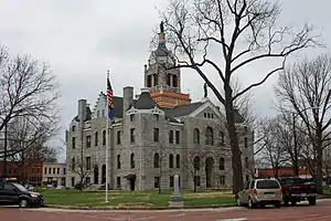 Bates County Courthouse |
June 28, 2001 (#01000684) |
1 North Delaware 38°15′28″N 94°21′19″W |
Butler | |
| 2 | Hudson City School | 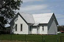 Hudson City School |
October 10, 2002 (#02001110) |
Approx. 1 mile NW of MO 52 and Hwy. W 38°12′12″N 94°05′25″W |
Appleton City | |
| 3 | Palace Hotel | 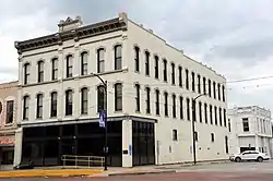 Palace Hotel |
July 19, 2002 (#02000795) |
2-4 W. Ohio St. 38°15′31″N 94°19′54″W |
Butler | |
| 4 | Papinville Marais des Cygnes River Bridge | 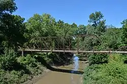 Papinville Marais des Cygnes River Bridge |
October 22, 2002 (#02001192) |
Cty. Rd. 648 over the Marais des Cygenes R. 38°04′06″N 94°13′54″W |
Papinville |
Benton County
| [7] | Name on the Register | Image | Date listed[8] | Location | City or town | Description |
|---|---|---|---|---|---|---|
| 1 | Central Cole Camp Historic District | April 11, 2002 (#02000355) |
Roughly consists of the 100 blocks of E. and W. Main St., most of Maple St., 105 E. Butterfield, 106 N. Olive, and 107 N. Boonville 38°27′35″N 93°14′14″W |
Cole Camp | ||
| 2 | Rodgers Shelter Archeological Site | June 23, 1969 (#69000090) |
Right bank of the Pomme de Terre River, 5 miles (8.0 km) by road southwest of Fristoe[9] 38°05′34″N 93°20′43″W |
Fristoe | ||
| 3 | Augustus Sander House | June 9, 2004 (#04000581) |
408 W. Jefferson St. 38°27′21″N 93°12′22″W |
Cole Camp | ||
| 4 | Upper Bridge | 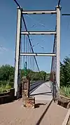 Upper Bridge |
September 17, 1999 (#99001159) |
Old Highway A, over Osage River 38°14′39″N 93°23′16″W |
Warsaw |
Bollinger County
| [7] | Name on the Register | Image | Date listed[8] | Location | City or town | Description |
|---|---|---|---|---|---|---|
| 1 | Will Mayfield College Arts and Science Building | 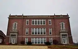 Will Mayfield College Arts and Science Building |
May 25, 2005 (#05000929) |
207 Mayfield Dr. 37°18′31″N 89°58′28″W |
Marble Hill | |
| 2 | Will Mayfield College Campus | Will Mayfield College Campus |
January 14, 2013 (#12001176) |
207 Mayfield Dr. 37°18′31″N 89°58′30″W |
Marble Hill | Now the site of the Bollinger County Museum of Natural History |
Caldwell County
| [7] | Name on the Register | Image | Date listed[8] | Location | City or town | Description |
|---|---|---|---|---|---|---|
| 1 | Caldwell County Courthouse | 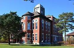 Caldwell County Courthouse |
January 13, 1972 (#72000707) |
49 E. Main St. 39°38′28″N 94°02′13″W |
Kingston | |
| 2 | Far West | 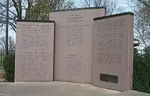 Far West |
September 22, 1970 (#70000324) |
5.5 miles (8.9 km) west of Kingston via County Roads D and H 39°40′17″N 94°07′52″W |
Kingston |
Cedar County
| [7] | Name on the Register | Image | Date listed[8] | Location | City or town | Description |
|---|---|---|---|---|---|---|
| 1 | Caplinger Mills Historic District | 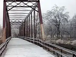 Caplinger Mills Historic District |
September 2, 1993 (#93000903) |
Junction of Washington Ave. and the Sac River 37°47′51″N 93°48′21″W |
Caplinger Mills | |
| 2 | Montgomery Archeological Site | September 21, 1978 (#78001639) |
Address Restricted |
Stockton | ||
| 3 | Stockton Community Building | 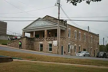 Stockton Community Building |
December 10, 1998 (#98001502) |
Junction of Spring and Morth Sts. 37°42′00″N 93°47′46″W |
Stockton |
Christian County
| [7] | Name on the Register | Image | Date listed[8] | Location | City or town | Description |
|---|---|---|---|---|---|---|
| 1 | Ozark Courthouse Square Historic District | 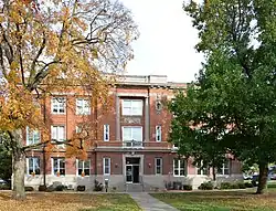 Ozark Courthouse Square Historic District |
February 5, 2009 (#08001409) |
Portions of 2nd Ave. and Church, Elm, and 2nd Sts. on the courthouse square 37°01′11″N 93°12′29″W |
Ozark | |
| 2 | Smallin Cave Historic District | March 8, 2018 (#100002186) |
3575 N Smallin Rd. 37°03′04″N 93°11′12″W |
Ozark vicinity | ||
| 3 | Southwest Missouri Prehistoric Rock Shelter and Cave Sites Discontiguous Archeological District | October 24, 1991 (#91002046) |
Address Restricted |
Chadwick |
Clinton County
| [7] | Name on the Register | Image | Date listed[8] | Location | City or town | Description |
|---|---|---|---|---|---|---|
| 1 | David L. and Sallie Ann Stoutimore House | July 23, 2013 (#13000536) |
501 S. Birch Ave. 39°33′39″N 94°27′06″W |
Plattsburg |
Dade County
| [7] | Name on the Register | Image | Date listed[8] | Location | City or town | Description |
|---|---|---|---|---|---|---|
| 1 | Greenfield Opera House Building | 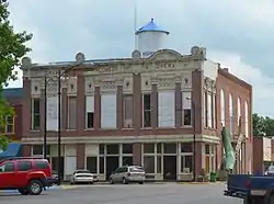 Greenfield Opera House Building |
December 10, 1998 (#98001504) |
Junction of Water and Allison Sts. 37°24′53″N 93°50′27″W |
Greenfield | |
| 2 | Washington Hotel | October 16, 2002 (#02001178) |
2 S. Main St. 37°24′56″N 93°50′24″W |
Greenfield |
Former listing
| [7] | Name on the Register | Image | Date listed | Date removed | Location | City or town | Summary |
|---|---|---|---|---|---|---|---|
| 1 | Dilday Mill | August 26, 1977 (#77000805) | December 19, 1994 | Southeast of South Greenfield on Turnback Creek |
South Greenfield | Collapsed in 1982.[10] |
Dallas County
| [7] | Name on the Register | Image | Date listed[8] | Location | City or town | Description |
|---|---|---|---|---|---|---|
| 1 | Bennett Spring State Park Hatchery-Lodge Area Historic District |  Bennett Spring State Park Hatchery-Lodge Area Historic District |
March 4, 1985 (#85000504) |
Route A64 37°43′31″N 92°51′24″W |
Bennett Spring | At Bennett Spring State Park |
| 2 | Bennett Spring State Park Shelter House and Water Gauge Station | 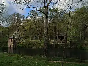 Bennett Spring State Park Shelter House and Water Gauge Station |
February 28, 1985 (#85000527) |
Off Route A64 37°43′01″N 92°51′27″W |
Bennett Spring | At Bennett Spring State Park |
Daviess County
| [7] | Name on the Register | Image | Date listed[8] | Location | City or town | Description |
|---|---|---|---|---|---|---|
| 1 | Daviess County Courthouse | 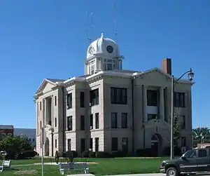 Daviess County Courthouse |
November 14, 1980 (#80002350) |
Public Sq. 39°54′55″N 93°57′44″W |
Gallatin | |
| 2 | Daviess County Rotary Jail and Sheriff's Residence | 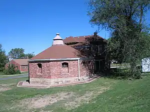 Daviess County Rotary Jail and Sheriff's Residence |
February 23, 1990 (#90000131) |
310 W. Jackson 39°54′55″N 93°57′50″W |
Gallatin | |
| 3 | A. Taylor Ray House | 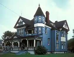 A. Taylor Ray House |
April 12, 1982 (#82003135) |
212 W. Van Buren St. 39°54′48″N 93°57′50″W |
Gallatin |
DeKalb County
| [7] | Name on the Register | Image | Date listed[8] | Location | City or town | Description |
|---|---|---|---|---|---|---|
| 1 | Dalton-Uphoff House | April 12, 1982 (#82004634) |
North of Stewartsville 39°51′12″N 94°29′58″W |
Stewartsville | ||
| 2 | DeKalb County Courthouse | .JPG.webp) DeKalb County Courthouse |
February 5, 1998 (#98000068) |
109 W. Main St. 39°53′24″N 94°21′35″W |
Maysville | |
| 3 | Absolom Riggs House | April 12, 1982 (#82004635) |
SR 1 39°55′32″N 94°15′12″W |
Weatherby |
Douglas County
| [7] | Name on the Register | Image | Date listed[8] | Location | City or town | Description |
|---|---|---|---|---|---|---|
| 1 | Ava Ranger Station Historic District | 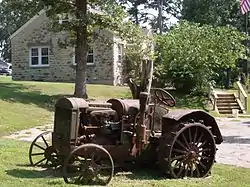 Ava Ranger Station Historic District |
August 4, 2003 (#03000714) |
Route 5S 36°56′15″N 92°39′41″W |
Ava | Old tractor by the Ava ranger station |
| 2 | Southwest Missouri Prehistoric Rock Shelter and Cave Sites Discontiguous Archeological District | October 24, 1991 (#91002046) |
Address Restricted |
Dogwood |
Gentry County
| [7] | Name on the Register | Image | Date listed[8] | Location | City or town | Description |
|---|---|---|---|---|---|---|
| 1 | Albany Carnegie Public Library | 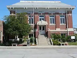 Albany Carnegie Public Library |
February 23, 1990 (#90000130) |
101 W. Clay St. 40°14′52″N 94°19′55″W |
Albany | |
| 2 | Gentry County Courthouse | 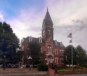 Gentry County Courthouse |
September 18, 1980 (#80002352) |
Public Sq. 40°11′43″N 94°20′01″W |
Albany | |
| 3 | Opera Hall Block | May 9, 2002 (#02000472) |
101-03 W. Vermont/101-03 S. Connecticut 40°03′04″N 94°31′25″W |
King City | ||
| 4 | Samuel and Pauline Peery House | August 11, 2005 (#05000881) |
1105 N. Hundley St. 40°15′21″N 94°19′51″W |
Albany |
Harrison County
| [7] | Name on the Register | Image | Date listed[8] | Location | City or town | Description |
|---|---|---|---|---|---|---|
| 1 | Hamilton House | April 11, 1985 (#85000733) |
1228 W. Main 40°16′06″N 94°02′17″W |
Bethany | ||
| 2 | Slatten House | July 9, 1984 (#84002553) |
Route 4 40°16′24″N 93°56′34″W |
Bethany |
Hickory County
| [7] | Name on the Register | Image | Date listed[8] | Location | City or town | Description |
|---|---|---|---|---|---|---|
| 1 | Quincy Public Hall | April 7, 1995 (#95000370) |
Route 83 38°00′31″N 93°28′17″W |
Quincy | ||
| 2 | John Siddle Williams House | September 27, 1980 (#80002356) |
Off U.S. Route 54 37°56′33″N 93°19′10″W |
Hermitage |
Holt County
| [7] | Name on the Register | Image | Date listed[8] | Location | City or town | Description |
|---|---|---|---|---|---|---|
| 1 | Chicago, Burlington and Quincy Depot | 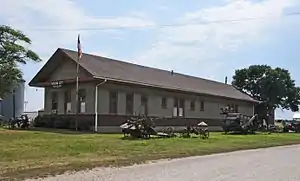 Chicago, Burlington and Quincy Depot |
December 12, 1978 (#78001648) |
S. State St. 40°07′43″N 95°13′52″W |
Mound City | |
| 2 | City Hall | 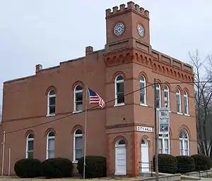 City Hall |
June 27, 1979 (#79001362) |
Route 111 39°58′57″N 95°11′25″W |
Forest City | |
| 3 | St. John's Evangelical Lutheran Church and Parochial School | .jpg.webp) St. John's Evangelical Lutheran Church and Parochial School |
January 4, 2008 (#07001339) |
112 Walters St. 40°14′52″N 95°27′16″W |
Corning |
Former listings
| [7] | Name on the Register | Image | Date listed | Date removed | Location | City or town | Summary |
|---|---|---|---|---|---|---|---|
| 1 | Carroll Stagecoach Inn | August 18, 1983 (#83000993) | December 19, 1994 | East of Oregon |
Oregon | ||
| 2 | Rulo Bridge |  Rulo Bridge |
January 4, 1993 (#92000718) | November 16, 2015 | U.S. Route 159 over the Missouri River 40°03′14″N 95°25′14″W |
Fortescue | Demolished (imploded) in 2014 |
Knox County
| [7] | Name on the Register | Image | Date listed[8] | Location | City or town | Description |
|---|---|---|---|---|---|---|
| 1 | Edina Double Square Historic District | 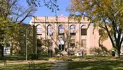 Edina Double Square Historic District |
July 28, 1999 (#99000902) |
118-124 S. Main St.; also roughly along portions of Main and E. Lafayette Sts. 40°10′06″N 92°10′21″W |
Edina | Second set of boundaries represents a boundary increase of March 13, 2002 |
Lawrence County
| [7] | Name on the Register | Image | Date listed[8] | Location | City or town | Description |
|---|---|---|---|---|---|---|
| 1 | Lewis Shaw Coleman House |  Lewis Shaw Coleman House |
October 17, 2016 (#16000727) |
227 E. College St. 36°58′18″N 93°43′02″W |
Aurora | |
| 2 | Lawrence County Bank Building | March 10, 2005 (#05000119) |
100 W. Commercial St. 36°56′41″N 94°00′10″W |
Pierce City | ||
| 3 | Lawrence County Courthouse | 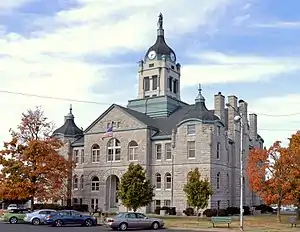 Lawrence County Courthouse |
September 23, 1980 (#80002374) |
City Sq. 37°06′12″N 93°49′06″W |
Mount Vernon | |
| 4 | Old Spanish Fort Archeological Site | January 25, 1971 (#71000469) |
In and around the Spanish Fort Cemetery, south of Mount Vernon[11] 37°03′14″N 93°49′54″W |
Mount Vernon | ||
| 5 | Pierce City Fire Station, Courthouse and Jail | August 28, 1998 (#98001108) |
Walnut St. 36°56′44″N 94°00′11″W |
Pierce City |
Livingston County
| [7] | Name on the Register | Image | Date listed[8] | Location | City or town | Description |
|---|---|---|---|---|---|---|
| 1 | Chillicothe Commercial Historic District | 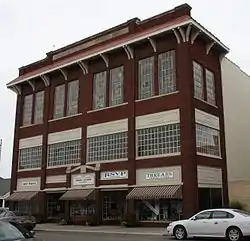 Chillicothe Commercial Historic District |
October 16, 2002 (#02001176) |
Roughly bounded Clay, Ann, Washington, and Locust Sts. 39°47′32″N 93°33′09″W |
Chillicothe | |
| 2 | Chillicothe Industrial Home for Girls | 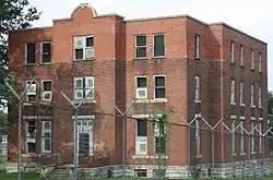 Chillicothe Industrial Home for Girls |
April 19, 2010 (#10000182) |
1500 Third St. 39°47′22″N 93°33′45″W |
Chillicothe | |
| 3 | Courthouse Square Historic District | 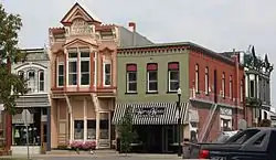 Courthouse Square Historic District |
October 16, 2002 (#02001177) |
Roughly bounded by Calhoun, Jackson, Washington, and Elm Sts. 39°47′39″N 93°33′09″W |
Chillicothe | |
| 4 | Grace Episcopal Church and Building |  Grace Episcopal Church and Building |
September 17, 1980 (#80002375) |
421 Elm St. 39°47′29″N 93°33′04″W |
Chillicothe |
Maries County
| [7] | Name on the Register | Image | Date listed[8] | Location | City or town | Description |
|---|---|---|---|---|---|---|
| 1 | Maries County Jail and Sheriff's House | 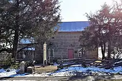 Maries County Jail and Sheriff's House |
March 1, 2002 (#02000101) |
Junction of 5th and Mill Sts. 38°11′11″N 91°56′46″W |
Vienna |
McDonald County
| [7] | Name on the Register | Image | Date listed[8] | Location | City or town | Description |
|---|---|---|---|---|---|---|
| 1 | Old McDonald County Courthouse | 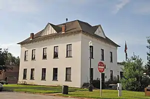 Old McDonald County Courthouse |
May 1, 2012 (#12000251) |
400 N. Main St. 36°35′37″N 94°23′01″W |
Pineville | |
| 2 | Old McDonald County Jail | July 20, 2020 (#100005347) |
200 East 3rd St. 36°35′34″N 94°23′00″W |
Pineville | ||
| 3 | Pineville Site | July 28, 1999 (#99000903) |
Address Restricted |
Pineville | ||
| 4 | Powell Bridge | Powell Bridge |
April 20, 2011 (#11000215) |
0.4 miles (0.64 km) southwest of Powell on Cowan Ridge Rd. off Highway E 36°36′57″N 94°10′56″W |
Powell |
Mercer County
| [7] | Name on the Register | Image | Date listed[8] | Location | City or town | Description |
|---|---|---|---|---|---|---|
| 1 | Herbert Cain and Corah Brantley Casteel House | July 14, 1995 (#95000781) |
Address Restricted |
Princeton | ||
| 2 | Leo Ellis Post No. 22, American Legion Building | April 26, 1996 (#96000478) |
804 Grant St. 40°24′01″N 93°35′03″W |
Princeton |
Morgan County
| [7] | Name on the Register | Image | Date listed[8] | Location | City or town | Description |
|---|---|---|---|---|---|---|
| 1 | Martin Hotel | September 6, 1978 (#78001669) |
118 N. Monroe St. 38°25′57″N 92°50′29″W |
Versailles | ||
| 2 | Morgan County Courthouse | 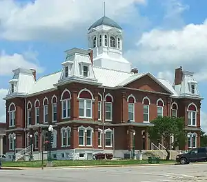 Morgan County Courthouse |
January 10, 1980 (#80002383) |
Courthouse Sq. 38°25′53″N 92°51′11″W |
Versailles | |
| 3 | Old St. Patrick's Church | March 2, 1979 (#79001384) |
South of Gravois Mills on Route 0 38°12′44″N 92°49′33″W |
Gravois Mills | ||
| 4 | Jesse Ratcliff House | April 12, 1982 (#82003154) |
Northeast of Barnett 38°24′09″N 92°38′17″W |
Barnett | ||
| 5 | Second Baptist Church and Booker T. Washington School Historic District | July 20, 2020 (#100005348) |
313 South Monroe St. 38°25′41″N 92°50′32″W |
Versailles |
Oregon County
| [7] | Name on the Register | Image | Date listed[8] | Location | City or town | Description |
|---|---|---|---|---|---|---|
| 1 | Church of the Holy Trinity | July 24, 2017 (#100001352) |
117 N. 5th St. 36°31′28″N 91°32′37″W |
Thayer | ||
| 2 | Greer Mill | January 26, 2006 (#05001551) |
Western side of Route 10, 10 miles (16 km) north of Alton 36°47′11″N 91°20′33″W |
Alton | ||
| 3 | Pigman Mound Archeological Site | March 4, 1971 (#71000472) |
Address Restricted |
Riverton |
Ozark County
| [7] | Name on the Register | Image | Date listed[8] | Location | City or town | Description |
|---|---|---|---|---|---|---|
| 1 | John Conkin and Clara Layton Harlin House |  John Conkin and Clara Layton Harlin House |
October 22, 2003 (#03001065) |
403 Harlin Dr. 36°36′20″N 92°25′48″W |
Gainesville | |
| 2 | Hodgson-Aid Mill | 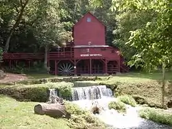 Hodgson-Aid Mill |
February 12, 2002 (#02000015) |
Route 181 36°42′28″N 92°15′59″W |
Sycamore | Historic grist mill on Bryant Creek |
Polk County
| [7] | Name on the Register | Image | Date listed[8] | Location | City or town | Description |
|---|---|---|---|---|---|---|
| 1 | Bolivar Public Library | 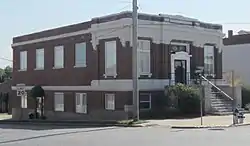 Bolivar Public Library |
July 17, 2003 (#03000652) |
120 E. Jackson St. 37°36′48″N 93°24′37″W |
Bolivar | |
| 2 | George Dimmitt Memorial Hospital | 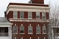 George Dimmitt Memorial Hospital |
March 12, 2012 (#12000101) |
102 S. Bolivar Rd. 37°47′41″N 93°34′34″W |
Humansville | |
| 3 | First National Bank | October 16, 2013 (#13000839) |
103 E. Broadway 37°36′51″N 93°24′42″W |
Bolivar | ||
| 4 | North Ward School | July 14, 2011 (#11000442) |
201 W. Locust St. 37°36′57″N 93°24′49″W |
Bolivar |
Putnam County
| [7] | Name on the Register | Image | Date listed[8] | Location | City or town | Description |
|---|---|---|---|---|---|---|
| 1 | Unionville Square Historic District | 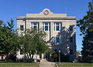 Unionville Square Historic District |
July 19, 2002 (#02000793) |
Roughly along portions of Main, Grant., 16th and 17th Sts. 40°28′36″N 93°00′08″W |
Unionville |
Randolph County
| [7] | Name on the Register | Image | Date listed[8] | Location | City or town | Description |
|---|---|---|---|---|---|---|
| 1 | Burkholder-O'Keefe House |  Burkholder-O'Keefe House |
September 25, 1989 (#89001414) |
605 S. Fifth St. 39°24′47″N 92°26′31″W |
Moberly | |
| 2 | Mitchell Petroglyph Archeological Site | June 23, 1969 (#69000124) |
Hillside 0.5 miles (0.80 km) north of Thunderbird Lake[12] 39°32′59″N 92°20′06″W |
Cairo | ||
| 3 | Moberly Commercial Historic District | 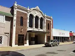 Moberly Commercial Historic District |
September 4, 2012 (#12000592) |
Roughly bounded by W. Coates, W. Rollins, N. Clark, & Johnson Sts. 39°25′11″N 92°26′27″W |
Moberly | |
| 4 | Moberly Junior High School | 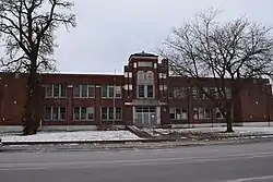 Moberly Junior High School |
January 4, 2008 (#07001340) |
101 N. Johnson St. 39°25′09″N 92°26′37″W |
Moberly |
Reynolds County
| [7] | Name on the Register | Image | Date listed[8] | Location | City or town | Description |
|---|---|---|---|---|---|---|
| 1 | Buford-Carty Farmstead | June 16, 2004 (#04000603) |
0.75 miles south of Highway J on County Road 814 37°31′11″N 90°56′11″W |
Black | ||
| 2 | Civil War Fortification at Barnesville | July 1, 1998 (#98000817) |
Deer Run State Forest 37°13′10″N 90°59′14″W |
Ellington |
St. Clair County
| [7] | Name on the Register | Image | Date listed[8] | Location | City or town | Description |
|---|---|---|---|---|---|---|
| 1 | Appleton City Downtown Commercial District | June 17, 2019 (#100004061) |
100-200 e. 4th St., 100-131 W. 4th St., 201-306 N. Walnut St. 38°11′26″N 94°01′41″W |
Appleton City | ||
| 2 | Harper School | July 24, 2007 (#07000751) |
Junction of Missouri Routes 82 and U 38°03′47″N 93°31′04″W |
Harper | ||
| 3 | Osceola Public School Building | January 21, 1999 (#98001638) |
Junction of Fifth and Pine Sts. 38°02′41″N 93°42′03″W |
Osceola |
Schuyler County
| [7] | Name on the Register | Image | Date listed[8] | Location | City or town | Description |
|---|---|---|---|---|---|---|
| 1 | Downing Railroad Depot | Downing Railroad Depot |
March 29, 1983 (#83001037) |
City Park 40°28′59″N 92°22′08″W |
Downing | |
| 2 | William P. Hall House | 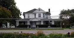 William P. Hall House |
April 1, 1975 (#75001073) |
U.S. Route 136, west of the Schuyler County Courthouse 40°31′25″N 92°31′45″W |
Lancaster |
Scotland County
| [7] | Name on the Register | Image | Date listed[8] | Location | City or town | Description |
|---|---|---|---|---|---|---|
| 1 | Bible Grove Consolidated District No. 5 School | May 5, 2000 (#00000441) |
Southern side of Route T at Bible Grove 40°21′04″N 92°18′08″W |
Bible Grove | ||
| 2 | Downing House | 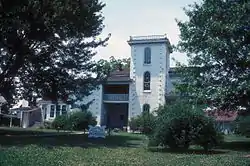 Downing House |
June 27, 1979 (#79001396) |
311 S. Main St. 40°27′22″N 92°10′15″W |
Memphis | |
| 3 | Rutledge School | January 31, 2017 (#100000608) |
142 2nd St. 40°18′58″N 92°05′15″W |
Rutledge |
Shelby County
| [7] | Name on the Register | Image | Date listed[8] | Location | City or town | Description |
|---|---|---|---|---|---|---|
| 1 | Benjamin House | 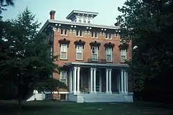 Benjamin House |
June 27, 1972 (#72000732) |
322 S. Shelby St. 39°41′23″N 92°02′47″W |
Shelbina | |
| 2 | Bethel Historic District | November 10, 1970 (#70000350) |
Roughly bounded by Liberty, King, 1st, and 4th Sts. 39°52′42″N 92°01′24″W |
Bethel | ||
| 3 | Elim | May 27, 1971 (#71000477) |
1.5 miles east of Bethel 39°52′10″N 92°00′10″W |
Bethel | ||
| 4 | Hebron | January 31, 1978 (#78001677) |
0.8 miles (1.3 km) northwest of Bethel 39°53′23″N 92°01′46″W |
Bethel |
Stoddard County
| [7] | Name on the Register | Image | Date listed[8] | Location | City or town | Description |
|---|---|---|---|---|---|---|
| 1 | Dexter Gymnasium |  Dexter Gymnasium |
August 8, 2001 (#01000839) |
Junction of Park Lane and Fannetta St. 36°47′25″N 89°57′50″W |
Dexter | |
| 2 | Henry Miller House | May 18, 2018 (#100002430) |
106 Cape Rd. 36°53′24″N 89°55′29″W |
Bloomfield | ||
| 3 | Mingo National Wildlife Refuge Archeology District | May 12, 1975 (#75001074) |
Address Restricted |
Puxico | ||
| 4 | Rich Wood Archeological Site | January 25, 1971 (#71000478) |
7 miles (11 km) south of Dexter on the old road to Malden[13] 36°42′24″N 89°57′36″W |
Bernie | ||
| 5 | Stoddard County Courthouse | 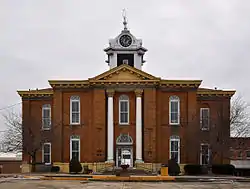 Stoddard County Courthouse |
September 18, 1984 (#84002718) |
Prairie and Court Sts. 36°53′04″N 89°55′45″W |
Bloomfield |
Stone County
| [7] | Name on the Register | Image | Date listed[8] | Location | City or town | Description |
|---|---|---|---|---|---|---|
| 1 | Levi Morrill Post | April 3, 1979 (#79001397) |
Southeast of Reeds Spring 36°40′32″N 93°20′13″W |
Notch | ||
| 2 | Southwest Missouri Prehistoric Rock Shelter and Cave Sites Discontiguous Archeological District | October 24, 1991 (#91002046) |
Section 34, Township 26 North, Range 23 West[14] 36°55′02″N 93°26′54″W |
Elsey | Location is that of Hay Cave (23SN1), a part of the district | |
| 3 | Stone County Courthouse | 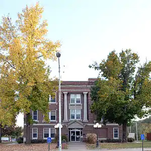 Stone County Courthouse |
November 14, 1980 (#80002396) |
Public Sq. 36°48′17″N 93°27′58″W |
Galena | |
| 4 | Y Bridge |  Y Bridge |
May 23, 1991 (#91000591) |
Junction of Routes 13 and 43 across the James River 36°48′18″N 93°27′41″W |
Galena |
Wayne County
| [7] | Name on the Register | Image | Date listed[8] | Location | City or town | Description |
|---|---|---|---|---|---|---|
| 1 | Fort Benton | October 21, 2002 (#02000212) |
3.5 miles south of the junction of Routes 34 and 67 37°11′02″N 90°33′14″W |
Patterson | ||
| 2 | Old Greenville (23WE637) | 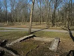 Old Greenville (23WE637) |
February 17, 1990 (#90000005) |
2 miles (3.2 km) south of Greenville off U.S. Route 67[15] 37°06′03″N 90°27′17″W |
Greenville | |
| 3 | Sam A. Baker State Park Historic District | 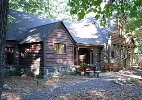 Sam A. Baker State Park Historic District |
February 27, 1985 (#85000540) |
St. Francis Mountains bounded roughly around Cedar Creek, Big Creek and Mudlick Canyon off Route 143 37°15′32″N 90°31′34″W |
Patterson | All or part of Sam A. Baker State Park |
Webster County
| [7] | Name on the Register | Image | Date listed[8] | Location | City or town | Description |
|---|---|---|---|---|---|---|
| 1 | Hosmer Dairy Farm Historic District | May 16, 1996 (#96000549) |
County Farm Road 522, approximately 0.5 miles southwest of its junction with Route E 37°21′33″N 93°01′40″W |
Marshfield | ||
| 2 | Col. Thomas C. Love House | 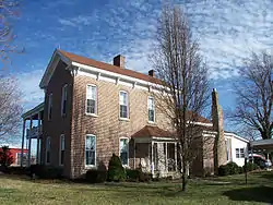 Col. Thomas C. Love House |
January 18, 1985 (#85000108) |
Off Route 1 37°11′20″N 92°43′48″W |
Seymour | |
| 3 | Rainey Funeral Home Building | 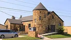 Rainey Funeral Home Building |
January 22, 2014 (#13001112) |
242 E. Washington St. 37°20′18″N 92°54′17″W |
Marshfield |
Worth County
| [7] | Name on the Register | Image | Date listed[8] | Location | City or town | Description |
|---|---|---|---|---|---|---|
| 1 | Worth County Courthouse | 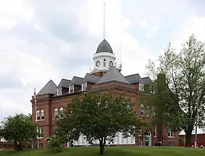 Worth County Courthouse |
January 20, 1983 (#83001056) |
Public Sq. 40°29′10″N 94°24′32″W |
Grant City |
See also
References
| Wikimedia Commons has media related to National Register of Historic Places in Missouri. |
- "National Register of Historic Places: Weekly List Actions". National Park Service, United States Department of the Interior. Retrieved on January 29, 2021.
- "National Register Information System". National Register of Historic Places. National Park Service. March 13, 2009.
- "National Register of Historic Places: Weekly List Actions". National Park Service. Retrieved January 2, 2009.
- Weekly List Actions, National Register of Historic Places website
- Kansas City Parks and Boulevards Historic District appears in downtown and non-downtown listings in the Jackson County portions of Kansas City.
- The following sites are listed in multiple counties: Arrow Rock (Cooper and Saline), Beaumont-Tyson Quarry District (Jefferson and St. Louis (county)), Bennett Spring State Park Hatchery-Lodge Area Historic District (Dallas and Laclede), Delmar Loop-Parkview Gardens Historic District (St. Louis (city) and St. Louis (county)), Hi-Pointe-De Mun Historic District (St.. Louis (city) and St. Louis (county)), Lake of the Ozarks State Park Highway 134 Historic District (Camden and Miller), Little Black River Archeological District (Butler and Ripley), Parkview Historic District (St.. Louis (city) and St. Louis (county)), Southwest Missouri Prehistoric Rock Shelter and Cave Sites Discontiguous Archeological District (Barry, Christian, Douglas and Stone), Wydown-Forsyth District (St.. Louis (city) and St. Louis (county)).
- Numbers represent an alphabetical ordering by significant words. Various colorings, defined here, differentiate National Historic Landmarks and historic districts from other NRHP buildings, structures, sites or objects.
- The eight-digit number below each date is the number assigned to each location in the National Register Information System database, which can be viewed by clicking the number.
- Ahler, Stanley A. "Post-Pleistocene Depositional Change at Rodgers Shelter, Missouri". Plains Anthropologist 18.59 (1973): 1-26: 2.
- "Archived copy". Archived from the original on 2012-04-05. Retrieved 2013-04-02.CS1 maint: archived copy as title (link)
- Adams, Lee M. "Archaeological Investigations of Southwestern Missouri". Missouri Archaeologist 20 Whole Volume (1958): 160, 163.
- Eichenberger, J. Allen. "Investigations of the Marion-Ralls Archaeological Society in Northeast Missouri". Missouri Archaeologist 19 (1944): 1-69:61.
- Thomas, Cyrus. Report on the Mound Explorations of the Bureau of Ethnology. Twelfth Annual Report of the Bureau of Ethnology. Washington: Government Printing Office, 1894, 175.
- Lee M. "Archaeological Investigations of Southwestern Missouri". Missouri Archaeologist 20 Whole Volume (1958): 172.
- "Old Greenville (historical)". Geographic Names Information System. United States Geological Survey.
External links
| Topics | |
|---|---|
| Lists by state |
|
| Lists by insular areas | |
| Lists by associated state | |
| Other areas | |
| Related | |
| |