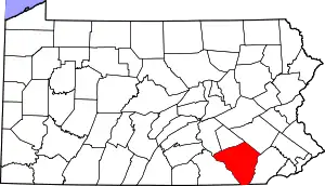
Churchtown, Pennsylvania
Churchtown is an unincorporated community and census-designated place (CDP) in Caernarvon Township, Lancaster County, Pennsylvania, United States, along Pennsylvania Route 23. The population was 470 as of the 2010 census.[2]
Churchtown, Pennsylvania | |
|---|---|
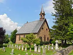 Bangor Episcopal Church | |
 Churchtown Location in Pennsylvania  Churchtown Location in the United States | |
| Coordinates: 40°7′59″N 75°57′53″W | |
| Country | United States |
| State | Pennsylvania |
| County | Lancaster |
| Township | Caernarvon |
| Area | |
| • Total | 1.90 sq mi (4.92 km2) |
| • Land | 1.88 sq mi (4.88 km2) |
| • Water | 0.02 sq mi (0.04 km2) |
| Elevation | 564 ft (172 m) |
| Population | |
| • Total | 470 |
| • Density | 249/sq mi (96.3/km2) |
| Time zone | UTC-5 (Eastern (EST)) |
| • Summer (DST) | UTC-4 (EDT) |
| ZIP code | 17555 |
| Area code(s) | 717 |
| FIPS code | 42-13632 |
| GNIS feature ID | 1171873[3] |
History
The first settlers of the oldest Amish settlement still in existence, the Lancaster Amish settlement, settled near Churchtown.[4]
The Bangor Episcopal Church, Caernarvon Presbyterian Church and Edward Davies House are listed on the National Register of Historic Places.[5]
Geography
Churchtown is in eastern Lancaster County, in the center of Caernarvon Township. Pennsylvania Route 23 is the community's Main Street, leading east 4 miles (6 km) to Morgantown and west 20 miles (32 km) to Lancaster, the county seat.
According to the U.S. Census Bureau, the Churchtown CDP has a total area of 1.9 square miles (4.9 km2), of which 0.02 square miles (0.04 km2), or 0.71%, are water.[1] The community sits on a ridge draining south to the Conestoga River, a west-flowing tributary of the Susquehanna River.
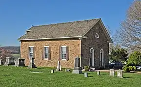 Caernarvon Presbyterian Church
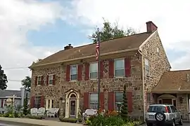 Edward Davies House
References
- "2019 U.S. Gazetteer Files: Places: Pennsylvania". United States Census Bureau. Retrieved September 18, 2020.
- "Total Population: 2010 Census DEC Summary File 1 (P1), Churchtown CDP, Pennsylvania". data.census.gov. U.S. Census Bureau. Retrieved September 18, 2020.
- U.S. Geological Survey Geographic Names Information System: Churchtown, Pennsylvania
- "6 Takeaways from Our Conversation with Don Kraybill" at lancasteronline.com.
- "National Register Information System". National Register of Historic Places. National Park Service. March 13, 2009.