East Earl, Pennsylvania
East Earl is an unincorporated community and census-designated place (CDP) in East Earl Township, Lancaster County, Pennsylvania, United States. As of the 2010 census it had a population of 1,144.[2]
East Earl, Pennsylvania | |
|---|---|
 East Earl  East Earl | |
| Coordinates: | |
| Country | United States |
| State | Pennsylvania |
| County | Lancaster |
| Township | East Earl |
| Area | |
| • Total | 0.94 sq mi (2.44 km2) |
| • Land | 0.94 sq mi (2.44 km2) |
| • Water | 0.004 sq mi (0.01 km2) |
| Elevation | 512 ft (156 m) |
| Population | |
| • Total | 1,144 |
| • Density | 1,217/sq mi (469.7/km2) |
| Time zone | UTC-5 (Eastern (EST)) |
| • Summer (DST) | UTC-4 (EDT) |
| ZIP code | 17519 |
| Area code(s) | 717 |
| FIPS code | 42-21064 |
| GNIS feature ID | 1173799 |
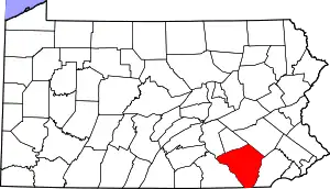
Geography
East Earl is in northeastern Lancaster County, in the south-central part of East Earl Township. It is bordered to the northwest by Blue Ball. U.S. Route 322 (Division Highway) passes through East Earl, leading northwest 9 miles (14 km) to Ephrata and southeast 20 miles (32 km) to Downingtown. Pennsylvania Route 897 (Springville Road) leads south 11 miles (18 km) to Gap and north 10 miles (16 km) to Swartzville. Lancaster, the county seat, is 16 miles (26 km) to the southwest.
According to the U.S. Census Bureau, the East Earl CDP has a total area of 0.93 square miles (2.4 km2), of which 1.6 acres (6,524 m2), or 0.27%, are water.[1] The community drains northeast and northwest to the Conestoga River and southwest to Mill Creek, a tributary of the Conestoga.
References
- "2019 U.S. Gazetteer Files: Places: Pennsylvania". United States Census Bureau. Retrieved September 22, 2020.
- "Total Population: 2010 Census DEC Summary File 1 (P1), East Earl CDP, Pennsylvania". data.census.gov. U.S. Census Bureau. Retrieved September 22, 2020.
| Authority control |
|---|