Cimarron Hills, Colorado
Cimarron Hills is an unincorporated community and a census-designated place (CDP) located in and governed by El Paso County, Colorado, United States. Cimarron Hills is an enclave of the City of Colorado Springs. The CDP is a part of the Colorado Springs, CO Metropolitan Statistical Area. The population of the Cimarron Hills CDP was 16,161 at the United States Census 2010.[4] The Colorado Springs post office (Zip Codes 80914, 80915, and 80922) serves the area.[3]
Cimarron Hills, Colorado | |
|---|---|
 Looking west along East Platte Avenue in Cimarron Hills. | |
 Location of the Cimarron Hills CDP in El Paso County, Colorado. | |
 Cimarron Hills Location of the Cimarron Hills CDP in the United States. | |
| Coordinates: 38°51′35″N 104°41′58″W[1] | |
| Country | |
| State | |
| County | El Paso County |
| Government | |
| • Type | unincorporated community |
| Area | |
| • Total | 5.942 sq mi (15.391 km2) |
| • Land | 5.939 sq mi (15.382 km2) |
| • Water | 0.003 sq mi (0.009 km2) |
| Elevation | 6,463 ft (1,970 m) |
| Population (2010) | |
| • Total | 16,161 |
| • Density | 2,721/sq mi (1,051/km2) |
| Time zone | UTC-7 (MST) |
| • Summer (DST) | UTC-6 (MDT) |
| ZIP Code[3] | Colorado Springs 80914, 80915, and 80922 |
| Area code(s) | 719 |
| GNIS feature[2] | Cimarron Hills CDP |
Geography
The Cimarron Hills CDP has an area of 3,803 acres (15.391 km2), including 2.2 acres (0.009 km2) of water.[1]
Demographics
The United States Census Bureau initially defined the Aetna Estates CDP for the 1980 United States Census.
| Year | Pop. | ±% |
|---|---|---|
| 1980 | 6,597 | — |
| 1990 | 11,160 | +69.2% |
| 2000 | 15,194 | +36.1% |
| 2010 | 16,161 | +6.4% |
| 2020 | — | |
| Source: United States Census Bureau | ||
Transportation
Highway: Cimarron Hills is 1.5 miles north of U.S. Highway 24. It is also 9 miles from Interstate 25.
Air: The community is three miles north of the Colorado Springs Airport.
Rail: (Historical information) In 1888, the Chicago, Rock Island and Pacific Railroad began construction of a main line between Limon and Colorado Springs, passing through Cimarron Hills. The Rocky Mountain Rocket provided passenger service from 1939 to 1966. In later years, the Cadillac and Lake City Railroad provided service between Cimarron Hills and Limon. Although the tracks were removed in the 1980s, the railroad grade can still be seen as a prominent U-shape in aerial images of Cimarron Hills.
See also
- Outline of Colorado
- State of Colorado
- Colorado cities and towns
- Colorado counties
- Colorado metropolitan areas
References
- "State of Colorado Census Designated Places - BAS20 - Data as of January 1, 2020". United States Census Bureau. Retrieved December 21, 2020.
- "U.S. Board on Geographic Names: Domestic Names". United States Geological Survey. Retrieved December 15, 2020.
- "Look Up a ZIP Code". United States Postal Service. Retrieved December 15, 2020.
- "2010: DEC Summary File 1". United States Census Bureau. Retrieved December 22, 2020.
External links
Municipalities and communities of El Paso County, Colorado, United States | ||
|---|---|---|
| Cities | 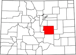 Map of Colorado highlighting El Paso County | |
| Towns | ||
| CDPs | ||
| Unincorporated communities | ||
| Ghost towns |
| |
| Footnotes | ‡This populated place also has portions in an adjacent county or counties | |
| ||